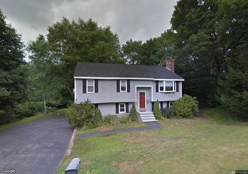
98 Stow Rd Marlborough, MA 01752
Estimated Value: $564,000 - $634,000
3
Beds
2
Baths
1,080
Sq Ft
$559/Sq Ft
Est. Value
About This Home
This home is located at 98 Stow Rd, Marlborough, MA 01752 and is currently estimated at $603,363, approximately $558 per square foot. 98 Stow Rd is a home located in Middlesex County with nearby schools including Marlborough High School, New Covenant Christian School, and Glenhaven Academy - JRI School.
Ownership History
Date
Name
Owned For
Owner Type
Purchase Details
Closed on
Aug 26, 2022
Sold by
Paschalides Nicholas D and Paschalides Donna L
Bought by
Paschalides Lt and Paschalides
Current Estimated Value
Purchase Details
Closed on
Apr 28, 2000
Sold by
Macneil Alexander W and Macneil Elizabeth A
Bought by
Paschalides Nicholas and Paschalides Donna L
Create a Home Valuation Report for This Property
The Home Valuation Report is an in-depth analysis detailing your home's value as well as a comparison with similar homes in the area
Home Values in the Area
Average Home Value in this Area
Purchase History
| Date | Buyer | Sale Price | Title Company |
|---|---|---|---|
| Paschalides Lt | -- | None Available | |
| Paschalides Nicholas | $217,500 | -- |
Source: Public Records
Mortgage History
| Date | Status | Borrower | Loan Amount |
|---|---|---|---|
| Previous Owner | Paschalides Nicholas | $35,000 | |
| Previous Owner | Paschalides Nicholas | $171,000 |
Source: Public Records
Tax History Compared to Growth
Tax History
| Year | Tax Paid | Tax Assessment Tax Assessment Total Assessment is a certain percentage of the fair market value that is determined by local assessors to be the total taxable value of land and additions on the property. | Land | Improvement |
|---|---|---|---|---|
| 2025 | $5,023 | $509,400 | $219,900 | $289,500 |
| 2024 | $4,906 | $479,100 | $200,000 | $279,100 |
| 2023 | $5,223 | $452,600 | $163,700 | $288,900 |
| 2022 | $5,066 | $386,100 | $155,900 | $230,200 |
| 2021 | $13,202 | $350,900 | $127,100 | $223,800 |
| 2020 | $7,204 | $337,800 | $123,800 | $214,000 |
| 2019 | $4,465 | $332,200 | $121,400 | $210,800 |
| 2018 | $4,078 | $338,300 | $118,300 | $220,000 |
| 2017 | $3,810 | $314,800 | $118,100 | $196,700 |
| 2016 | $4,674 | $304,700 | $118,100 | $186,600 |
| 2015 | $4,241 | $269,100 | $121,300 | $147,800 |
Source: Public Records
Map
Nearby Homes
- 323 Robert Rd
- 38 Airport Blvd
- 256 Robert Rd
- 45 Raffaele Rd
- 37 Hosmer St Unit 10
- 37 Hosmer St Unit 20
- 116 Boston Post Rd E Unit 105
- 110 Boston Post Rd E Unit 104
- 99 Kings Grant Rd
- 274 Naugler Ave
- 96 Cook Ln
- 97 Cook Ln
- 181 Boston Post Rd E Unit 26
- 41 Kane Dr
- 261 Boston Post Rd E Unit 1
- 271 Boston Post Rd E Unit 4
- 24 Clinton St
- 16 Clinton St
- 114 Lodi Rd
- 23 Victoria Ln