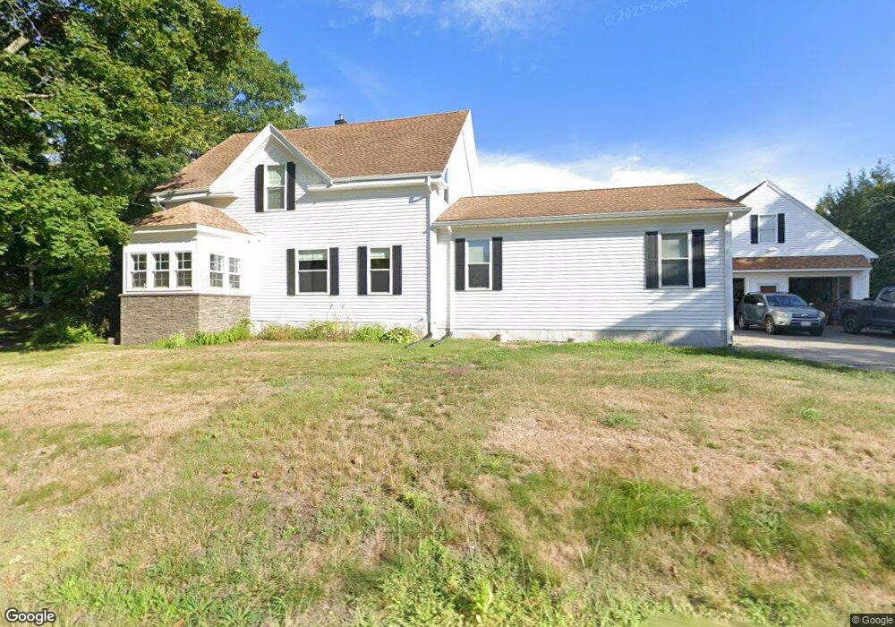
98 W Bacon St Plainville, MA 02762
Estimated Value: $564,000 - $733,000
3
Beds
3
Baths
2,028
Sq Ft
$316/Sq Ft
Est. Value
About This Home
This home is located at 98 W Bacon St, Plainville, MA 02762 and is currently estimated at $641,039, approximately $316 per square foot. 98 W Bacon St is a home located in Norfolk County with nearby schools including Anna Ware Jackson School, Beatrice H. Wood Elementary School, and Cadence Academy Preschool - North Attleborough.
Ownership History
Date
Name
Owned For
Owner Type
Purchase Details
Closed on
Oct 27, 2015
Sold by
White Howard and White Jean D
Bought by
White Brian H and White Mary-Beth
Current Estimated Value
Home Financials for this Owner
Home Financials are based on the most recent Mortgage that was taken out on this home.
Original Mortgage
$260,000
Outstanding Balance
$205,264
Interest Rate
3.9%
Mortgage Type
New Conventional
Estimated Equity
$435,776
Create a Home Valuation Report for This Property
The Home Valuation Report is an in-depth analysis detailing your home's value as well as a comparison with similar homes in the area
Home Values in the Area
Average Home Value in this Area
Purchase History
| Date | Buyer | Sale Price | Title Company |
|---|---|---|---|
| White Brian H | $325,000 | -- |
Source: Public Records
Mortgage History
| Date | Status | Borrower | Loan Amount |
|---|---|---|---|
| Open | White Brian H | $260,000 |
Source: Public Records
Tax History Compared to Growth
Tax History
| Year | Tax Paid | Tax Assessment Tax Assessment Total Assessment is a certain percentage of the fair market value that is determined by local assessors to be the total taxable value of land and additions on the property. | Land | Improvement |
|---|---|---|---|---|
| 2025 | $53 | $457,500 | $233,500 | $224,000 |
| 2024 | $5,225 | $435,400 | $213,500 | $221,900 |
| 2023 | $5,157 | $413,200 | $213,500 | $199,700 |
| 2022 | $5,379 | $383,400 | $206,000 | $177,400 |
| 2021 | $5,358 | $364,500 | $206,000 | $158,500 |
| 2020 | $5,618 | $382,200 | $206,000 | $176,200 |
| 2019 | $5,305 | $354,400 | $206,000 | $148,400 |
| 2018 | $4,878 | $323,900 | $187,300 | $136,600 |
| 2017 | $4,055 | $270,300 | $187,300 | $83,000 |
| 2016 | $3,740 | $252,200 | $187,300 | $64,900 |
| 2015 | $3,638 | $235,900 | $162,000 | $73,900 |
| 2014 | $3,549 | $237,200 | $162,000 | $75,200 |
Source: Public Records
Map
Nearby Homes
- 105 W Bacon St
- 145 W Bacon St
- 10 Cliff Dr
- 16 Elizabeth St
- 3 Field Dr
- 5 Farm Hill Ln
- 45 Moran St
- 10 Legion Dr
- 35-R Whiting St
- 230 South St
- 20 South St
- 133 Pleasant St Unit 2
- 12 Morgan Way
- 6 Hilltop Rd Unit 122
- 64 Smith St
- 1066 Mount Hope St
- 99 Arnold Rd
- 8 Al Pace Dr Unit 8
- 68 Fisher St
- 19 Church St Unit A5
- 94 W Bacon St
- 103 W Bacon St
- 106 W Bacon St
- 99 W Bacon St
- 91 W Bacon St
- 1 Fletcher St Unit B
- 1 Fletcher St Unit A
- 1 Fletcher St Unit 1B
- 1 Fletcher St Unit 1A
- 110 W Bacon St
- 109 W Bacon St
- 88 W Bacon St
- 3 Fletcher St
- 111 W Bacon St
- 2 Fletcher St
- 112 W Bacon St
- 5 Fletcher St
- 4A Fletcher St
- 4 Fletcher St
- 84 W Bacon St