Estimated Value: $839,000 - $882,255
About This Home
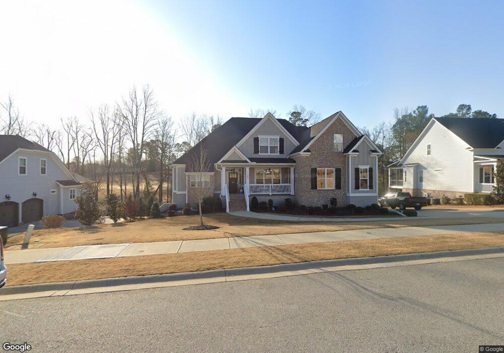
This home is located at 980 Bartram Ridge, Evans, GA 30809 and is currently estimated at $860,564, approximately $199 per square foot. 980 Bartram Ridge is a home located in Columbia County with nearby schools including Lewiston Elementary School, Columbia Middle School, and Grovetown High School.
Ownership History
We collect this data history from publicly available records. To have your information removed, we recommend requesting removal directly through your county’s website.
Purchase Details
Home Financials for this Owner
Home Financials are based on the most recent Mortgage that was taken out on this home.Home Values in the Area
Average Home Value in this Area
Purchase History
We collect this data history from publicly available records. To have your information removed, we recommend requesting removal directly through your county’s website.
| Date | Buyer | Sale Price | Title Company |
|---|---|---|---|
| $544,900 | -- |
Mortgage History
We collect this data history from publicly available records. To have your information removed, we recommend requesting removal directly through your county’s website.
| Date | Status | Borrower | Loan Amount |
|---|---|---|---|
| Open | $463,165 |
Tax History
We collect this data history from publicly available records. To have your information removed, we recommend requesting removal directly through your county’s website.
| Year | Tax Paid | Tax Assessment Tax Assessment Total Assessment is a certain percentage of the fair market value that is determined by local assessors to be the total taxable value of land and additions on the property. | Land | Improvement |
|---|---|---|---|---|
| 2025 | $8,491 | $353,704 | $44,504 | $309,200 |
| 2024 | $8,103 | $322,100 | $50,369 | $271,731 |
| 2023 | $8,103 | $308,571 | $50,369 | $258,202 |
| 2022 | $7,112 | $271,570 | $35,764 | $235,806 |
| 2021 | $6,649 | $242,488 | $34,154 | $208,334 |
| 2020 | $5,938 | $211,838 | $34,154 | $177,684 |
| 2019 | $4,143 | $147,168 | $35,879 | $111,289 |
| 2018 | $890 | $29,800 | $29,800 | $0 |
| 2017 | $775 | $25,576 | $25,576 | $0 |
| 2016 | -- | $26,392 | $26,392 | $0 |
Map
- 4304 Sabal Dr
- 984 Bartram Ridge
- 2516 Laurel Dr
- 2512 Laurel Dr
- 1001 Kalmia Cir
- 1036 Bartram Ridge
- 1044 Bartram Ridge
- 5355 Magnolia Dr
- 5629 Sunbury Loop
- 2219 Fossil Trace Ln Unit 41
- 346 Streamsong Rd
- 2223 Fossil Trace Ln
- 2224 Fossil Trace Ln
- 127 Ellerston Dr
- 4703 Southwind Rd
- 4704 Southwind Rd
- 129 Ellerston Dr
- 5305 Magnolia Ln
- 133 Ellerston Dr
- 604 Hillock Ct
- 978 Bartram Ridge
- 982 Bartram Ridge
- 977 Bartram Ridge
- 4303 Sabal Dr
- 975 Bartram Ridge
- 4308 Sabal Dr
- 4305 Sabal Dr
- 4310 Sabal Dr
- 973 Bartram Ridge
- 4312 Sabal Dr
- 2115 Fothergill Dr
- 2119 Fothergill Dr
- 2117 Fothergill Dr
- 2113 Fothergill Dr
- 4314 Sabal Dr
- 2121 Fothergill Dr
- 4315 Sabal Dr
- 2111 Fothergill Dr
- 4318 Sabal Dr
- 964 Bartram Ridge
Ask me questions while you tour the home.