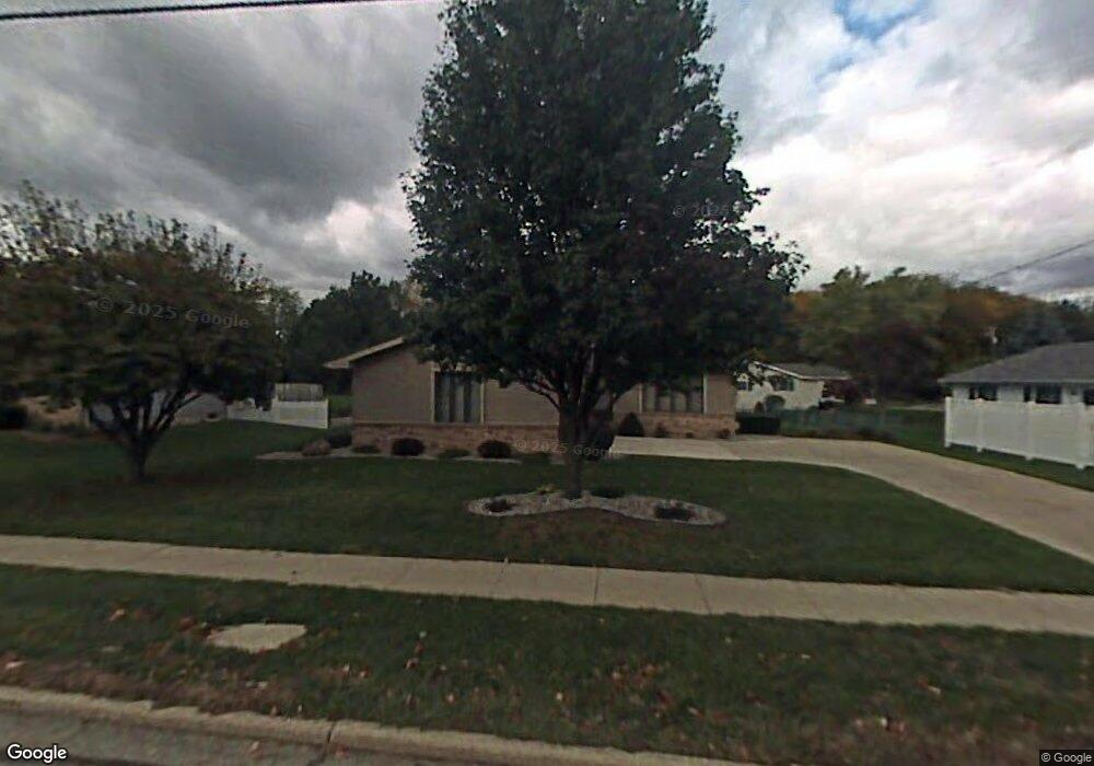
980 W Maple Ave Adrian, MI 49221
Estimated Value: $222,000 - $248,000
3
Beds
2
Baths
1,357
Sq Ft
$172/Sq Ft
Est. Value
About This Home
This home is located at 980 W Maple Ave, Adrian, MI 49221 and is currently estimated at $233,957, approximately $172 per square foot. 980 W Maple Ave is a home located in Lenawee County with nearby schools including Adrian High School, Berean Baptist Academy, and Trenton Hills Learning Center.
Ownership History
Date
Name
Owned For
Owner Type
Purchase Details
Closed on
Jun 28, 2011
Sold by
Anthony Sofia R
Bought by
Anthony Sofia R and Lean Pradeep B
Current Estimated Value
Home Financials for this Owner
Home Financials are based on the most recent Mortgage that was taken out on this home.
Original Mortgage
$112,084
Outstanding Balance
$80,164
Interest Rate
5.37%
Mortgage Type
FHA
Estimated Equity
$153,793
Purchase Details
Closed on
Aug 21, 2009
Sold by
Barrett Jane E
Bought by
Baker Wanda L
Create a Home Valuation Report for This Property
The Home Valuation Report is an in-depth analysis detailing your home's value as well as a comparison with similar homes in the area
Home Values in the Area
Average Home Value in this Area
Purchase History
| Date | Buyer | Sale Price | Title Company |
|---|---|---|---|
| Anthony Sofia R | -- | Prestige Title Insurance Age | |
| Baker Wanda L | $122,500 | Bell Title Agency Of Adrian |
Source: Public Records
Mortgage History
| Date | Status | Borrower | Loan Amount |
|---|---|---|---|
| Open | Anthony Sofia R | $112,084 |
Source: Public Records
Tax History
| Year | Tax Paid | Tax Assessment Tax Assessment Total Assessment is a certain percentage of the fair market value that is determined by local assessors to be the total taxable value of land and additions on the property. | Land | Improvement |
|---|---|---|---|---|
| 2025 | $2,988 | $99,900 | $0 | $0 |
| 2024 | $25 | $100,200 | $0 | $0 |
| 2023 | $2,868 | $89,600 | $0 | $0 |
| 2022 | $2,526 | $79,300 | $0 | $0 |
| 2021 | $2,480 | $73,500 | $0 | $0 |
| 2020 | $2,471 | $67,500 | $0 | $0 |
| 2019 | $159,532 | $65,700 | $0 | $0 |
| 2018 | $2,389 | $79,311 | $0 | $0 |
| 2017 | $2,313 | $64,351 | $0 | $0 |
| 2016 | $2,295 | $60,681 | $0 | $0 |
| 2014 | -- | $52,200 | $0 | $0 |
Source: Public Records
Map
Nearby Homes
- 146 Budlong St
- 1144 W Maumee St
- 914 W Maumee St
- 703 Company St
- 967 W Maumee St Unit A
- 559 Northwestern Dr
- 155 S Scott St
- 1100 Country Club Rd Unit 1100 blk Country Clu
- 176 S Scott St
- 333 Greenly St
- 1351 University Ave
- 1006 College Ave
- 227 Greenly St
- 306 Summer St
- 218 Greenly St
- 1139 College Ave
- 143 Park St
- 520 Meadowbrook Dr
- 547 Riverside Ave
- 169 Park St
- 986 W Maple Ave
- 974 W Maple Ave
- 415 Maplewood Ct
- 420 N Scott St
- 425 Maplewood Ct
- 388 N Scott St
- 422 N Scott St
- 414 Maplewood Ct
- 426 N Scott St
- 968 W Maple Ave
- 382 N Scott St
- 385 N Scott St
- 414 W Maple Ave
- 962 W Maple Ave
- 975 W Maple Ave
- 424 Maplewood Ct
- 376 N Scott St
- 1021 W Maple Ave
- 1027 W Maple Ave
- 1027 W Maple Ave Unit MAPLE
Your Personal Tour Guide
Ask me questions while you tour the home.