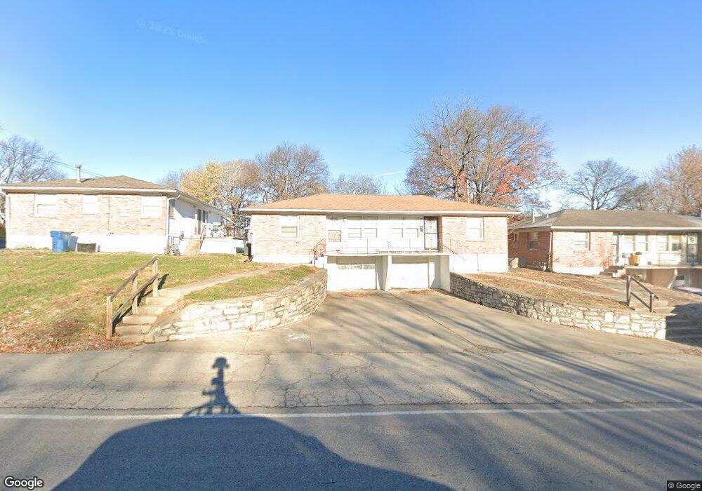
9800 E Westport Rd Independence, MO 64052
Rockwood NeighborhoodEstimated Value: $184,000 - $211,000
4
Beds
2
Baths
1,256
Sq Ft
$154/Sq Ft
Est. Value
About This Home
This home is located at 9800 E Westport Rd, Independence, MO 64052 and is currently estimated at $193,784, approximately $154 per square foot. 9800 E Westport Rd is a home located in Jackson County with nearby schools including Korte Elementary School, Clifford H. Nowlin Middle School, and Van Horn High School.
Ownership History
Date
Name
Owned For
Owner Type
Purchase Details
Closed on
Dec 8, 2022
Sold by
1902 S Ralston Llc
Bought by
9800-9804 E Westport Road Llc
Current Estimated Value
Purchase Details
Closed on
Jun 21, 2017
Sold by
Mcmurray Esther
Bought by
1902 S Ralston Llc
Purchase Details
Closed on
Mar 10, 2011
Sold by
Brown John Fred and Metzelthin Edith M
Bought by
Mcmurray John W and Mcmurray Esther
Create a Home Valuation Report for This Property
The Home Valuation Report is an in-depth analysis detailing your home's value as well as a comparison with similar homes in the area
Home Values in the Area
Average Home Value in this Area
Purchase History
| Date | Buyer | Sale Price | Title Company |
|---|---|---|---|
| 9800-9804 E Westport Road Llc | -- | -- | |
| 1902 S Ralston Llc | -- | None Available | |
| Mcmurray John W | -- | Chicago Title |
Source: Public Records
Tax History
| Year | Tax Paid | Tax Assessment Tax Assessment Total Assessment is a certain percentage of the fair market value that is determined by local assessors to be the total taxable value of land and additions on the property. | Land | Improvement |
|---|---|---|---|---|
| 2025 | $1,614 | $26,034 | $3,606 | $22,428 |
| 2024 | $1,575 | $22,639 | $2,717 | $19,922 |
| 2023 | $1,575 | $22,639 | $2,434 | $20,205 |
| 2022 | $1,606 | $21,090 | $1,797 | $19,293 |
| 2021 | $1,600 | $21,090 | $1,797 | $19,293 |
| 2020 | $1,436 | $18,429 | $1,797 | $16,632 |
| 2019 | $1,415 | $18,429 | $1,797 | $16,632 |
| 2018 | $1,268 | $16,039 | $1,564 | $14,475 |
| 2017 | $1,268 | $16,039 | $1,564 | $14,475 |
| 2016 | $1,265 | $15,637 | $1,330 | $14,307 |
Source: Public Records
Map
Nearby Homes
- 9712 E Westport Rd
- 2511 S Evanston Ave
- 2515 S Arlington Ave
- 2507 S Arlington Ave
- 2310 S Hall Rd
- 2601 S Hardy Ave
- 2209 S Hawthorne Ave
- 10409 E 26th St S
- 2322 S Glenwood Ave
- 2705 S Brookside Ave
- 2004 S Hawthorne Ave
- 2249 Blue Ridge Blvd
- 2000 S Glenwood Ave
- 2604 S Northern Blvd
- 1915 S Overton Ave
- 10709 E 27th Terrace S
- 2022 S Hedges Ave
- 10816 E 27th St S
- 2010 S Northern Blvd
- 10212 E 31st St S
- 2541 S Overton Ave
- 2523 S Overton Ave
- 9806 E Westport Rd
- 2519 S Overton Ave
- 9822 E Westport Rd
- 2601 S Overton Ave
- 2517 S Overton Ave
- 2516 S Hawthorne Ave
- 9821 E Westport Rd
- 2540 S Overton Ave
- 2518 S Overton Ave
- 2514 S Hawthorne Ave
- 2515 S Overton Ave
- 9708 E Westport Rd
- 2512 S Overton Ave
- 2512 S Hawthorne Ave
- 9727 E Westport Rd
- 2513 S Overton Ave
- 9800 E 25th Terrace S
- 2518 S Hawthorne Ave
Your Personal Tour Guide
Ask me questions while you tour the home.