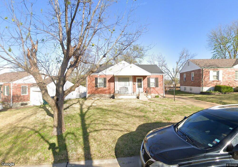
9806 Ravensbrook Dr Saint Louis, MO 63123
Estimated Value: $216,000 - $248,000
2
Beds
2
Baths
872
Sq Ft
$261/Sq Ft
Est. Value
About This Home
This home is located at 9806 Ravensbrook Dr, Saint Louis, MO 63123 and is currently estimated at $227,796, approximately $261 per square foot. 9806 Ravensbrook Dr is a home located in St. Louis County with nearby schools including Mesnier Primary School, Gotsch Intermediate School, and Rogers Middle School.
Ownership History
Date
Name
Owned For
Owner Type
Purchase Details
Closed on
Sep 13, 2018
Sold by
Darandari Sami H and Darandari Tina M
Bought by
Darandari Sami H and Darandari Tina M
Current Estimated Value
Home Financials for this Owner
Home Financials are based on the most recent Mortgage that was taken out on this home.
Original Mortgage
$110,000
Outstanding Balance
$95,729
Interest Rate
4.5%
Mortgage Type
New Conventional
Estimated Equity
$132,067
Purchase Details
Closed on
Jun 25, 2009
Sold by
Boyd Karen Steffen
Bought by
Darandari Sami H and Moushey Tina A
Home Financials for this Owner
Home Financials are based on the most recent Mortgage that was taken out on this home.
Original Mortgage
$120,280
Interest Rate
4.97%
Mortgage Type
FHA
Purchase Details
Closed on
Sep 15, 2006
Sold by
Steffen Edgar E and Steffen Ruth A
Bought by
Steffen Family Revocable Trust
Create a Home Valuation Report for This Property
The Home Valuation Report is an in-depth analysis detailing your home's value as well as a comparison with similar homes in the area
Home Values in the Area
Average Home Value in this Area
Purchase History
| Date | Buyer | Sale Price | Title Company |
|---|---|---|---|
| Darandari Sami H | -- | Freedom Title Llc St Louis | |
| Darandari Sami H | $122,500 | None Available | |
| Steffen Family Revocable Trust | -- | None Available |
Source: Public Records
Mortgage History
| Date | Status | Borrower | Loan Amount |
|---|---|---|---|
| Open | Darandari Sami H | $110,000 | |
| Closed | Darandari Sami H | $120,280 |
Source: Public Records
Tax History Compared to Growth
Tax History
| Year | Tax Paid | Tax Assessment Tax Assessment Total Assessment is a certain percentage of the fair market value that is determined by local assessors to be the total taxable value of land and additions on the property. | Land | Improvement |
|---|---|---|---|---|
| 2025 | $2,624 | $34,760 | $13,780 | $20,980 |
| 2024 | $2,624 | $32,260 | $9,840 | $22,420 |
| 2023 | $2,537 | $32,260 | $9,840 | $22,420 |
| 2022 | $2,594 | $28,270 | $9,840 | $18,430 |
| 2021 | $2,368 | $28,270 | $9,840 | $18,430 |
| 2020 | $2,226 | $24,780 | $9,670 | $15,110 |
| 2019 | $2,222 | $24,780 | $9,670 | $15,110 |
| 2018 | $2,251 | $22,200 | $6,750 | $15,450 |
| 2017 | $2,237 | $22,200 | $6,750 | $15,450 |
| 2016 | $1,927 | $20,300 | $3,900 | $16,400 |
| 2015 | $1,935 | $20,300 | $3,900 | $16,400 |
| 2014 | $1,828 | $19,080 | $4,240 | $14,840 |
Source: Public Records
Map
Nearby Homes
- 9804 Allendale Dr
- 9118 Radiom Dr
- 9837 Huntingdon Ln
- 9883 Ione Ln
- 9606 Dana Ave
- 9862 Glenmont Dr
- 9030 Villaridge Ct Unit 53
- 8709 Holbrook Dr
- 8628 Hillery Dr
- 9197 Villaridge Ct
- 9070 Villaridge Ct Unit 38
- 9925 Bunker Hill Dr Unit F
- 9925 Bunker Hill Dr Unit G
- 9117 Villaridge Ct Unit E
- 9920 Bunker Hill Dr Unit E
- 9544 Dana Ave
- 9228 Nemo Dr
- 10010 Bunker Hill Dr Unit H
- 10018 Bunker Hill Dr Unit G
- 1908 Union Rd Unit 1908
- 9810 Ravensbrook Dr
- 8922 Southview Ln
- 9814 Ravensbrook Dr
- 8918 Southview Ln
- 9809 Ravensbrook Dr
- 8927 Blackpool Dr
- 9000 Southview Ln
- 9818 Ravensbrook Dr
- 8912 Southview Ln
- 8931 Blackpool Dr
- 8923 Blackpool Dr
- 9815 Ravensbrook Dr
- 9822 Ravensbrook Dr
- 9008 Southview Ln
- 8906 Southview Ln
- 8993 Southview Ln
- 9001 Southview Ln
- 9819 Ravensbrook Dr
- 8925 Southview Ln
- 8919 Blackpool Dr