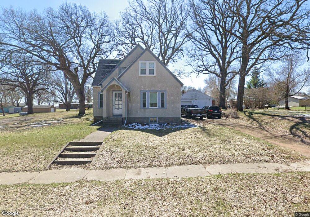
981 2nd St N Brownton, MN 55312
Estimated Value: $173,000 - $210,000
3
Beds
3
Baths
1,480
Sq Ft
$131/Sq Ft
Est. Value
About This Home
This home is located at 981 2nd St N, Brownton, MN 55312 and is currently estimated at $193,333, approximately $130 per square foot. 981 2nd St N is a home located in McLeod County with nearby schools including Lincoln Elementary School, Lakeside Elementary School, and Glencoe-Silver Lake Jr. High School.
Ownership History
Date
Name
Owned For
Owner Type
Purchase Details
Closed on
May 8, 2019
Sold by
Lamprecht Doris A
Bought by
Lamprecht Ricky W
Current Estimated Value
Purchase Details
Closed on
Nov 30, 2012
Sold by
West Warren W and Jordet Nancy J
Bought by
Lamprecht Durwood W and Lamprecht Doris A
Home Financials for this Owner
Home Financials are based on the most recent Mortgage that was taken out on this home.
Original Mortgage
$25,000
Interest Rate
3.36%
Mortgage Type
Unknown
Purchase Details
Closed on
Nov 28, 2012
Sold by
West William H and West Eleanor B
Bought by
West Family Trust
Home Financials for this Owner
Home Financials are based on the most recent Mortgage that was taken out on this home.
Original Mortgage
$25,000
Interest Rate
3.36%
Mortgage Type
Unknown
Create a Home Valuation Report for This Property
The Home Valuation Report is an in-depth analysis detailing your home's value as well as a comparison with similar homes in the area
Purchase History
We collect this data history from publicly available records. To have your information removed, we recommend requesting removal directly through your county’s website.
| Date | Buyer | Sale Price | Title Company |
|---|---|---|---|
| Lamprecht Ricky W | -- | None Available | |
| Lamprecht Durwood W | -- | Title Mark Cokato | |
| West Family Trust | -- | Title Mark Cokato |
Source: Public Records
Mortgage History
We collect this data history from publicly available records. To have your information removed, we recommend requesting removal directly through your county’s website.
| Date | Status | Borrower | Loan Amount |
|---|---|---|---|
| Previous Owner | Lamprecht Durwood W | $25,000 | |
| Previous Owner | West Family Trust | $25,000 |
Source: Public Records
Tax History
| Year | Tax Paid | Tax Assessment Tax Assessment Total Assessment is a certain percentage of the fair market value that is determined by local assessors to be the total taxable value of land and additions on the property. | Land | Improvement |
|---|---|---|---|---|
| 2025 | $2,456 | $148,500 | $38,100 | $110,400 |
| 2024 | $2,116 | $125,400 | $34,700 | $90,700 |
| 2023 | $2,116 | $125,400 | $34,700 | $90,700 |
| 2022 | $1,806 | $107,700 | $30,200 | $77,500 |
| 2021 | $1,972 | $93,100 | $26,300 | $66,800 |
| 2020 | $1,922 | $98,500 | $26,300 | $72,200 |
| 2019 | $2,058 | $89,300 | $23,900 | $65,400 |
| 2018 | $2,028 | $0 | $0 | $0 |
| 2017 | $1,930 | $0 | $0 | $0 |
| 2016 | $1,858 | $0 | $0 | $0 |
| 2015 | $1,680 | $0 | $0 | $0 |
| 2014 | -- | $0 | $0 | $0 |
Source: Public Records
Map
Nearby Homes
- 304 5th Ave N
- 352 4th St N
- 226 3rd Ave S
- 140 1st Ave N
- xxx Lot 3 Division St W
- Lot 2 U S Highway 212
- XXX US Hwy 212
- 11462 Minnesota 15
- 11742 Sunset Cir
- 12406 Highway 212
- 12893 County Road 7
- 426 Main St
- 8655 8th Ave
- 540 Mowbray St
- 41 Bowman St
- 1199 E 2nd St
- 401 17th St W
- 511 Southfork Cir SE
- XXX Airport Rd
- 441 Grant Ave SE
- 981 981 2nd-Street-n
- 976 2nd St N
- 973 2nd St N
- 1003 2nd St N
- 942 Division St
- 936 Division St
- 1002 Division St
- 860 860 2nd-Street-n
- 1011 2nd St N
- 930 Division St E
- 158 9th Ave N
- 930 930 Division St
- 982 2nd St N
- 864 2nd St N
- 1006 Division St
- 826 Division St E
- 180 11th Ave N
- 180 11th Ave N
- 180 11th Ave N
- 822 Division St
Your Personal Tour Guide
Ask me questions while you tour the home.