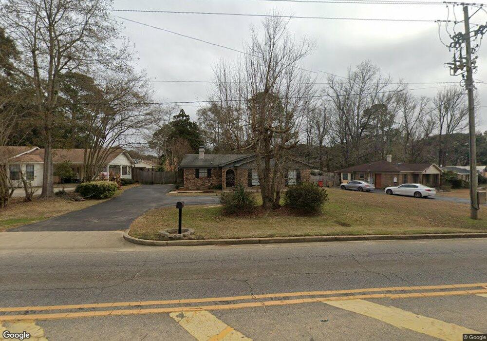
981 Dawes Rd Mobile, AL 36695
Kimberline NeighborhoodEstimated Value: $181,000 - $255,000
3
Beds
3
Baths
1,952
Sq Ft
$110/Sq Ft
Est. Value
About This Home
This home is located at 981 Dawes Rd, Mobile, AL 36695 and is currently estimated at $214,765, approximately $110 per square foot. 981 Dawes Rd is a home located in Mobile County with nearby schools including O'rourke Elementary School, Bernice J Causey Middle School, and Baker High School.
Ownership History
Date
Name
Owned For
Owner Type
Purchase Details
Closed on
May 5, 2021
Sold by
William Walker and William John
Bought by
Walker Donna
Current Estimated Value
Home Financials for this Owner
Home Financials are based on the most recent Mortgage that was taken out on this home.
Original Mortgage
$121,600
Interest Rate
3.69%
Mortgage Type
New Conventional
Create a Home Valuation Report for This Property
The Home Valuation Report is an in-depth analysis detailing your home's value as well as a comparison with similar homes in the area
Home Values in the Area
Average Home Value in this Area
Purchase History
| Date | Buyer | Sale Price | Title Company |
|---|---|---|---|
| Walker Donna | $125,900 | Servicelink |
Source: Public Records
Mortgage History
| Date | Status | Borrower | Loan Amount |
|---|---|---|---|
| Previous Owner | Walker Donna | $121,600 |
Source: Public Records
Tax History Compared to Growth
Tax History
| Year | Tax Paid | Tax Assessment Tax Assessment Total Assessment is a certain percentage of the fair market value that is determined by local assessors to be the total taxable value of land and additions on the property. | Land | Improvement |
|---|---|---|---|---|
| 2024 | $761 | $16,850 | $2,400 | $14,450 |
| 2023 | $761 | $15,230 | $2,400 | $12,830 |
| 2022 | $592 | $13,570 | $2,400 | $11,170 |
| 2021 | $544 | $12,590 | $2,400 | $10,190 |
| 2020 | $544 | $12,590 | $2,400 | $10,190 |
| 2019 | $532 | $12,340 | $2,450 | $9,890 |
| 2018 | $532 | $12,360 | $0 | $0 |
| 2017 | $547 | $12,660 | $0 | $0 |
| 2016 | $554 | $12,800 | $0 | $0 |
| 2013 | $546 | $12,520 | $0 | $0 |
Source: Public Records
Map
Nearby Homes
- 8053 Stacey Rd Unit 36
- 8285 Magnolia Village Dr N
- 8051 Bonanza Dr
- 740 Abbey Way Unit 13
- 1031 Navion Dr
- 758 Abbey Way Unit 15
- 741 Abbey Way Unit 42
- 1350 Schillinger Rd S
- 8621 Grelot Rd
- 8710 Londonderry Ct Unit 2
- 0 Oxbridge Way Unit 7471868
- 0 Oxbridge Way Unit 7471878
- 0 Oxbridge Way Unit 7 369320
- 0 Oxbridge Way Unit 6 369321
- 8712 Fangorn Rd
- 8391 Jeff Hamilton Road Extension
- 8391 Jeff Hamilton Road Extension
- 8050 Saint Jude Cir N
- 0 Airport Blvd Unit 7368583
- 0 Airport Blvd Unit 7368582
- 963 Dawes Rd
- 955 Dawes Rd
- 971 Dawes Rd
- 1001 Leroy Stevens Rd
- 1050 Cruisair Cir
- 1040 Cruisair Cir
- 951 Dawes Rd
- 1011 Leroy Stevens Rd
- 8181 Kimberlin Dr S
- 8201 Kimberlin Dr S
- 8191 Kimberlin Dr S
- 990 Dawes Rd
- 8013 Kimberlin Dr S
- 1021 Leroy Stevens Rd
- 1060 Cruisair Cir
- 8171 Cruisair Cir
- 8161 Cruisair Cir
- 8210 Kimberlin Dr S
- 1031 Leroy Stevens Rd
- 8200 Kimberlin Dr S