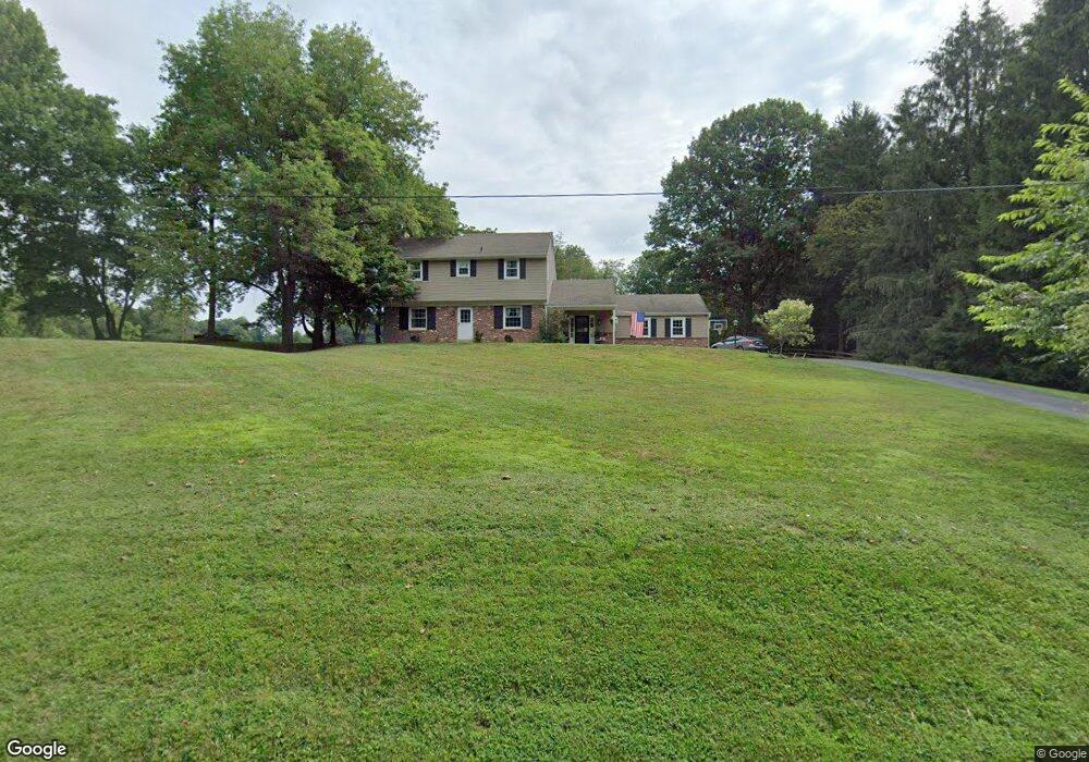
981 Hershey Mill Rd Malvern, PA 19355
Estimated Value: $619,000 - $768,000
4
Beds
3
Baths
2,136
Sq Ft
$324/Sq Ft
Est. Value
About This Home
This home is located at 981 Hershey Mill Rd, Malvern, PA 19355 and is currently estimated at $692,840, approximately $324 per square foot. 981 Hershey Mill Rd is a home located in Chester County with nearby schools including East Goshen Elementary School, J.R. Fugett Middle School, and West Chester East High School.
Ownership History
Date
Name
Owned For
Owner Type
Purchase Details
Closed on
Feb 17, 2009
Sold by
Celentano Norma Teresa
Bought by
Virgilio Joseph R and Virgilio Faith K
Current Estimated Value
Home Financials for this Owner
Home Financials are based on the most recent Mortgage that was taken out on this home.
Original Mortgage
$272,000
Outstanding Balance
$171,015
Interest Rate
5%
Mortgage Type
Purchase Money Mortgage
Estimated Equity
$521,825
Create a Home Valuation Report for This Property
The Home Valuation Report is an in-depth analysis detailing your home's value as well as a comparison with similar homes in the area
Home Values in the Area
Average Home Value in this Area
Purchase History
| Date | Buyer | Sale Price | Title Company |
|---|---|---|---|
| Virgilio Joseph R | $340,000 | None Available |
Source: Public Records
Mortgage History
| Date | Status | Borrower | Loan Amount |
|---|---|---|---|
| Open | Virgilio Joseph R | $272,000 |
Source: Public Records
Tax History
| Year | Tax Paid | Tax Assessment Tax Assessment Total Assessment is a certain percentage of the fair market value that is determined by local assessors to be the total taxable value of land and additions on the property. | Land | Improvement |
|---|---|---|---|---|
| 2025 | $5,670 | $197,310 | $51,310 | $146,000 |
| 2024 | $5,670 | $197,310 | $51,310 | $146,000 |
| 2023 | $5,670 | $197,310 | $51,310 | $146,000 |
| 2022 | $5,497 | $197,310 | $51,310 | $146,000 |
| 2021 | $5,419 | $197,310 | $51,310 | $146,000 |
| 2020 | $5,383 | $197,310 | $51,310 | $146,000 |
| 2019 | $5,306 | $197,310 | $51,310 | $146,000 |
| 2018 | $5,190 | $197,310 | $51,310 | $146,000 |
| 2017 | $5,074 | $197,310 | $51,310 | $146,000 |
| 2016 | $4,428 | $197,310 | $51,310 | $146,000 |
| 2015 | $4,428 | $197,310 | $51,310 | $146,000 |
| 2014 | $4,428 | $197,310 | $51,310 | $146,000 |
Source: Public Records
Map
Nearby Homes
- THE PRESCOTT - (1010 Hershey Mill Rd) -*Millstone Cir
- THE DELCHESTER- Millstone Circle (Gps 1010 Hershey Mill Rd)
- THE WARREN - (1010 Hershey Mill Rd )- *Millstone Cir
- THE GREENBRIAR - Cir
- 1218 Candytuft Ln
- 621 Glenwood Ln
- 1308 S Tulip Dr
- 46 Ashton Way
- 10 Glen Loch Way
- 821 Jefferson Way
- 4 Treemont Dr
- 445 Eaton Way
- 838 Jefferson Way
- 161 Chandler Dr
- 1611 Vance Ave
- 1703 Yardley Dr
- 1653 Yardley Ct
- 35 Addison Ln
- 1741 Yardley Dr
- 7 Ridge Rd
- 1001 Millstream Dr
- 1003 Millstream Dr
- 1005 Millstream Dr
- 1000 Millstream Dr
- 990 Hershey Mill Rd
- 1007 Millstream Dr
- 1004 Millstream Dr
- 1009 Millstream Dr
- 1002 Millstream Dr
- 1011 Millstream Dr
- 4 Anthony Dr
- 1008 Millstream Dr
- 1006 Millstream Dr
- 1013 Millstream Dr
- 1 Anthony Dr
- 1010 Millstream Dr
- 6 Anthony Dr
- 1015 Millstream Dr
- 3 Anthony Dr
- 8 Anthony Dr
Your Personal Tour Guide
Ask me questions while you tour the home.