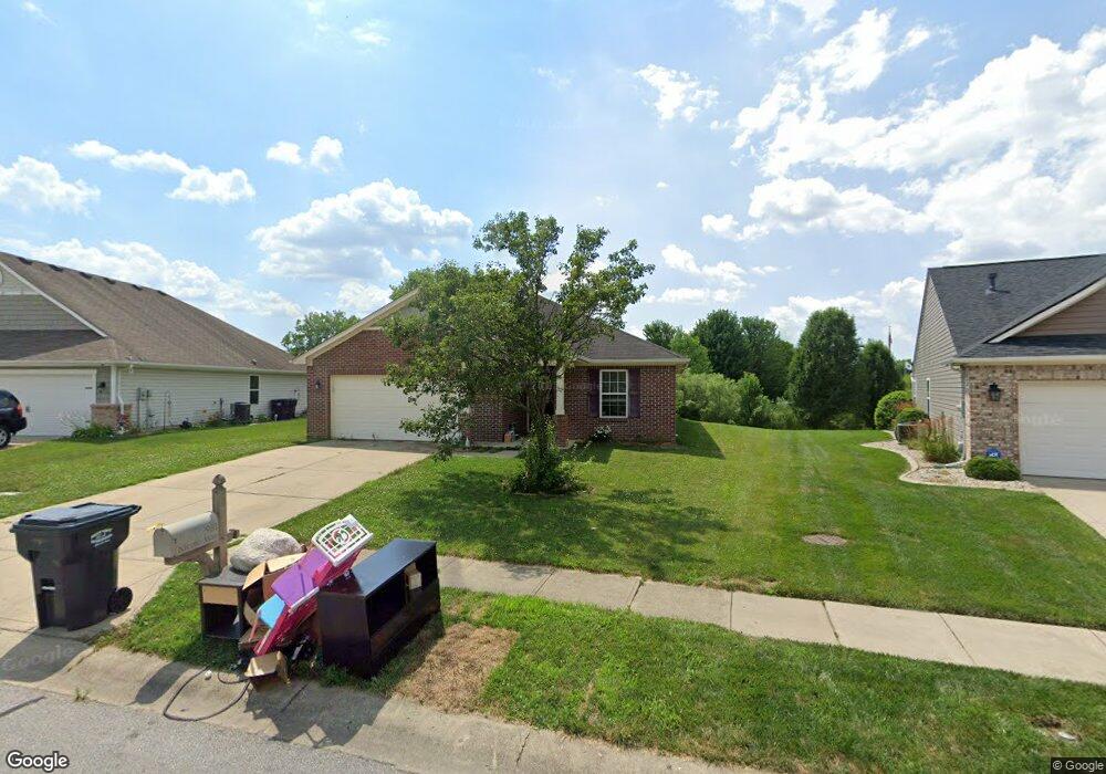
981 Nicole Way Whiteland, IN 46184
Estimated Value: $226,000 - $259,000
3
Beds
3
Baths
1,700
Sq Ft
$145/Sq Ft
Est. Value
About This Home
This home is located at 981 Nicole Way, Whiteland, IN 46184 and is currently estimated at $246,632, approximately $145 per square foot. 981 Nicole Way is a home located in Johnson County with nearby schools including Break-O-Day Elementary School, Clark-Pleasant Middle School, and Whiteland Community High School.
Ownership History
Date
Name
Owned For
Owner Type
Purchase Details
Closed on
Jan 7, 2022
Sold by
Crabtree Chris A
Bought by
Frame Benjamin E and Frame Jill M
Current Estimated Value
Home Financials for this Owner
Home Financials are based on the most recent Mortgage that was taken out on this home.
Original Mortgage
$131,250
Outstanding Balance
$104,588
Interest Rate
3.12%
Mortgage Type
New Conventional
Estimated Equity
$142,044
Purchase Details
Closed on
Nov 14, 2006
Sold by
Kb Home Indiana Inc
Bought by
Crabtree Chris A
Home Financials for this Owner
Home Financials are based on the most recent Mortgage that was taken out on this home.
Original Mortgage
$81,343
Interest Rate
6.4%
Create a Home Valuation Report for This Property
The Home Valuation Report is an in-depth analysis detailing your home's value as well as a comparison with similar homes in the area
Home Values in the Area
Average Home Value in this Area
Purchase History
| Date | Buyer | Sale Price | Title Company |
|---|---|---|---|
| Frame Benjamin E | $175,000 | New Title Company Name | |
| Crabtree Chris A | -- | None Available |
Source: Public Records
Mortgage History
| Date | Status | Borrower | Loan Amount |
|---|---|---|---|
| Open | Frame Benjamin E | $131,250 | |
| Previous Owner | Crabtree Chris A | $81,343 |
Source: Public Records
Tax History Compared to Growth
Tax History
| Year | Tax Paid | Tax Assessment Tax Assessment Total Assessment is a certain percentage of the fair market value that is determined by local assessors to be the total taxable value of land and additions on the property. | Land | Improvement |
|---|---|---|---|---|
| 2025 | $4,773 | $235,700 | $56,000 | $179,700 |
| 2024 | $4,773 | $228,500 | $56,000 | $172,500 |
| 2023 | $4,672 | $224,000 | $56,000 | $168,000 |
| 2022 | $1,972 | $190,100 | $29,900 | $160,200 |
| 2021 | $1,681 | $161,800 | $29,900 | $131,900 |
| 2020 | $1,502 | $143,800 | $29,900 | $113,900 |
| 2019 | $1,364 | $130,900 | $29,900 | $101,000 |
| 2018 | $1,340 | $129,900 | $22,600 | $107,300 |
| 2017 | $1,337 | $132,700 | $22,600 | $110,100 |
| 2016 | $1,279 | $127,900 | $22,600 | $105,300 |
| 2014 | $1,208 | $120,800 | $27,600 | $93,200 |
| 2013 | $1,208 | $121,800 | $27,600 | $94,200 |
Source: Public Records
Map
Nearby Homes
- 132 Arabian Ct
- 1003 Hilltop Commons Blvd
- 647 Bluestem Cir
- 587 Bluestem Ln
- 114 Tracy Ridge Blvd
- 733 Hanover Dr
- 588 Bluestem Ln
- Lincoln Plan at Crossroads at Southport
- Liberty Plan at Crossroads at Southport
- Rushmore Plan at Crossroads at Southport
- Jefferson Plan at Crossroads at Southport
- Washington Plan at Crossroads at Southport
- 76 Fernleaf Dr
- 190 Tracy Ridge Blvd
- 1195 Count Turf Ct
- 125 Hilltop Farms Blvd
- 256 Bittersweet Dr
- 652 Mooreland Dr
- 1037 Warwick Rd
- 240 Shelton Place