Estimated Value: $328,998 - $596,000
--
Bed
--
Bath
--
Sq Ft
6,186
Sq Ft Lot
About This Home
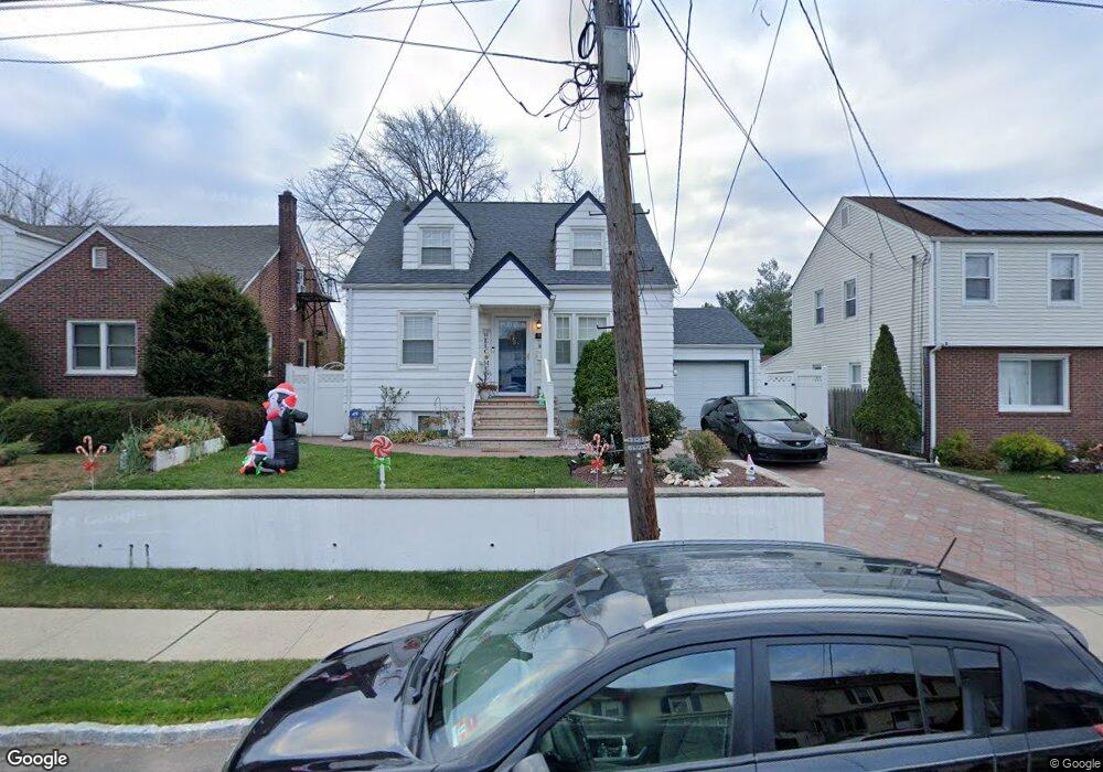
This home is located at 981 Potter Ave, Union, NJ 07083 and is currently estimated at $493,000. 981 Potter Ave is a home located in Union County with nearby schools including Livingston Elementary School, Union High School, and Bruriah High School For Girls.
Ownership History
Date
Name
Owned For
Owner Type
Purchase Details
Closed on
Feb 19, 1998
Sold by
Odonnell Irene and Lippincott Joanne
Bought by
Oliveira Joao and Oliveira Isabel
Current Estimated Value
Home Financials for this Owner
Home Financials are based on the most recent Mortgage that was taken out on this home.
Original Mortgage
$118,700
Outstanding Balance
$19,625
Interest Rate
6.25%
Estimated Equity
$473,375
Create a Home Valuation Report for This Property
The Home Valuation Report is an in-depth analysis detailing your home's value as well as a comparison with similar homes in the area
Home Values in the Area
Average Home Value in this Area
Purchase History
| Date | Buyer | Sale Price | Title Company |
|---|---|---|---|
| Oliveira Joao | $125,000 | -- |
Source: Public Records
Mortgage History
| Date | Status | Borrower | Loan Amount |
|---|---|---|---|
| Open | Oliveira Joao | $118,700 |
Source: Public Records
Tax History Compared to Growth
Tax History
| Year | Tax Paid | Tax Assessment Tax Assessment Total Assessment is a certain percentage of the fair market value that is determined by local assessors to be the total taxable value of land and additions on the property. | Land | Improvement |
|---|---|---|---|---|
| 2025 | $9,253 | $41,400 | $20,200 | $21,200 |
| 2024 | $8,971 | $41,400 | $20,200 | $21,200 |
| 2023 | $8,971 | $41,400 | $20,200 | $21,200 |
| 2022 | $8,659 | $41,400 | $20,200 | $21,200 |
| 2021 | $8,449 | $41,400 | $20,200 | $21,200 |
| 2020 | $8,281 | $41,400 | $20,200 | $21,200 |
| 2019 | $8,169 | $41,400 | $20,200 | $21,200 |
| 2018 | $8,030 | $41,400 | $20,200 | $21,200 |
| 2017 | $7,912 | $41,400 | $20,200 | $21,200 |
| 2016 | $7,719 | $41,400 | $20,200 | $21,200 |
| 2015 | $7,591 | $41,400 | $20,200 | $21,200 |
| 2014 | $7,421 | $41,400 | $20,200 | $21,200 |
Source: Public Records
Map
Nearby Homes
- 969 Arnet Ave
- 875 Salem Rd
- 790 Green Ln Unit A1
- 1370 Beverly Rd
- 795 Colonial Arms Rd
- 1084 Woodland Ave
- 600 Plymouth Rd
- 365 Broadwell Ave
- 1031 Lowden Ave
- 934 Lowden Ave
- 717 Winchester Ave
- 750 Midland Blvd
- 1322 Marcella Dr
- 314 Fitzpatrick St
- 1048 Chester St
- 1393 Cornell Place
- 292 Crann St
- 507 Locust Ave
- 1040 Cranbrook Rd
- 383 Conant St