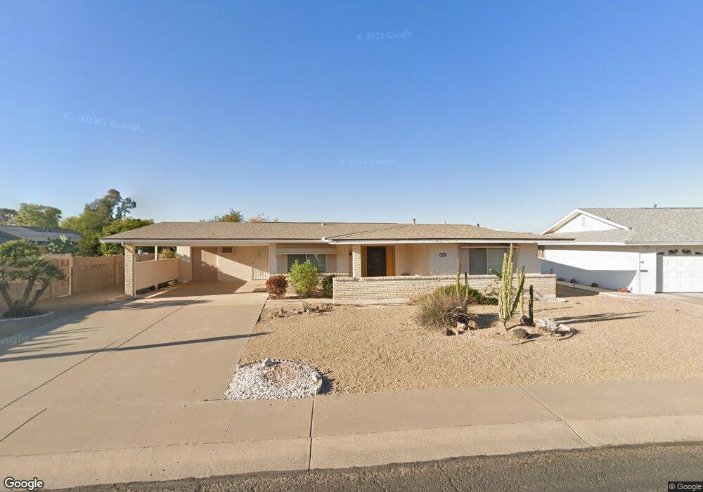
9810 N 101st Ave Sun City, AZ 85351
Estimated Value: $235,068 - $303,000
--
Bed
2
Baths
1,311
Sq Ft
$202/Sq Ft
Est. Value
About This Home
This home is located at 9810 N 101st Ave, Sun City, AZ 85351 and is currently estimated at $264,517, approximately $201 per square foot. 9810 N 101st Ave is a home located in Maricopa County with nearby schools including Ombudsman - Northwest Charter and Peoria Accelerated High School.
Ownership History
Date
Name
Owned For
Owner Type
Purchase Details
Closed on
Mar 5, 2025
Sold by
Dial Dave C and Dial Kathleen S
Bought by
David C Dial And Kathleen S Dial Trust and Dial
Current Estimated Value
Purchase Details
Closed on
Dec 26, 2001
Sold by
Wold Robert S and Wold Mary J
Bought by
Dial Dave C and Dial Kathleen S
Home Financials for this Owner
Home Financials are based on the most recent Mortgage that was taken out on this home.
Original Mortgage
$93,765
Interest Rate
6.51%
Mortgage Type
New Conventional
Purchase Details
Closed on
Apr 25, 1997
Sold by
Welch Margaret A
Bought by
Wold Robert S and Wold Mary J
Home Financials for this Owner
Home Financials are based on the most recent Mortgage that was taken out on this home.
Original Mortgage
$64,000
Interest Rate
7.91%
Mortgage Type
New Conventional
Create a Home Valuation Report for This Property
The Home Valuation Report is an in-depth analysis detailing your home's value as well as a comparison with similar homes in the area
Home Values in the Area
Average Home Value in this Area
Purchase History
| Date | Buyer | Sale Price | Title Company |
|---|---|---|---|
| David C Dial And Kathleen S Dial Trust | -- | None Listed On Document | |
| Dial Dave C | $98,700 | Arizona Title Agency Inc | |
| Wold Robert S | $80,000 | First American Title |
Source: Public Records
Mortgage History
| Date | Status | Borrower | Loan Amount |
|---|---|---|---|
| Previous Owner | Dial Dave C | $93,765 | |
| Previous Owner | Wold Robert S | $64,000 |
Source: Public Records
Tax History Compared to Growth
Tax History
| Year | Tax Paid | Tax Assessment Tax Assessment Total Assessment is a certain percentage of the fair market value that is determined by local assessors to be the total taxable value of land and additions on the property. | Land | Improvement |
|---|---|---|---|---|
| 2025 | $926 | $11,288 | -- | -- |
| 2024 | $836 | $10,751 | -- | -- |
| 2023 | $836 | $20,560 | $4,110 | $16,450 |
| 2022 | $785 | $16,110 | $3,220 | $12,890 |
| 2021 | $803 | $15,020 | $3,000 | $12,020 |
| 2020 | $781 | $12,970 | $2,590 | $10,380 |
| 2019 | $780 | $11,950 | $2,390 | $9,560 |
| 2018 | $731 | $10,770 | $2,150 | $8,620 |
| 2017 | $722 | $9,470 | $1,890 | $7,580 |
| 2016 | $678 | $8,860 | $1,770 | $7,090 |
| 2015 | $643 | $7,930 | $1,580 | $6,350 |
Source: Public Records
Map
Nearby Homes
- 10166 W Cinnebar Ave
- 10131 W Cheryl Dr Unit 6D
- 9834 N Balboa Dr
- 9939 W Ironwood Dr Unit 6D
- 10022 W Mountain View Rd
- 9925 W Mountain View Rd Unit 27
- 9915 W Mountain View Rd
- 9891 N Balboa Dr
- 10109 W Mountain View Rd
- 10034 W Concord Ave
- 10302 W Cheryl Dr Unit D
- 10014 W Mission Ln
- 9815 N 103rd Ave
- 10240 W Concord Ave
- 10316 W Salem Dr Unit 6D
- 10201 N 99th Ave Unit 3
- 10201 N 99th Ave Unit 33
- 10201 N 99th Ave Unit 149
- 10201 N 99th Ave Unit 2
- 10201 N 99th Ave Unit 96
- 9818 N 101st Ave Unit 6D
- 10102 W Ironwood Dr
- 10110 W Ironwood Dr
- 10130 W Cinnebar Ave
- 10136 W Cinnebar Ave
- 10118 W Ironwood Dr
- 9824 N 101st Ave
- 10130 W Ironwood Dr
- 9813 N 101st Ave
- 9801 N 101st Ave
- 10142 W Cinnebar Ave
- 9823 N 101st Ave
- 9830 N 101st Ave
- 10101 W Ironwood Dr
- 10109 W Ironwood Dr
- 10153 W Cinnebar Ave
- 10053 W Ironwood Dr
- 10113 W Ironwood Dr
- 10040 W Ironwood Dr
- 10148 W Cinnebar Ave