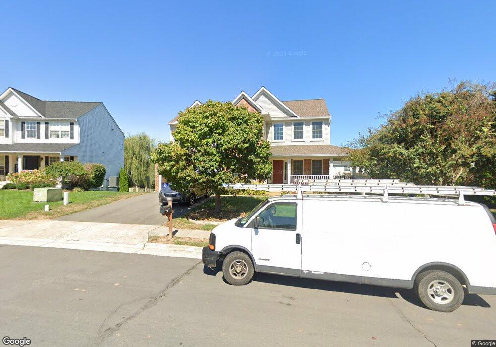
9813 Nugget Ct Bristow, VA 20136
Villages At Saybrooke NeighborhoodEstimated Value: $824,000 - $881,000
5
Beds
4
Baths
3,128
Sq Ft
$270/Sq Ft
Est. Value
About This Home
This home is located at 9813 Nugget Ct, Bristow, VA 20136 and is currently estimated at $843,874, approximately $269 per square foot. 9813 Nugget Ct is a home located in Prince William County with nearby schools including Patriot High School, Cedar Point Elementary School, and E.H. Marsteller Middle School.
Ownership History
Date
Name
Owned For
Owner Type
Purchase Details
Closed on
Sep 21, 2001
Sold by
Richmond American Hms Va
Bought by
Darmstead Edward
Current Estimated Value
Home Financials for this Owner
Home Financials are based on the most recent Mortgage that was taken out on this home.
Original Mortgage
$269,050
Outstanding Balance
$104,838
Interest Rate
6.98%
Estimated Equity
$739,036
Create a Home Valuation Report for This Property
The Home Valuation Report is an in-depth analysis detailing your home's value as well as a comparison with similar homes in the area
Home Values in the Area
Average Home Value in this Area
Purchase History
| Date | Buyer | Sale Price | Title Company |
|---|---|---|---|
| Darmstead Edward | $336,325 | -- |
Source: Public Records
Mortgage History
| Date | Status | Borrower | Loan Amount |
|---|---|---|---|
| Open | Darmstead Edward | $269,050 |
Source: Public Records
Tax History Compared to Growth
Tax History
| Year | Tax Paid | Tax Assessment Tax Assessment Total Assessment is a certain percentage of the fair market value that is determined by local assessors to be the total taxable value of land and additions on the property. | Land | Improvement |
|---|---|---|---|---|
| 2025 | $7,439 | $804,500 | $205,100 | $599,400 |
| 2024 | $7,439 | $748,000 | $195,200 | $552,800 |
| 2023 | $7,384 | $709,700 | $175,000 | $534,700 |
| 2022 | $7,407 | $668,800 | $155,500 | $513,300 |
| 2021 | $7,160 | $588,800 | $143,000 | $445,800 |
| 2020 | $8,251 | $532,300 | $127,500 | $404,800 |
| 2019 | $8,227 | $530,800 | $127,500 | $403,300 |
| 2018 | $6,117 | $506,600 | $121,400 | $385,200 |
| 2017 | $6,174 | $502,600 | $121,400 | $381,200 |
| 2016 | $5,817 | $477,600 | $109,500 | $368,100 |
| 2015 | $5,497 | $468,800 | $109,500 | $359,300 |
| 2014 | $5,497 | $441,300 | $104,300 | $337,000 |
Source: Public Records
Map
Nearby Homes
- 12048 Elliots Oak Place
- 9579 Scales Place
- 9656 Bedder Stone Place
- 12151 Hayfield Ct
- 9218 Dawkins Crest Cir
- 12021 Spring Beauty Rd
- 12100 Brevard Park Ct
- 9475 Sarah Mill Terrace
- 9381 Crestview Ridge Dr
- 9293 Crestview Ridge Dr
- 9318 Crestview Ridge Dr
- 9244 Crestview Ridge Dr
- 10554 Andrew Humphreys Ct
- 9073 Ribbon Falls Loop
- 10423 Rifle Rd
- 10512 Blazing Star Loop
- Hampton II Plan at Parkgate Estates
- 9256 Crestview Ridge Dr
- 9090 Brewer Creek Place
- 12673 Crabtree Falls Dr
- 9809 Nugget Ct
- 9817 Nugget Ct
- 9875 Upper Mill Loop
- 9879 Upper Mill Loop
- 9867 Upper Mill Loop
- 9805 Nugget Ct
- 9821 Nugget Ct
- 9808 Nugget Ct
- 9883 Upper Mill Loop
- 9863 Upper Mill Loop
- 9887 Upper Mill Loop
- 9859 Upper Mill Loop
- 9825 Nugget Ct
- 9801 Nugget Ct
- 9818 Nugget Ct
- 9800 Nugget Ct
- 9876 Upper Mill Loop
- 12064 Vantage Point Ct
- 12023 Thornbrooke Ct
- 9849 Upper Mill Loop