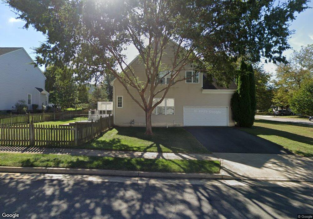
9817 Canmore Way Bristow, VA 20136
Braemar NeighborhoodEstimated Value: $737,668 - $789,000
3
Beds
4
Baths
2,240
Sq Ft
$342/Sq Ft
Est. Value
About This Home
This home is located at 9817 Canmore Way, Bristow, VA 20136 and is currently estimated at $765,417, approximately $341 per square foot. 9817 Canmore Way is a home located in Prince William County with nearby schools including Patriot High School, T. Clay Wood Elementary School, and E.H. Marsteller Middle School.
Ownership History
Date
Name
Owned For
Owner Type
Purchase Details
Closed on
Nov 4, 2003
Sold by
Brookfield Braemar Ii Llc
Bought by
Brown Dale
Current Estimated Value
Home Financials for this Owner
Home Financials are based on the most recent Mortgage that was taken out on this home.
Original Mortgage
$309,800
Outstanding Balance
$144,123
Interest Rate
6.05%
Mortgage Type
New Conventional
Estimated Equity
$621,294
Create a Home Valuation Report for This Property
The Home Valuation Report is an in-depth analysis detailing your home's value as well as a comparison with similar homes in the area
Home Values in the Area
Average Home Value in this Area
Purchase History
| Date | Buyer | Sale Price | Title Company |
|---|---|---|---|
| Brown Dale | $344,290 | -- |
Source: Public Records
Mortgage History
| Date | Status | Borrower | Loan Amount |
|---|---|---|---|
| Open | Brown Dale | $309,800 |
Source: Public Records
Tax History Compared to Growth
Tax History
| Year | Tax Paid | Tax Assessment Tax Assessment Total Assessment is a certain percentage of the fair market value that is determined by local assessors to be the total taxable value of land and additions on the property. | Land | Improvement |
|---|---|---|---|---|
| 2025 | $6,531 | $721,500 | $193,600 | $527,900 |
| 2024 | $6,531 | $656,700 | $184,400 | $472,300 |
| 2023 | $6,483 | $623,100 | $174,800 | $448,300 |
| 2022 | $6,560 | $582,000 | $150,300 | $431,700 |
| 2021 | $6,190 | $507,800 | $132,300 | $375,500 |
| 2020 | $7,125 | $459,700 | $120,400 | $339,300 |
| 2019 | $7,056 | $455,200 | $120,400 | $334,800 |
| 2018 | $5,226 | $432,800 | $114,700 | $318,100 |
| 2017 | $5,165 | $419,000 | $114,700 | $304,300 |
| 2016 | $4,986 | $408,100 | $109,000 | $299,100 |
| 2015 | $4,899 | $409,800 | $109,000 | $300,800 |
| 2014 | $4,899 | $392,300 | $104,000 | $288,300 |
Source: Public Records
Map
Nearby Homes
- 10240 Inchberry Ct
- 10028 Boreland Ct
- 9994 Shortbread Way
- 10045 Pentland Hills Way
- 10119 Orland Stone Dr
- 9505 Dunblane Ct
- 12750 Brewland Way
- 9817 Maitland Loop
- 12127 & 12131 Vint Hill Rd
- Hampton II Plan at Parkgate Estates
- 9709 Kinloss Mews
- 10024 Darnaway Ct
- 12410 Iona Sound Dr
- 13761 Vint Hill Rd
- 12916 Ness Hollow Ct
- 9516 Tarvie Cir
- 9512 Silas Dr
- 12360 Corncrib Ct
- 9179 Weathersfield Dr
- 9197 Rilda Place
- 14508 Swordale Ln
- 9813 Canmore Way
- 9816 Canmore Way
- 14504 Swordale Ln
- 14513 Swordale Ln
- 9812 Canmore Way
- 14517 Swordale Ln
- 14509 Swordale Ln
- 9809 Canmore Way
- 14524 Swordale Ln
- 10014 Broadsword Dr
- 14521 Swordale Ln
- 14500 Swordale Ln
- 14505 Swordale Ln
- 9806 Canmore Way
- 10010 Broadsword Dr
- 10032 Broadsword Dr
- 14525 Swordale Ln
- 14528 Swordale Ln
- 14501 Swordale Ln