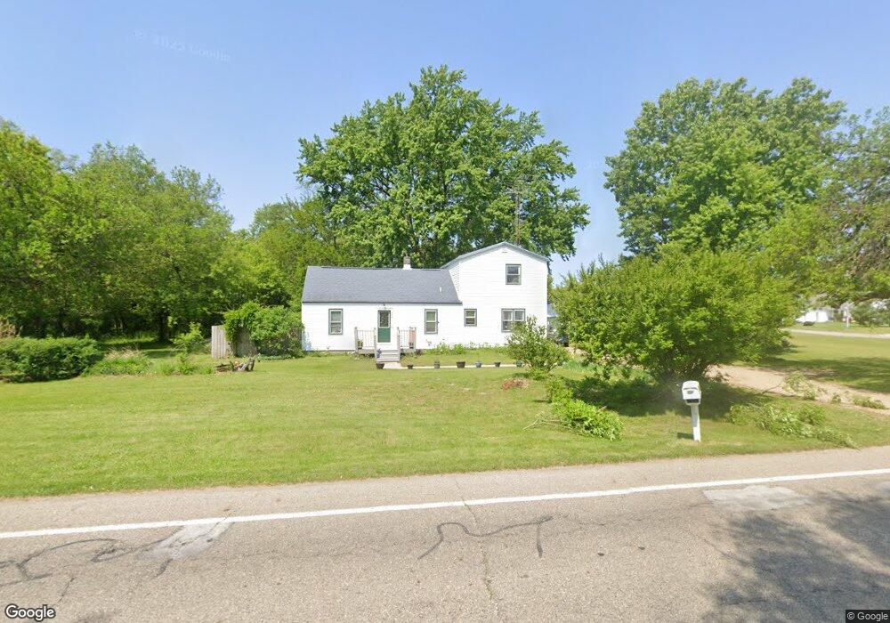
9818 Oakland Dr Portage, MI 49024
Estimated Value: $199,000 - $320,000
--
Bed
--
Bath
1,452
Sq Ft
$182/Sq Ft
Est. Value
About This Home
This home is located at 9818 Oakland Dr, Portage, MI 49024 and is currently estimated at $263,673, approximately $181 per square foot. 9818 Oakland Dr is a home located in Kalamazoo County with nearby schools including Moorsbridge Elementary School, Portage Central Middle School, and Portage Central High School.
Ownership History
Date
Name
Owned For
Owner Type
Purchase Details
Closed on
Oct 17, 2006
Sold by
Versluis Susan L and Versluis Susan
Bought by
Versluis Susan L and Versluis Susan
Current Estimated Value
Purchase Details
Closed on
Sep 26, 2003
Sold by
Snyder Robert and Snyder Joann M
Bought by
Versluis Susan
Home Financials for this Owner
Home Financials are based on the most recent Mortgage that was taken out on this home.
Original Mortgage
$64,000
Outstanding Balance
$29,907
Interest Rate
6.23%
Mortgage Type
Purchase Money Mortgage
Estimated Equity
$233,766
Create a Home Valuation Report for This Property
The Home Valuation Report is an in-depth analysis detailing your home's value as well as a comparison with similar homes in the area
Home Values in the Area
Average Home Value in this Area
Purchase History
| Date | Buyer | Sale Price | Title Company |
|---|---|---|---|
| Versluis Susan L | -- | None Available | |
| Versluis Susan | $50,000 | Trans |
Source: Public Records
Mortgage History
| Date | Status | Borrower | Loan Amount |
|---|---|---|---|
| Open | Versluis Susan | $64,000 |
Source: Public Records
Tax History Compared to Growth
Tax History
| Year | Tax Paid | Tax Assessment Tax Assessment Total Assessment is a certain percentage of the fair market value that is determined by local assessors to be the total taxable value of land and additions on the property. | Land | Improvement |
|---|---|---|---|---|
| 2025 | $1,774 | $120,300 | $0 | $0 |
| 2024 | $1,562 | $98,800 | $0 | $0 |
| 2023 | $1,474 | $95,700 | $0 | $0 |
| 2022 | $1,593 | $89,200 | $0 | $0 |
| 2021 | $1,540 | $74,600 | $0 | $0 |
| 2020 | $1,506 | $64,800 | $0 | $0 |
| 2019 | $136 | $65,300 | $0 | $0 |
| 2018 | $0 | $63,800 | $0 | $0 |
| 2016 | -- | $63,800 | $0 | $0 |
| 2015 | -- | $61,100 | $0 | $0 |
| 2014 | -- | $59,900 | $0 | $0 |
Source: Public Records
Map
Nearby Homes
- 2612 Ashford Trail
- 2750 Ashford Trail
- 9899 Windflower Ln
- 2586 Ashford Trail
- 2613 Ashford Trail
- 10029 Kearns Ct
- 10077 Kearns Ct
- 2685 Ashford Trail
- 10118 Pennridge Dr
- 10025 Kearns Ct
- 9820 Windflower Ln
- 9898 Windflower Ln
- 9770 Windflower Ln
- 10187 Pennridge Dr
- 10197 Pennridge Dr
- Integrity 1800 Plan at Pennridge Trail North
- Integrity 2085 Plan at Pennridge Trail North
- Integrity 1910 Plan at Pennridge Trail North
- 10025 Shuman St
- 10381 Schrier Ln
- 2151 Ashford Trail
- 2183 Ashford Trail
- 9832 Oakland Dr
- 9804 Oakland Dr
- 2156 Ashford Trail
- 9821 Oakland Dr
- 2213 Ashford Trail
- 9842 Oakland Dr
- 2180 Oakland Farms Trail
- 2180 Oakland Farm Trail
- 2233 Ashford Trail
- 2184 Ashford Trail
- 2212 Oakland Farms Trail
- 2214 Ashford Trail
- 2212 Oakland Farm Trail
- 9828 Shaver Rd
- 2257 Ashford Trail
- 2236 Oakland Farm Trail
- 2236 Oakland Farms Trail
- 2234 Ashford Trail