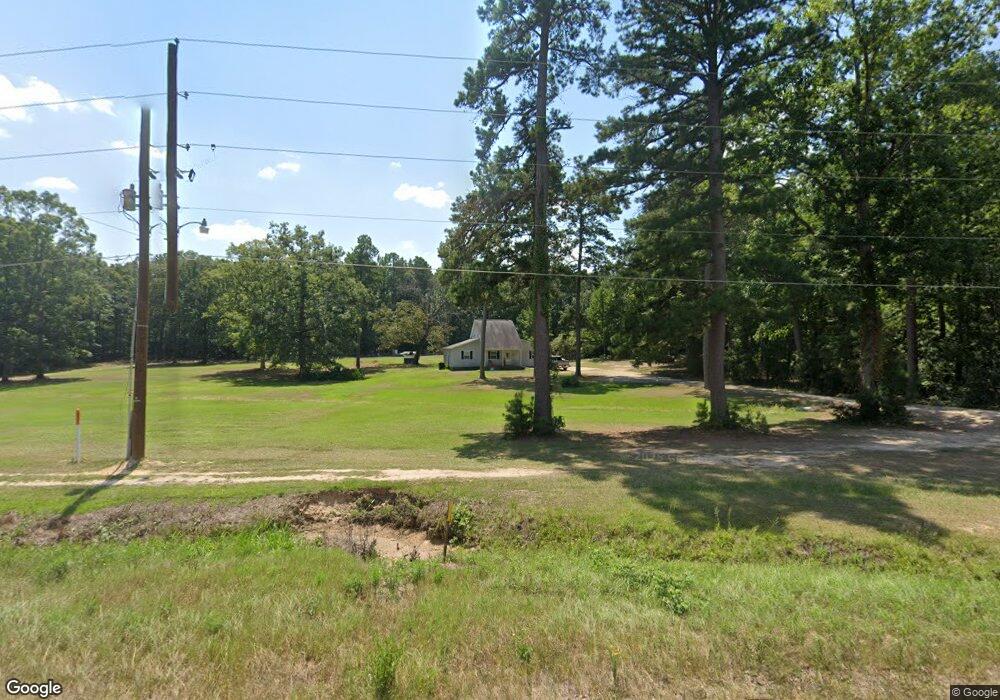
9819 Highway 270 E Sheridan, AR 72150
Estimated Value: $245,000 - $330,000
--
Bed
2
Baths
1,304
Sq Ft
$208/Sq Ft
Est. Value
About This Home
This home is located at 9819 Highway 270 E, Sheridan, AR 72150 and is currently estimated at $270,942, approximately $207 per square foot. 9819 Highway 270 E is a home located in Grant County with nearby schools including Sheridan High School.
Ownership History
Date
Name
Owned For
Owner Type
Purchase Details
Closed on
Nov 17, 2017
Sold by
Painter James C and Painter Susan D
Bought by
Roberts Tristan and Roberts Rebecca
Current Estimated Value
Home Financials for this Owner
Home Financials are based on the most recent Mortgage that was taken out on this home.
Original Mortgage
$147,283
Interest Rate
4.5%
Mortgage Type
FHA
Purchase Details
Closed on
May 5, 2006
Sold by
Duke Herbert
Bought by
Painter James C and Painter Susan D
Purchase Details
Closed on
Feb 10, 2004
Bought by
Duke
Purchase Details
Closed on
Jan 1, 1994
Bought by
More
Create a Home Valuation Report for This Property
The Home Valuation Report is an in-depth analysis detailing your home's value as well as a comparison with similar homes in the area
Home Values in the Area
Average Home Value in this Area
Purchase History
| Date | Buyer | Sale Price | Title Company |
|---|---|---|---|
| Roberts Tristan | $150,000 | First National Title | |
| Painter James C | $29,848 | Stewart Title Of Arkansas | |
| Duke | $72,000 | -- | |
| More | -- | -- |
Source: Public Records
Mortgage History
| Date | Status | Borrower | Loan Amount |
|---|---|---|---|
| Open | More | $147,283 | |
| Closed | Roberts Tristan | $147,283 |
Source: Public Records
Tax History Compared to Growth
Tax History
| Year | Tax Paid | Tax Assessment Tax Assessment Total Assessment is a certain percentage of the fair market value that is determined by local assessors to be the total taxable value of land and additions on the property. | Land | Improvement |
|---|---|---|---|---|
| 2024 | $674 | $25,250 | $2,750 | $22,500 |
| 2023 | $249 | $25,250 | $2,750 | $22,500 |
| 2022 | $269 | $25,250 | $2,750 | $22,500 |
| 2021 | $240 | $25,250 | $2,750 | $22,500 |
| 2020 | $211 | $13,020 | $2,500 | $10,520 |
| 2019 | $211 | $13,020 | $2,500 | $10,520 |
| 2018 | $236 | $13,020 | $2,500 | $10,520 |
| 2017 | $236 | $13,020 | $2,500 | $10,520 |
| 2015 | -- | $12,850 | $2,500 | $10,350 |
| 2014 | -- | $12,850 | $2,500 | $10,350 |
| 2012 | -- | $12,850 | $2,500 | $10,350 |
Source: Public Records
Map
Nearby Homes
- 9693 Highway 270 E
- 9561 U S 270
- 10847 U S 270
- 1228 Keg Mill Rd
- 223 W Clearwater Dr
- 193 Sycamore Ln
- 000 Grant 75 Grant 75
- 6200 Olloway Rd
- 2915 Ashley Rd
- 6100 Olloway Rd
- 9931 Grant 75
- 766 Grant 735
- Lot 1 Grant County Road 762
- lot 16 Grant County Road 761
- lot 27 Grant County Road 763
- lot 23 Grant County Road 763
- TBD Sassafras Trail
- 0 Highway 46 N
- 7894 Highway 46 N
- 199 Hardin Reed Rd
- E Hwy 270
- 50 Brunson Ln
- 50 Brunson Ln
- 122 Brunson Ln
- 9844 Highway 270 E
- 41 Brunson Ln
- 97 Ed Haven Dr
- 0 Ed Haven Dr Unit 15018080
- 30 Keg Mill Rd
- 9693 Highway 270 E
- 115 Ed Haven Dr
- 98 Ed Haven Dr
- 9667 Highway 270 E
- 9667 Highway 270 E
- 165 Brunson Ln
- 37 Lillian Wood Dr
- 120 Ed Haven Dr
- 69 Lillian Wood Dr
- 45 Keg Mill Rd
- 185 Ed Haven Dr