Estimated Value: $262,832 - $476,000
4
Beds
2
Baths
2,104
Sq Ft
$191/Sq Ft
Est. Value
About This Home
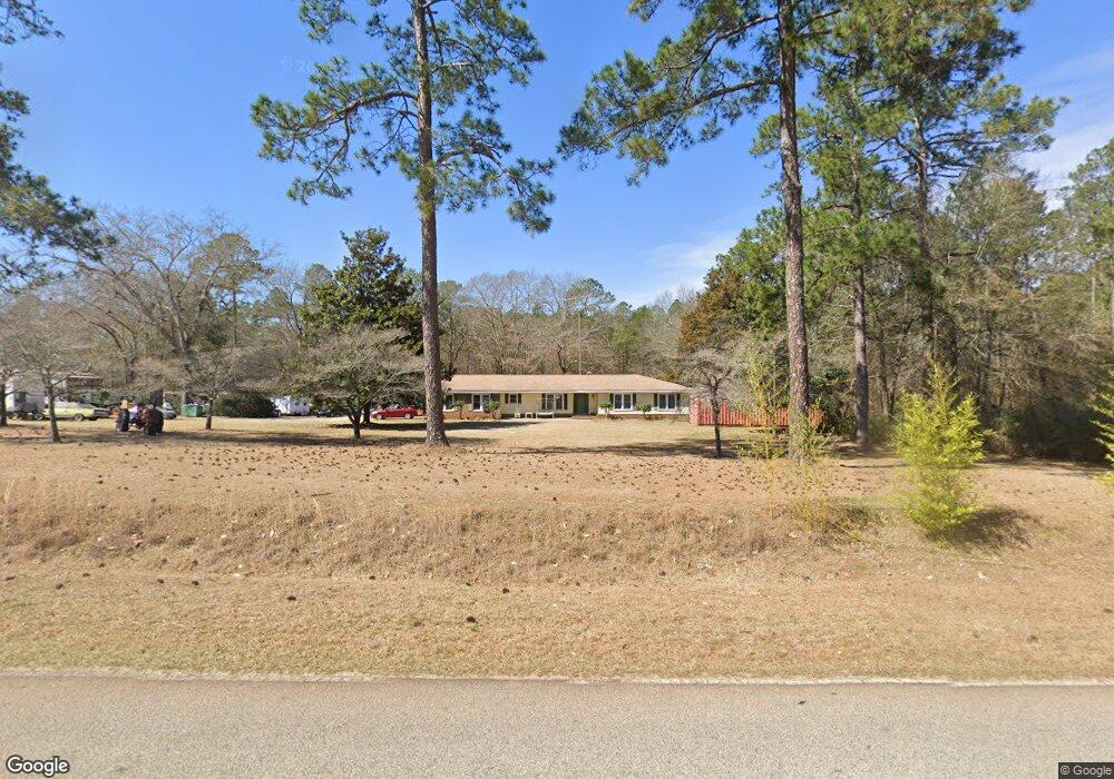
This home is located at 982 Airport Rd, Perry, GA 31069 and is currently estimated at $401,944, approximately $191 per square foot. 982 Airport Rd is a home located in Peach County with nearby schools including Kay Road Elementary School, Fort Valley Middle School, and Peach County High School.
Ownership History
Date
Name
Owned For
Owner Type
Purchase Details
Closed on
Sep 5, 2019
Sold by
Brown James L
Bought by
Walston Bryan A and Walston Laurie K
Current Estimated Value
Purchase Details
Closed on
Dec 16, 2003
Sold by
Brown James L
Bought by
Brown James L and Brown Mary-Joy
Purchase Details
Closed on
Jan 15, 1997
Bought by
Brown James L
Purchase Details
Closed on
Nov 25, 1996
Bought by
Herin Ralph D
Purchase Details
Closed on
Aug 6, 1996
Bought by
First Union Nh Bank Of Ga
Purchase Details
Closed on
Jul 31, 1981
Bought by
Harris Henry G and Harris Carol D
Create a Home Valuation Report for This Property
The Home Valuation Report is an in-depth analysis detailing your home's value as well as a comparison with similar homes in the area
Home Values in the Area
Average Home Value in this Area
Purchase History
| Date | Buyer | Sale Price | Title Company |
|---|---|---|---|
| Walston Bryan A | -- | -- | |
| Brown James L | -- | -- | |
| Brown James L | $37,500 | -- | |
| Herin Ralph D | $25,000 | -- | |
| First Union Nh Bank Of Ga | -- | -- | |
| Harris Henry G | -- | -- |
Source: Public Records
Tax History Compared to Growth
Tax History
| Year | Tax Paid | Tax Assessment Tax Assessment Total Assessment is a certain percentage of the fair market value that is determined by local assessors to be the total taxable value of land and additions on the property. | Land | Improvement |
|---|---|---|---|---|
| 2024 | $2,265 | $79,240 | $15,080 | $64,160 |
| 2023 | $1,412 | $65,280 | $10,040 | $55,240 |
| 2022 | $1,748 | $59,368 | $10,040 | $49,328 |
| 2021 | $1,634 | $47,796 | $10,040 | $37,756 |
| 2020 | $1,992 | $59,276 | $10,040 | $49,236 |
| 2019 | $1,883 | $55,520 | $10,040 | $45,480 |
| 2018 | $1,892 | $55,520 | $10,040 | $45,480 |
| 2017 | $1,900 | $55,520 | $10,040 | $45,480 |
| 2016 | $1,645 | $56,080 | $10,600 | $45,480 |
| 2015 | $1,849 | $54,120 | $8,640 | $45,480 |
| 2014 | $1,849 | $54,120 | $8,640 | $45,480 |
| 2013 | -- | $54,120 | $8,640 | $45,480 |
Source: Public Records
Map
Nearby Homes
- 218 Walton Chase
- 0 Airport Rd Unit 250304
- 2XX Airport Rd
- 0 Todd Rd Unit 253674
- 104 Bayview Dr
- 309 Bermuda Ridge
- 150 MacK Thompson Rd
- 0 MacK Thompson Rd Unit 253661
- 118 Jennifer Ln
- 1801 Quail Ridge Ln
- 1802 Quail Ridge Ln
- 902 Quail Ridge Ln
- 1803 Quail Ridge Ln
- 0 N Highway 341 Unit 1522479
- 149 MacK Thompson Road Common
- 309 Charles Gray Blvd
- 214 S Houston Springs Blvd
- 310 Pebble Beach Dr
- 103 Steeple Ct
- 315 Pebble Beach Dr
- 880 Airport Rd
- 1717 Harper Rd
- 862 Airport Rd
- 38 Harper Rd
- 309 Walton Chase
- 616 Harper Rd
- 605 Harper Rd
- 305 Walton Chase
- 601 Harper Rd
- 301 Walton Chase
- 0 Pine Bough Trail
- 0 Harper Rd Unit 159392
- 0 Harper Rd Unit 8941543
- 0 Harper Rd
- 620 Harper Rd
- 17 Racking Ln Unit 17A
- 0 Racking Ln Unit M151217
- 0 Racking Ln Unit 8906118
- 0 Racking Ln
- 302 Walton Chase