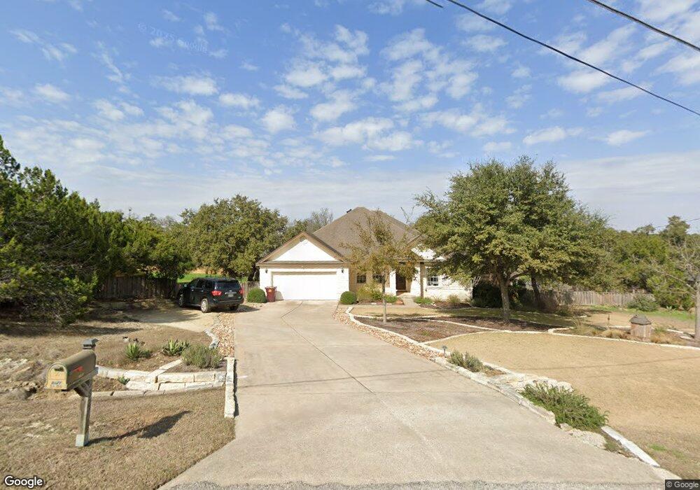
9827 Buckskin Trail Austin, TX 78737
Estimated Value: $605,846 - $748,000
4
Beds
2
Baths
2,109
Sq Ft
$331/Sq Ft
Est. Value
About This Home
This home is located at 9827 Buckskin Trail, Austin, TX 78737 and is currently estimated at $697,462, approximately $330 per square foot. 9827 Buckskin Trail is a home located in Hays County with nearby schools including Sycamore Springs Elementary School, Sycamore Springs Middle, and Dripping Springs High School.
Ownership History
Date
Name
Owned For
Owner Type
Purchase Details
Closed on
Nov 23, 2011
Sold by
Migl Thomas Scott and Migl Tammi Renee
Bought by
Migl Thomas Scott and Migl Tammi Renee
Current Estimated Value
Home Financials for this Owner
Home Financials are based on the most recent Mortgage that was taken out on this home.
Original Mortgage
$192,925
Interest Rate
3%
Mortgage Type
VA
Create a Home Valuation Report for This Property
The Home Valuation Report is an in-depth analysis detailing your home's value as well as a comparison with similar homes in the area
Home Values in the Area
Average Home Value in this Area
Purchase History
| Date | Buyer | Sale Price | Title Company |
|---|---|---|---|
| Migl Thomas Scott | -- | National Title Network |
Source: Public Records
Mortgage History
| Date | Status | Borrower | Loan Amount |
|---|---|---|---|
| Closed | Migl Thomas Scott | $192,925 |
Source: Public Records
Tax History Compared to Growth
Tax History
| Year | Tax Paid | Tax Assessment Tax Assessment Total Assessment is a certain percentage of the fair market value that is determined by local assessors to be the total taxable value of land and additions on the property. | Land | Improvement |
|---|---|---|---|---|
| 2025 | $6,257 | $519,103 | -- | -- |
| 2024 | $6,257 | $471,912 | $222,120 | $317,220 |
| 2023 | $6,478 | $429,011 | $222,120 | $407,760 |
| 2022 | $6,652 | $390,010 | $66,570 | $323,440 |
| 2021 | $6,676 | $356,840 | $66,570 | $290,270 |
| 2020 | $5,759 | $326,790 | $53,110 | $273,680 |
| 2019 | $6,369 | $308,850 | $43,460 | $265,390 |
| 2018 | $6,089 | $293,640 | $43,460 | $250,180 |
| 2017 | $5,991 | $286,740 | $43,460 | $243,280 |
| 2016 | $5,674 | $271,530 | $43,460 | $228,070 |
| 2015 | $4,910 | $259,090 | $43,460 | $215,630 |
Source: Public Records
Map
Nearby Homes
- 12800 Old Baldy Trail
- 10107 Davy Crockett Dr
- 9300 N Madrone Trail
- 11601 Morningsun Dr
- 9513 Morninghill Dr
- 155 Leaning Rock Ridge
- 489 Leaning Rock Ridge
- 134 Leaning Rock Ridge
- 501 Leaning Rock Ridge
- 228 Trickling Brook Rd
- 276 Leaning Rock Ridge
- 500 Leaning Rock Ridge
- 11420 Rim Rock Trail
- TBD Anglin Ln
- 8409 Appaloosa Run
- 13109 Madrone Mountain Way
- 13555 Nutty Brown Rd
- 519 Drury Ln
- 0 Broadwing Cove Unit ACT9121874
- 12932 Nutty Brown Rd
- 9825 Buckskin Trail
- 9831 Buckskin Trail
- 10401 Davy Crockett Dr
- 9830 Buckskin Trail
- 9823 Buckskin Trail
- 9808 Buckskin Trail
- 14300 Old Baldy Trail
- 9835 Buckskin Trail
- 9819 Buckskin Trail
- 9804 Buckskin Trail
- 9834 Buckskin Trail
- 9800 Buckskin Trail
- 9815 Buckskin Trail
- 9809 Buckskin Trail
- 10451 Davy Crockett Dr
- 10451 Davy Crockett Dr
- 9801 Buckskin Trail
- 9813 Buckskin Trail
- 10115 Davy Crockett Dr
- TBD Davy Crockett Dr