


983 State Highway 78 S Farmersville, TX 75442
Estimated payment $58,332/month
About This Lot
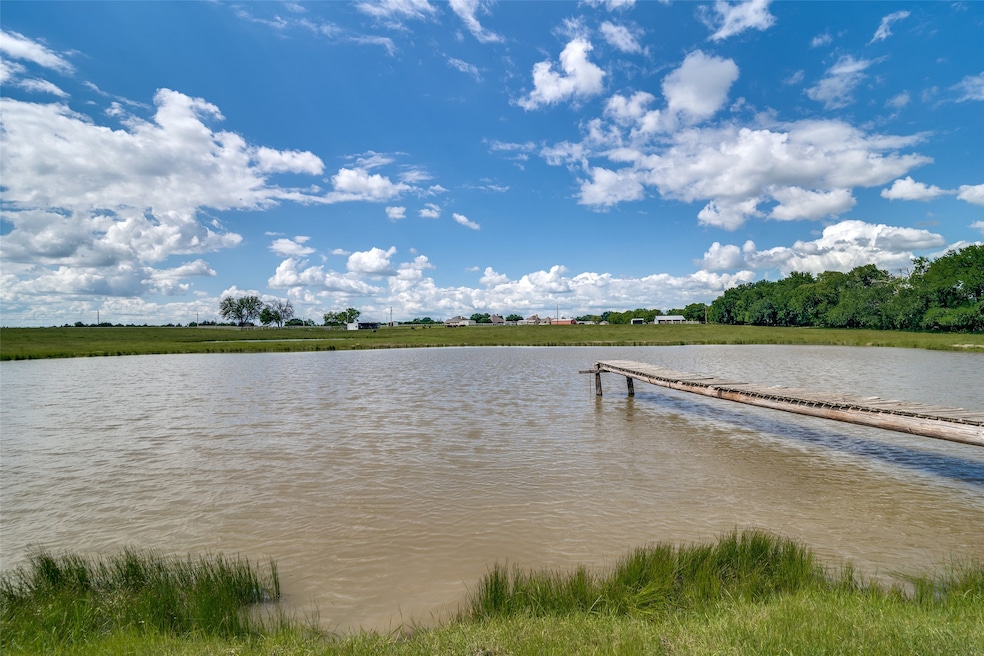
CALLING ALL INVESTORS AND DEVELOPERS!! Looking for the perfect setting to bring your innovative development projects to fruition? Look no further than this expansive 27.83-acre tract strategically located on heavily traveled HWY 78, in the thriving Farmersville area of Collin County. Many other commercial properties in the area are expanding or developing. This property would be perfect for apartments, storage facility, homesite development, you name it! Approximately 1 hr to DFW, 25 minutes to Greenville, Wylie, & McKinney. Just 2.5 miles to the Historic Downtown Farmersville, to do your shopping, eating or just walking around. Let's GOOOOOO!
Listing Agent
Core One Real Estate, L.L.C Brokerage Phone: 214-726-6389 License #0759300 Listed on: 05/15/2025
Property Details
Property Type
- Land
Est. Annual Taxes
- $375
Lot Details
- 27.83 Acre Lot
- Cleared Lot
- Few Trees
- Zoning described as Residential, Commercial
Schools
- Tatum Elementary School
- Farmersville High School
Farming
- Agricultural
Community Details
- Abs A0452 M C Hamilton Subdivision
Listing and Financial Details
- Assessor Parcel Number R645200000601
Map
Home Values in the Area
Average Home Value in this Area
Tax History
| Year | Tax Paid | Tax Assessment Tax Assessment Total Assessment is a certain percentage of the fair market value that is determined by local assessors to be the total taxable value of land and additions on the property. | Land | Improvement |
|---|---|---|---|---|
| 2024 | $375 | $25,490 | $22,616 | $2,874 |
| 2023 | $375 | $25,122 | $22,755 | $2,367 |
| 2022 | $378 | $24,835 | $22,839 | $1,996 |
| 2021 | $315 | $406,386 | $403,620 | $2,766 |
| 2020 | $289 | $406,358 | $403,620 | $2,738 |
| 2019 | $313 | $19,781 | $403,620 | $2,720 |
| 2018 | $302 | $18,997 | $0 | $0 |
| 2017 | $263 | $347,451 | $0 | $0 |
| 2016 | $857 | $326,401 | $0 | $0 |
| 2015 | $891 | $326,401 | $0 | $0 |
Property History
| Date | Event | Price | Change | Sq Ft Price |
|---|---|---|---|---|
| 05/15/2025 05/15/25 | For Sale | $10,700,000 | -- | -- |
Purchase History
| Date | Type | Sale Price | Title Company |
|---|---|---|---|
| Deed | -- | New Title Company Name |
Mortgage History
| Date | Status | Loan Amount | Loan Type |
|---|---|---|---|
| Previous Owner | $103,350 | Credit Line Revolving | |
| Previous Owner | $105,000 | Unknown |
Source: North Texas Real Estate Information Systems (NTREIS)
MLS Number: 20938443
APN: R-6452-000-0060-1
Disclaimer: Certain information contained herein is derived from information provided by parties other than Homes.com. All information provided is deemed reliable, but is not guaranteed to be accurate and should be independently verified.
![]() Listing information provided in part by the North Texas Real Estate Information Systems, Inc, for personal, non-commercial use by viewers of this site and may not be reproduced or redistributed. All information is deemed reliable but not guaranteed. Copyright © NTREIS 2025. All rights reserved
Listing information provided in part by the North Texas Real Estate Information Systems, Inc, for personal, non-commercial use by viewers of this site and may not be reproduced or redistributed. All information is deemed reliable but not guaranteed. Copyright © NTREIS 2025. All rights reserved
- 14215 County Road 606
- 1576 Emilia Dr
- Lot 1R County Road 607
- 1603 State Highway 78 S
- 1815 W Audie Murphy Pkwy
- TBD 12 W Audie Murphy Pkwy
- 42 Acres N State Highway 78
- 0000 S State Highway 78
- 77 Acres S State Highway 78
- 16658 County Road 558
- 1806 Harvard Blvd
- 1656 County Road 604
- 1809 Princeton Ave
- 2004 Princeton Ave
- 1900 Princeton Ave
- 1901 Yale St
- 1004 Henslee Hill
- 114 Harvard Blvd
- 112 New Haven St
- TBD 8 322 Acres Audie Murphy Hwy
- 16530 County Road 558
- 16658 County Road 558
- 2006 Princeton Ave
- 2004 Princeton Ave
- 107 Dartmouth Ave
- 2207 Hanover St
- 113 Providence Ave
- 1701 Crimson Ave
- 108 Dartmouth Ave
- 108 New Haven St
- 4000 Marble Falls Dr
- 989 Southgate Ct
- 2171 County Road 655
- 15159 County Road 549
- 2254 Cashmere Way
- 202 Lake Ridge
- 208 Lake Ridge Dr
- 2242 Cashmere Way
- 235 Enchanted Dr
- 233 Enchanted Way
