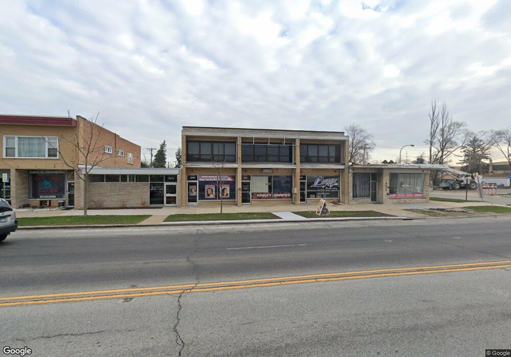
9838 W Roosevelt Rd West Chester, IL 60154
5
Beds
2
Baths
4,750
Sq Ft
5,227
Sq Ft Lot
About This Home
This home is located at 9838 W Roosevelt Rd, West Chester, IL 60154. 9838 W Roosevelt Rd is a home located in Cook County with nearby schools including Westchester Primary School, Westchester Intermediate School, and Westchester Middle School.
Ownership History
Date
Name
Owned For
Owner Type
Purchase Details
Closed on
Feb 27, 2025
Sold by
Pesek Jeffry A
Bought by
Municipal Trust
Purchase Details
Closed on
Mar 17, 2022
Sold by
Chitownlasercom Llc
Bought by
Pesek Jeffry A
Purchase Details
Closed on
May 25, 2017
Sold by
United Union Of Roofeis
Bought by
Chitowniaser Corn Llc
Create a Home Valuation Report for This Property
The Home Valuation Report is an in-depth analysis detailing your home's value as well as a comparison with similar homes in the area
Home Values in the Area
Average Home Value in this Area
Purchase History
| Date | Buyer | Sale Price | Title Company |
|---|---|---|---|
| Municipal Trust | -- | None Listed On Document | |
| Pesek Jeffry A | $255,000 | None Listed On Document | |
| Chitowniaser Corn Llc | $165,000 | Fidelity National Title |
Source: Public Records
Tax History Compared to Growth
Tax History
| Year | Tax Paid | Tax Assessment Tax Assessment Total Assessment is a certain percentage of the fair market value that is determined by local assessors to be the total taxable value of land and additions on the property. | Land | Improvement |
|---|---|---|---|---|
| 2024 | $4,745 | $18,080 | $1,641 | $16,439 |
| 2023 | $3,890 | $18,080 | $1,641 | $16,439 |
| 2022 | $3,890 | $12,751 | $1,444 | $11,307 |
| 2021 | $9,413 | $31,875 | $9,187 | $22,688 |
| 2020 | $9,070 | $31,436 | $9,187 | $22,249 |
| 2019 | $5,827 | $20,625 | $8,203 | $12,422 |
| 2018 | $5,750 | $20,625 | $8,203 | $12,422 |
| 2017 | $5,640 | $20,625 | $8,203 | $12,422 |
| 2016 | $11,493 | $39,406 | $7,875 | $31,531 |
| 2015 | $11,345 | $39,406 | $7,875 | $31,531 |
| 2014 | $11,083 | $39,406 | $7,875 | $31,531 |
| 2013 | $9,906 | $39,406 | $7,875 | $31,531 |
Source: Public Records
Map
Nearby Homes
- 923 Manchester Ave
- 920 Suffolk Ave
- 1119 Newcastle Ave
- 805 Norfolk Ave
- 814 Norfolk Ave
- 10072 Drury Ln
- 750 Bristol Ave
- 1433 Bristol Ave
- 1500 Bristol Ave
- 626 Manchester Ave
- 2003 S 24th Ave
- 1601 Bristol Ave
- 2320 S 22nd Ave
- 2237 S 22nd Ave
- 1623 Manchester Ave
- 1108 31st Ave
- 1102 31st Ave
- 1910 S 22nd Ave
- 723 Balmoral Ave
- 1909 S 22nd Ave
- 9838 W Roosevelt Rd Unit 2W
- 9834 W Roosevelt Rd
- 9848 Roosevelt Rd
- 1142 Bristol Ave
- 9625 W Roosevelt Rd Unit 101
- 9625 W Roosevelt Rd Unit 114-A
- 9625 W Roosevelt Rd Unit 110
- 9625 W Roosevelt Rd Unit 108
- 9625 W Roosevelt Rd
- 1136 Bristol Ave
- 1143 Manchester Ave
- 1139 Manchester Ave
- 1132 Bristol Ave
- 9900 Roosevelt Rd
- 1141 Bristol Ave
- 1131 Manchester Ave
- 1126 Bristol Ave
- 1135 Bristol Ave
- 1129 Bristol Ave
- 1122 Bristol Ave