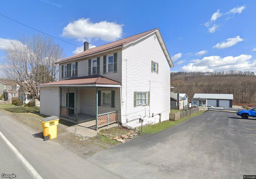
984 Locust St Saint Michael, PA 15951
Estimated Value: $62,045 - $146,000
4
Beds
2
Baths
1,920
Sq Ft
$59/Sq Ft
Est. Value
About This Home
This home is located at 984 Locust St, Saint Michael, PA 15951 and is currently estimated at $112,511, approximately $58 per square foot. 984 Locust St is a home located in Cambria County with nearby schools including Forest Hills Elementary School.
Create a Home Valuation Report for This Property
The Home Valuation Report is an in-depth analysis detailing your home's value as well as a comparison with similar homes in the area
Home Values in the Area
Average Home Value in this Area
Tax History
| Year | Tax Paid | Tax Assessment Tax Assessment Total Assessment is a certain percentage of the fair market value that is determined by local assessors to be the total taxable value of land and additions on the property. | Land | Improvement |
|---|---|---|---|---|
| 2025 | $312 | $6,280 | $320 | $5,960 |
| 2024 | $579 | $6,280 | $320 | $5,960 |
| 2023 | $560 | $6,280 | $320 | $5,960 |
| 2022 | $550 | $6,280 | $320 | $5,960 |
| 2021 | $565 | $6,280 | $320 | $5,960 |
| 2020 | $565 | $6,280 | $320 | $5,960 |
| 2019 | $565 | $6,280 | $320 | $5,960 |
| 2018 | $565 | $6,280 | $320 | $5,960 |
| 2017 | $568 | $6,280 | $320 | $5,960 |
| 2016 | $217 | $6,280 | $320 | $5,960 |
| 2015 | $185 | $6,280 | $320 | $5,960 |
| 2014 | $185 | $6,280 | $320 | $5,960 |
Source: Public Records
Map
Nearby Homes
- 223 2nd St
- 0 Crown St
- 464 Locust St
- 512 Broad St
- 1003 Forest Hills Dr
- 162 Orchard St
- 140 Hickory Dr
- Lot 3 Fifty Acre Rd
- 227 Martin Rd
- 1325 Forest Hills Dr
- 0 Forest Hills Drive Vacant Land - 5 48 Acres
- 203 Pine Bluff Rd
- 215 Old Luther St
- 0 Mount Airy Dr Unit 75145
- 0 Mount Airy Dr Unit 96037782
- 0 Mount Airy Dr Unit 1716723
- 170 Caitlyn Dr
- 139 Walnut St
- 2498 Portage St
- 2398 Centennial Dr
Your Personal Tour Guide
Ask me questions while you tour the home.