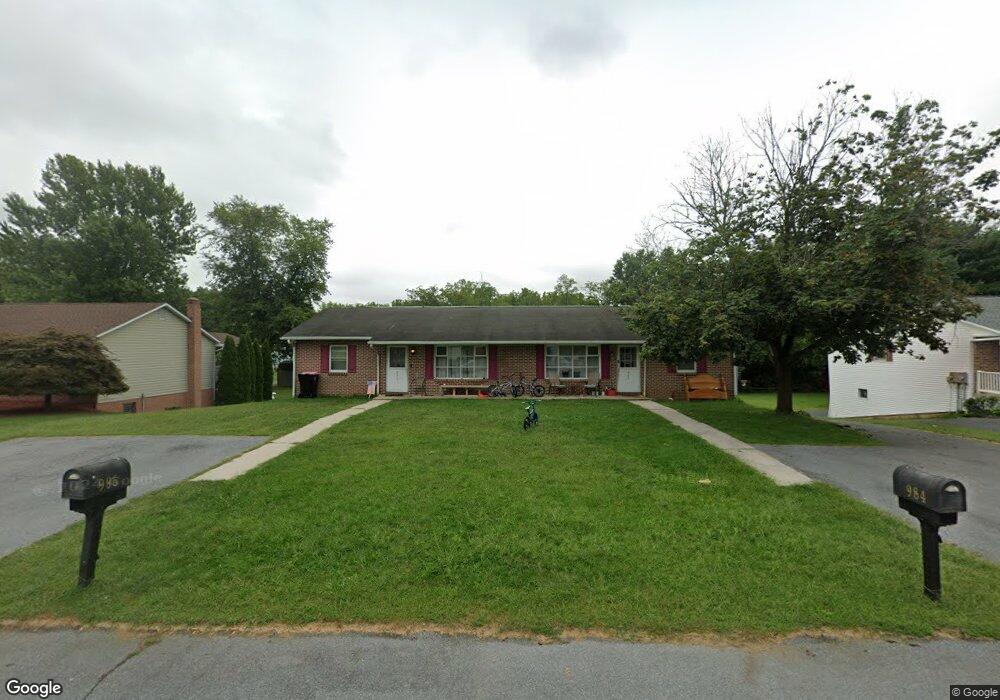
984 Reid Rd State Line, PA 17263
Estimated Value: $254,183 - $352,000
--
Bed
--
Bath
1,860
Sq Ft
$157/Sq Ft
Est. Value
About This Home
This home is located at 984 Reid Rd, State Line, PA 17263 and is currently estimated at $291,546, approximately $156 per square foot. 984 Reid Rd is a home with nearby schools including Greencastle-Antrim Elementary School, Greencastle-Antrim Primary School, and Greencastle-Antrim Middle School.
Ownership History
Date
Name
Owned For
Owner Type
Purchase Details
Closed on
Nov 29, 2021
Sold by
Keener Faye Luann and Lamb Kathy Elaine
Bought by
Plessinger Garrison
Current Estimated Value
Home Financials for this Owner
Home Financials are based on the most recent Mortgage that was taken out on this home.
Original Mortgage
$168,000
Outstanding Balance
$154,391
Interest Rate
3.05%
Mortgage Type
Commercial
Estimated Equity
$137,155
Create a Home Valuation Report for This Property
The Home Valuation Report is an in-depth analysis detailing your home's value as well as a comparison with similar homes in the area
Home Values in the Area
Average Home Value in this Area
Purchase History
| Date | Buyer | Sale Price | Title Company |
|---|---|---|---|
| Plessinger Garrison | $210,000 | Keystone Re Stlmt Svcs Inc |
Source: Public Records
Mortgage History
| Date | Status | Borrower | Loan Amount |
|---|---|---|---|
| Open | Plessinger Garrison | $168,000 |
Source: Public Records
Tax History Compared to Growth
Tax History
| Year | Tax Paid | Tax Assessment Tax Assessment Total Assessment is a certain percentage of the fair market value that is determined by local assessors to be the total taxable value of land and additions on the property. | Land | Improvement |
|---|---|---|---|---|
| 2025 | $3,677 | $21,980 | $980 | $21,000 |
| 2024 | $3,336 | $21,980 | $980 | $21,000 |
| 2023 | $3,297 | $21,980 | $980 | $21,000 |
| 2022 | $3,297 | $21,980 | $980 | $21,000 |
| 2021 | $3,137 | $21,330 | $980 | $20,350 |
| 2020 | $3,055 | $21,330 | $980 | $20,350 |
| 2019 | $2,986 | $21,330 | $980 | $20,350 |
| 2018 | $2,954 | $21,330 | $980 | $20,350 |
| 2017 | $2,879 | $21,330 | $980 | $20,350 |
| 2016 | $611 | $21,330 | $980 | $20,350 |
| 2015 | $570 | $21,330 | $980 | $20,350 |
| 2014 | $570 | $21,330 | $980 | $20,350 |
Source: Public Records
Map
Nearby Homes
- 1171 1173 Ridgeview Dr
- 15621 Oak Rd
- 171 East Ave
- 15444 Pennsylvania Ave
- 128 Hykes Rd E
- 110 Hykes Rd E
- Lot C3-2 Cedarbrook Dr
- Lot C3-1 Cedarbrook Dr
- 14732 Cedarbrook Dr
- 14799 Cedarbrook Dr
- 15480 Wedgewood Dr
- 1031 Dianne Dr
- 1033 Dianne Dr
- 684 Dresden Cir
- 14501 Molly Pitcher Hwy
- 14108 William Talcott Ln
- 0 Hykes Rd
- 18757 Mesa Terrace
- 226 Milnor Rd
- 19127 Grainary Dr
- 986 Redwood Dr
- 984 Redwood Dr
- 1010 Redwood Dr
- 956 Redwood Dr
- 0 Redwood Dr
- 932 Redwood Dr
- 1052 Woodland Pkwy
- 993 Redwood Dr
- 967 Redwood Dr
- 1069 Woodland Pkwy
- 1062 Redwood Dr
- 1088 Redwood Dr
- 1036 Redwood Dr
- 906 Redwood Dr
- 1083 Woodland Pkwy
- 1015 Woodland Pkwy
- 1045 Redwood Dr
- 1083 Woodland Pkwy
- 1015 Woodland Pkwy
- 860 Redwood Dr