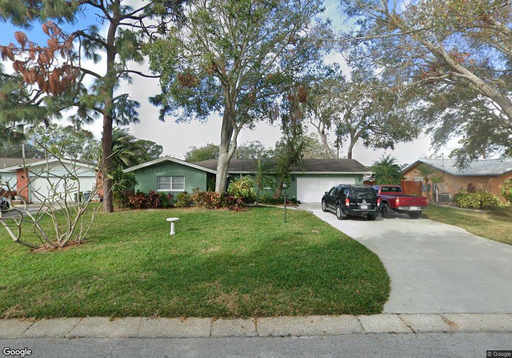
984 Sousa Dr Largo, FL 33771
North Largo NeighborhoodEstimated Value: $442,327 - $552,000
Studio
2
Baths
1,962
Sq Ft
$254/Sq Ft
Est. Value
About This Home
This home is located at 984 Sousa Dr, Largo, FL 33771 and is currently estimated at $498,332, approximately $253 per square foot. 984 Sousa Dr is a home located in Pinellas County with nearby schools including Largo High School, Belcher Elementary School, and Largo Middle School.
Ownership History
Date
Name
Owned For
Owner Type
Purchase Details
Closed on
Dec 28, 2001
Sold by
Focaracci Anthony N and Focaracci Laura A
Bought by
Koker Charles D and Koker Patricia
Current Estimated Value
Home Financials for this Owner
Home Financials are based on the most recent Mortgage that was taken out on this home.
Original Mortgage
$143,450
Interest Rate
6.49%
Mortgage Type
New Conventional
Create a Home Valuation Report for This Property
The Home Valuation Report is an in-depth analysis detailing your home's value as well as a comparison with similar homes in the area
Home Values in the Area
Average Home Value in this Area
Purchase History
| Date | Buyer | Sale Price | Title Company |
|---|---|---|---|
| Koker Charles D | $151,000 | -- |
Source: Public Records
Mortgage History
| Date | Status | Borrower | Loan Amount |
|---|---|---|---|
| Open | Koker Charles D | $127,282 | |
| Closed | Koker Charles D | $143,450 |
Source: Public Records
Tax History
| Year | Tax Paid | Tax Assessment Tax Assessment Total Assessment is a certain percentage of the fair market value that is determined by local assessors to be the total taxable value of land and additions on the property. | Land | Improvement |
|---|---|---|---|---|
| 2025 | $2,288 | $170,157 | -- | -- |
| 2024 | $2,283 | $165,362 | -- | -- |
| 2023 | $2,283 | $160,546 | $0 | $0 |
| 2022 | $2,263 | $156,929 | $0 | $0 |
| 2021 | $2,309 | $152,358 | $0 | $0 |
| 2020 | $2,314 | $150,254 | $0 | $0 |
| 2019 | $2,288 | $146,876 | $0 | $0 |
| 2018 | $2,273 | $144,137 | $0 | $0 |
| 2017 | $2,245 | $141,172 | $0 | $0 |
| 2016 | $2,217 | $138,268 | $0 | $0 |
| 2015 | $2,247 | $137,307 | $0 | $0 |
| 2014 | $2,230 | $136,217 | $0 | $0 |
Source: Public Records
Map
Nearby Homes
- 947 Sousa Dr
- 925 Irene Ave
- 1012 Irene Ave
- 1110 Irene Ave
- 3075 Rosery Rd NE
- 1895 Del Robles Terrace
- 1992 Arvis Cir E
- 2601 Oakwood Dr
- 1877 Del Robles Dr
- 546 Forest Pkwy E
- 2453 Roberta St
- 853 Seacrest Dr
- 1862 Del Robles Dr
- 1056 Keene Rd
- 1954 Arvis Cir W
- 921 Deville Dr E
- 869 Deville Dr E
- 732 Keene Rd
- 1849 Del Robles Dr
- 1950 Arvis Cir W
Your Personal Tour Guide
Ask me questions while you tour the home.