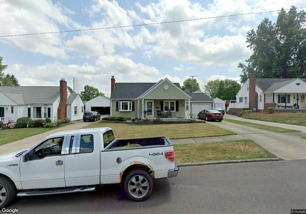
984 Vincent Blvd Alliance, OH 44601
Estimated Value: $200,000 - $247,000
3
Beds
2
Baths
1,894
Sq Ft
$117/Sq Ft
Est. Value
About This Home
This home is located at 984 Vincent Blvd, Alliance, OH 44601 and is currently estimated at $221,513, approximately $116 per square foot. 984 Vincent Blvd is a home located in Stark County with nearby schools including Alliance Early Learning School, Alliance Intermediate School at Northside, and Alliance Middle School.
Ownership History
Date
Name
Owned For
Owner Type
Purchase Details
Closed on
Nov 14, 2017
Sold by
Linder Linda K and Mcelroy Linda K
Bought by
Pepper Scott and Pepper Kathryn
Current Estimated Value
Home Financials for this Owner
Home Financials are based on the most recent Mortgage that was taken out on this home.
Original Mortgage
$126,000
Interest Rate
3.85%
Mortgage Type
New Conventional
Purchase Details
Closed on
Jul 19, 2001
Sold by
Lytle Josephine M
Bought by
Linder Linda K
Home Financials for this Owner
Home Financials are based on the most recent Mortgage that was taken out on this home.
Original Mortgage
$30,000
Interest Rate
7.22%
Mortgage Type
Purchase Money Mortgage
Create a Home Valuation Report for This Property
The Home Valuation Report is an in-depth analysis detailing your home's value as well as a comparison with similar homes in the area
Home Values in the Area
Average Home Value in this Area
Purchase History
| Date | Buyer | Sale Price | Title Company |
|---|---|---|---|
| Pepper Scott | $140,000 | None Available | |
| Linder Linda K | $87,000 | Quest Title Agency Inc |
Source: Public Records
Mortgage History
| Date | Status | Borrower | Loan Amount |
|---|---|---|---|
| Previous Owner | Pepper Scott | $126,000 | |
| Previous Owner | Linder Linda K | $30,000 |
Source: Public Records
Tax History Compared to Growth
Tax History
| Year | Tax Paid | Tax Assessment Tax Assessment Total Assessment is a certain percentage of the fair market value that is determined by local assessors to be the total taxable value of land and additions on the property. | Land | Improvement |
|---|---|---|---|---|
| 2025 | -- | $66,260 | $11,240 | $55,020 |
| 2024 | -- | $66,260 | $11,240 | $55,020 |
| 2023 | $1,970 | $49,000 | $8,890 | $40,110 |
| 2022 | $1,983 | $49,000 | $8,890 | $40,110 |
| 2021 | $1,985 | $49,000 | $8,890 | $40,110 |
| 2020 | $1,811 | $41,760 | $7,700 | $34,060 |
| 2019 | $1,786 | $41,760 | $7,700 | $34,060 |
| 2018 | $1,843 | $41,760 | $7,700 | $34,060 |
| 2017 | $1,630 | $37,320 | $5,990 | $31,330 |
| 2016 | $1,627 | $36,940 | $5,500 | $31,440 |
| 2015 | $1,641 | $36,940 | $5,500 | $31,440 |
| 2014 | $1,619 | $34,700 | $5,180 | $29,520 |
| 2013 | $808 | $34,700 | $5,180 | $29,520 |
Source: Public Records
Map
Nearby Homes
- 884 W College Rd
- 1515 S Rockhill Ave
- 1321 Parkway Blvd
- 1201 Overlook Dr
- 1038 Fairview Place
- 970 Kingsway St
- 738 Kingsway St
- 896 Parkway Blvd
- 2050 Federal Ave
- 2112 Blenheim Ave
- 734 Parkway Blvd
- 725 W Summit St
- 645 W Summit St
- 2220 Western Ave
- 1059 Oakwood Dr
- 112 E College St
- 1475 Chatauqua Ct
- 140 W Summit St
- 2839 S Rockhill Ave
- 807 S Union Ave
- 972 Vincent Blvd
- 998 Vincent Blvd
- 983 Lilly Rd
- 1008 Vincent Blvd
- 958 Vincent Blvd
- 997 Lilly Rd
- 973 Lilly Rd
- 963 Lilly Rd
- 979 Vincent Blvd
- 1018 Vincent Blvd
- 953 Lilly Rd
- 991 Vincent Blvd
- 1015 Lilly Rd
- 967 Vincent Blvd
- 1005 Vincent Blvd
- 1015 Vincent Blvd
- 943 Lilly Rd
- 951 Vincent Blvd
- 1019 Vincent Blvd
- 1028 Vincent Blvd