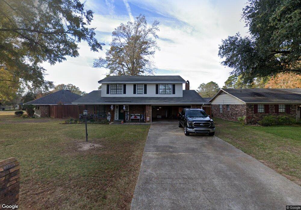
9848 High Point Dr Shreveport, LA 71106
Ellerbe Woods NeighborhoodEstimated Value: $315,000 - $329,000
4
Beds
4
Baths
2,724
Sq Ft
$118/Sq Ft
Est. Value
About This Home
This home is located at 9848 High Point Dr, Shreveport, LA 71106 and is currently estimated at $321,638, approximately $118 per square foot. 9848 High Point Dr is a home with nearby schools including Fairfield Magnet School, Judson Fundamental Elementary School, and Eden Gardens Fundamental Elementary School.
Ownership History
Date
Name
Owned For
Owner Type
Purchase Details
Closed on
Jan 8, 2015
Sold by
Roark Hershel Dewayne and Roark Kitty Davenport
Bought by
Darsey Christopher and Darsey Denise
Current Estimated Value
Home Financials for this Owner
Home Financials are based on the most recent Mortgage that was taken out on this home.
Original Mortgage
$218,500
Outstanding Balance
$168,405
Interest Rate
4.01%
Mortgage Type
New Conventional
Estimated Equity
$153,233
Create a Home Valuation Report for This Property
The Home Valuation Report is an in-depth analysis detailing your home's value as well as a comparison with similar homes in the area
Home Values in the Area
Average Home Value in this Area
Purchase History
| Date | Buyer | Sale Price | Title Company |
|---|---|---|---|
| Darsey Christopher | $230,000 | Bayou Title Inc |
Source: Public Records
Mortgage History
| Date | Status | Borrower | Loan Amount |
|---|---|---|---|
| Open | Darsey Christopher | $218,500 |
Source: Public Records
Tax History Compared to Growth
Tax History
| Year | Tax Paid | Tax Assessment Tax Assessment Total Assessment is a certain percentage of the fair market value that is determined by local assessors to be the total taxable value of land and additions on the property. | Land | Improvement |
|---|---|---|---|---|
| 2024 | $3,638 | $23,335 | $2,986 | $20,349 |
| 2023 | $3,488 | $21,883 | $2,844 | $19,039 |
| 2022 | $3,488 | $21,883 | $2,844 | $19,039 |
| 2021 | $3,435 | $21,883 | $2,844 | $19,039 |
| 2020 | $3,435 | $21,883 | $2,844 | $19,039 |
| 2019 | $3,690 | $22,820 | $2,844 | $19,976 |
| 2018 | $1,973 | $22,820 | $2,844 | $19,976 |
| 2017 | $3,749 | $22,820 | $2,844 | $19,976 |
| 2015 | $1,331 | $17,770 | $2,840 | $14,930 |
| 2014 | $2,321 | $17,770 | $2,840 | $14,930 |
| 2013 | -- | $17,770 | $2,840 | $14,930 |
Source: Public Records
Map
Nearby Homes
- 331 Pecan Dr
- 319 Buttonwood Cir
- 248 Hanging Moss Trail
- 209 Winterwood Dr
- 343 Crossfield Ct
- 379 Crossfield Ct Unit 5
- 367 Crossfield Ct
- Lot 148 Crossfield Ct
- 0 Railsback Ridge Dr Unit 20195227
- 10013 Beaver Creek Dr
- 0 Crossfield Ct
- 9614 Norris Ferry Rd
- 257 E Flournoy Lucas Rd
- 407 Mission Ridge Ct Unit 4A
- 354 Belle Winds Ct
- 0 Cross Ridge Ct Unit 156 21009262
- 0 Silver Point Unit 21005402
- 9610 Valencia Ct
- 9628 Valencia Ct Unit 3
- 9434 Valencia Ct
- 9842 High Point Dr
- 9838 High Point Dr
- 323 Peach Dr
- 9845 High Point Dr
- 319 Peach Dr
- 9849 High Point Dr
- 9834 High Point Dr
- 9841 High Point Dr
- 9857 High Point Dr
- 9853 High Point Dr
- 9837 High Point Dr
- 9830 High Point Dr
- 313 Peach Dr
- 324 Peach Dr
- 9833 High Point Dr
- 312 Peach Dr
- 347 Peach Dr
- 326 Peach Dr
- 9852 Ellerbe Rd
- 9856 Ellerbe Rd