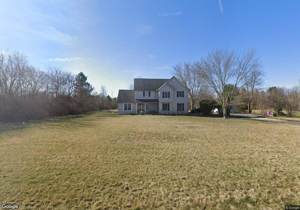
9849 Township Road 94 Findlay, OH 45840
Estimated Value: $435,000 - $551,000
4
Beds
3
Baths
2,428
Sq Ft
$198/Sq Ft
Est. Value
About This Home
This home is located at 9849 Township Road 94, Findlay, OH 45840 and is currently estimated at $479,873, approximately $197 per square foot. 9849 Township Road 94 is a home located in Hancock County with nearby schools including Liberty-Benton Elementary School, Liberty-Benton Middle School, and Liberty-Benton High School.
Ownership History
Date
Name
Owned For
Owner Type
Purchase Details
Closed on
Feb 2, 2016
Bought by
Abraham Rachel
Current Estimated Value
Home Financials for this Owner
Home Financials are based on the most recent Mortgage that was taken out on this home.
Interest Rate
3.79%
Purchase Details
Closed on
Aug 13, 1993
Bought by
Abraham Mathew and Abraham Rachel
Create a Home Valuation Report for This Property
The Home Valuation Report is an in-depth analysis detailing your home's value as well as a comparison with similar homes in the area
Home Values in the Area
Average Home Value in this Area
Purchase History
| Date | Buyer | Sale Price | Title Company |
|---|---|---|---|
| Abraham Rachel | -- | -- | |
| Abraham Mathew | $26,500 | -- |
Source: Public Records
Mortgage History
| Date | Status | Borrower | Loan Amount |
|---|---|---|---|
| Closed | Abraham Rachel | -- |
Source: Public Records
Tax History Compared to Growth
Tax History
| Year | Tax Paid | Tax Assessment Tax Assessment Total Assessment is a certain percentage of the fair market value that is determined by local assessors to be the total taxable value of land and additions on the property. | Land | Improvement |
|---|---|---|---|---|
| 2024 | $4,461 | $119,810 | $17,330 | $102,480 |
| 2023 | $4,355 | $119,810 | $17,330 | $102,480 |
| 2022 | $4,313 | $119,810 | $17,330 | $102,480 |
| 2021 | $3,875 | $95,000 | $15,950 | $79,050 |
| 2020 | $3,908 | $95,000 | $15,950 | $79,050 |
| 2019 | $3,750 | $85,230 | $13,300 | $71,930 |
| 2018 | $3,048 | $85,230 | $13,300 | $71,930 |
| 2017 | $1,572 | $85,230 | $13,300 | $71,930 |
| 2016 | $3,050 | $85,230 | $13,300 | $71,930 |
| 2015 | $2,812 | $76,590 | $13,300 | $63,290 |
| 2014 | $2,838 | $76,590 | $13,300 | $63,290 |
| 2012 | $2,722 | $70,320 | $13,300 | $57,020 |
Source: Public Records
Map
Nearby Homes
- 0 County Road 140
- 9960 W Us Route 224
- 0 County Road 95 Unit 6097574
- 6535 Silver Lake Dr
- 0 County Road 223
- 8922 Township Road 94
- 1405 Cypress Lake
- 3106 Saddlebrook
- 3018 Gleneagle Dr
- 925 W Melrose Ave
- 8179 Hazelwood Dr
- 933 Laurel Ln
- 905 W Melrose Ave
- 8256 Silverwood Dr
- 0 Rock Candy Rd Unit Lot 159
- 0 Rock Candy Rd Unit Lot 170
- 0 Rock Candy Rd Unit Lot 172 206819
- 0 Rock Candy Rd Unit Lot 162
- 0 Rock Candy Rd Unit Lot 171
- 0 Rock Candy Rd Unit Lot 168
- 9811 Township Road 94
- 9751 Township Road 94
- 7040 County Road 140
- 6986 County Road 140
- 6956 County Road 140
- 7142 County Road 140
- 10013 Township Road 94
- 6979 County Road 140
- 7154 County Road 140
- 10036 Township Road 94
- 6927 County Road 140
- 6951 County Road 140
- 9890 Independence Dr
- 6919 County Road 140
- 10078 Township Road 94
- 9910 Independence Dr
- 7250 County Road 140
- 7380 Congress Dr
- 7310 County Road 140
- 10140 Township Road 94