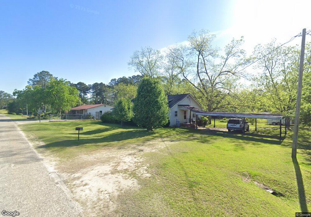
985 Sauls Rd Moultrie, GA 31768
Estimated Value: $120,839 - $173,000
Studio
1
Bath
1,452
Sq Ft
$99/Sq Ft
Est. Value
About This Home
This home is located at 985 Sauls Rd, Moultrie, GA 31768 and is currently estimated at $143,710, approximately $98 per square foot. 985 Sauls Rd is a home located in Colquitt County with nearby schools including Sunset Elementary School, Willie J. Williams Middle School, and C.A. Gray Junior High School.
Ownership History
Date
Name
Owned For
Owner Type
Purchase Details
Closed on
Apr 2, 2021
Sold by
Mcallister Beckie Sue
Bought by
Wilcox Jefferson Wayne
Current Estimated Value
Purchase Details
Closed on
Feb 18, 2015
Sold by
Parrish Nelson Enoch
Bought by
Spivey Robin
Home Financials for this Owner
Home Financials are based on the most recent Mortgage that was taken out on this home.
Original Mortgage
$41,326
Interest Rate
3.74%
Mortgage Type
New Conventional
Purchase Details
Closed on
May 11, 2006
Sold by
Parrish Enoch M
Bought by
Patten Vickie Parrish and Spradley Jackie Parrish
Purchase Details
Closed on
Sep 8, 1972
Bought by
Parrish Enoch M
Create a Home Valuation Report for This Property
The Home Valuation Report is an in-depth analysis detailing your home's value as well as a comparison with similar homes in the area
Purchase History
| Date | Buyer | Sale Price | Title Company |
|---|---|---|---|
| Wilcox Jefferson Wayne | $60,005 | -- | |
| Spivey Robin | $9,375 | -- | |
| Spivey Robin | $9,375 | -- | |
| Spivey Robin | $18,750 | -- | |
| Patten Vickie Parrish | -- | -- | |
| Parrish Enoch M | $4,500 | -- |
Source: Public Records
Mortgage History
| Date | Status | Borrower | Loan Amount |
|---|---|---|---|
| Previous Owner | Spivey Robin | $41,326 |
Source: Public Records
Tax History
| Year | Tax Paid | Tax Assessment Tax Assessment Total Assessment is a certain percentage of the fair market value that is determined by local assessors to be the total taxable value of land and additions on the property. | Land | Improvement |
|---|---|---|---|---|
| 2025 | $617 | $31,036 | $4,272 | $26,764 |
| 2024 | $617 | $28,573 | $3,205 | $25,368 |
| 2023 | $603 | $20,171 | $3,205 | $16,966 |
| 2022 | $460 | $19,339 | $2,848 | $16,491 |
| 2021 | $506 | $20,824 | $2,848 | $17,976 |
| 2020 | $491 | $19,859 | $2,848 | $17,011 |
| 2019 | $512 | $18,628 | $1,456 | $17,172 |
| 2018 | $476 | $18,628 | $1,456 | $17,172 |
| 2017 | $507 | $18,628 | $1,456 | $17,172 |
| 2016 | $514 | $18,628 | $1,456 | $17,172 |
| 2015 | $200 | $18,628 | $1,456 | $17,172 |
| 2014 | $194 | $13,408 | $1,456 | $11,952 |
| 2013 | -- | $13,407 | $1,456 | $11,951 |
Source: Public Records
Map
Nearby Homes
- Lot 3 Hummingbird Ln
- 10 Hummingbird Rd
- 5 Bracken Dr
- 0 Georgia 33
- 905 Barbara Cir
- 2005 S Main St
- 1816 S Main St
- 904 Barbara Cir
- 304 Clubview Dr
- 1841 S Main St
- 305 Clubview Dr
- 204 Nandina Dr
- 1215 12th St SW
- 1546 Ivy Ln
- 2216 Azalea Dr
- 301 Camellia Dr
- 2004 4th St SE
- 00 Southern Trail
- 1900 4th St SE
- 1200 10th St SW
- 975 Sauls Rd
- 142 Paul Murphy Rd
- 959 Sauls Rd
- 128 Paul Murphy Rd
- 548 Lower Meigs Rd
- 548 Lower Meigs Rd
- 121 Walter Murphy Rd
- 650 Lower Meigs Rd
- 149 Walter Murphy Rd
- 136 Walter Murphy Rd
- 925 Sauls Rd
- 932 Sauls Rd
- 171 Walter Murphy Rd
- 700 Lower Meigs Rd
- 156 Walter Murphy Rd
- 905 Sauls Rd
- 207 Walter Murphy Rd
- 470 Lower Meigs Rd
- 710 Lower Meigs Rd
- 893 Sauls Rd
Your Personal Tour Guide
Ask me questions while you tour the home.