9855 Dupont Dr Columbia Station, OH 44028
Estimated payment $1,180/month
Highlights
- Hot Property
- No HOA
- West Facing Home
- Cape Cod Architecture
- Forced Air Heating and Cooling System
About This Home
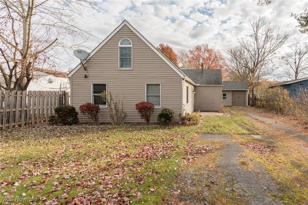
Charming 3-Bedroom Home in Columbia Station – Updated Kitchen, Huge Yard & Prime Location
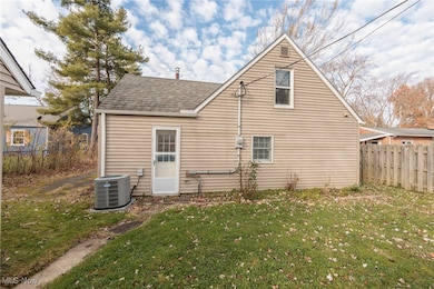
Welcome Home to your beautifully maintained 3-bedroom, 1-bath cape style home located in Columbia Station. This inviting property offers a perfect blend of comfort, character, and modern updates—ideal for homeowners seeking peaceful living with everyday convenience.
Step inside to a bright, remodeled kitchen featuring gorgeous dark countertops, stylish cabinetry, and plenty of workspace for cooking and entertaining. The home offers two spacious bedrooms on the main level and a huge upstairs bedroom that can double as a primary suite, guest space, or multipurpose room.
Enjoy the convenience of a separate laundry area, adding extra functionality to the layout.
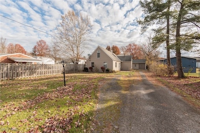
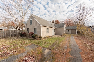
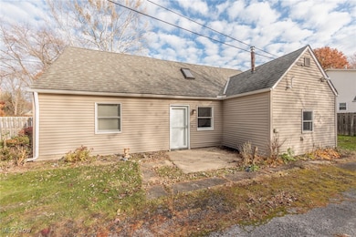
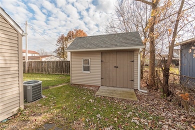
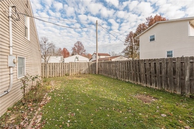
Outdoors, the property truly shines with its large yard, perfect for gatherings, gardening, or quiet relaxation. An enormous shed provides exceptional storage space for tools, equipment, or hobbies.
Located conveniently close to shopping, dining, parks, and major highways, this home offers peaceful suburban living with easy access to everything you need.
Don’t miss out on this charming and thoughtfully updated Columbia Station gem! Contact us today to schedule your private showing.
Listing Agent
Realuxe Ohio Brokerage Email: mandria@realuxerealestate.com, 440-341-2878 License #2003007374 Listed on: 11/15/2025
Home Details
Home Type
- Single Family
Est. Annual Taxes
- $2,466
Year Built
- Built in 1950 | Remodeled
Lot Details
- 6,098 Sq Ft Lot
- Lot Dimensions are 50x125
- West Facing Home
Parking
- Driveway
Home Design
- Cape Cod Architecture
- Frame Construction
- Fiberglass Roof
- Asphalt Roof
Interior Spaces
- 1,271 Sq Ft Home
- 1.5-Story Property
Bedrooms and Bathrooms
- 3 Bedrooms | 2 Main Level Bedrooms
- 1 Full Bathroom
Utilities
- Forced Air Heating and Cooling System
Community Details
- No Home Owners Association
- Westview Park Subdivision
Listing and Financial Details
- Assessor Parcel Number 12-00-020-106-006
Map
Home Values in the Area
Average Home Value in this Area
Tax History
| Year | Tax Paid | Tax Assessment Tax Assessment Total Assessment is a certain percentage of the fair market value that is determined by local assessors to be the total taxable value of land and additions on the property. | Land | Improvement |
|---|---|---|---|---|
| 2024 | $2,466 | $41,790 | $17,493 | $24,297 |
| 2023 | $1,880 | $29,663 | $11,263 | $18,400 |
| 2022 | $1,740 | $29,663 | $11,263 | $18,400 |
| 2021 | $1,440 | $29,663 | $11,263 | $18,400 |
| 2020 | $1,351 | $24,970 | $9,480 | $15,490 |
| 2019 | $2,635 | $24,970 | $9,480 | $15,490 |
| 2018 | $1,355 | $24,970 | $9,480 | $15,490 |
| 2017 | $1,457 | $24,900 | $6,020 | $18,880 |
| 2016 | $1,468 | $24,900 | $6,020 | $18,880 |
| 2015 | $1,505 | $24,900 | $6,020 | $18,880 |
| 2014 | $1,503 | $24,900 | $6,020 | $18,880 |
| 2013 | $1,508 | $24,900 | $6,020 | $18,880 |
Property History
| Date | Event | Price | List to Sale | Price per Sq Ft |
|---|---|---|---|---|
| 11/15/2025 11/15/25 | For Sale | $185,000 | -- | $146 / Sq Ft |
Purchase History
| Date | Type | Sale Price | Title Company |
|---|---|---|---|
| Interfamily Deed Transfer | -- | None Available | |
| Deed | $84,000 | -- |
Mortgage History
| Date | Status | Loan Amount | Loan Type |
|---|---|---|---|
| Open | $79,750 | FHA |
Source: MLS Now
MLS Number: 5171949
APN: 12-00-020-106-006
Disclaimer: Certain information contained herein is derived from information provided by parties other than Homes.com. All information provided is deemed reliable, but is not guaranteed to be accurate and should be independently verified.
![]() IDX information is provided exclusively for personal, non-commercial use, and may not be used for any purpose other than to identify prospective properties consumers may be interested in purchasing. Information is deemed reliable but not guaranteed.
IDX information is provided exclusively for personal, non-commercial use, and may not be used for any purpose other than to identify prospective properties consumers may be interested in purchasing. Information is deemed reliable but not guaranteed.
- V/L Aldridge Dr
- 24628 Sprague Rd
- 8809 Leatherleaf Dr
- 8960 Leatherleaf Dr
- 23390 Wainwright Terrace
- 8896 Firethorne Dr
- 23514 Grist Mill Ct Unit 4
- 8981 Leatherleaf Dr
- 9797 Sugarbush Cir
- 23155 Wainwright Terrace
- 23003 Chandlers Ln Unit 219
- 23003 Chandlers Ln Unit 230
- 23002 Chandlers Ln
- 23002 Chandlers Ln Unit 342
- 23002 Chandlers Ln Unit 221
- Brennan Plan at The Estates of Columbia Ridge
- Alden Plan at The Estates of Columbia Ridge
- Buchanan Plan at The Estates of Columbia Ridge
- Vanderburgh Plan at The Estates of Columbia Ridge
- Belleville Plan at The Estates of Columbia Ridge
- 9299 Columbia Rd
- 9640 Fernwood Dr
- 21518 Willow Ln
- 8581 Fair Rd
- 26640 Lake of the Falls Blvd Unit 26640
- 670-678 Prospect St
- 326 W Bagley Rd
- 21119 Albion Rd
- 367 S Rocky River Dr Unit ID1061192P
- 55 Barrett Rd
- 11814 Craig Dr
- 12649 Fieldstone Point
- 369 Front St Unit Townhouse
- 375-381 Front St
- 19 4th Ave
- 21600 Experience Way
- 1000 Stone Ridge Cir
- 8040 Strongsville Blvd Unit ID1061066P
- 80 Emerson Ave
- 775 Shelley Pkwy
