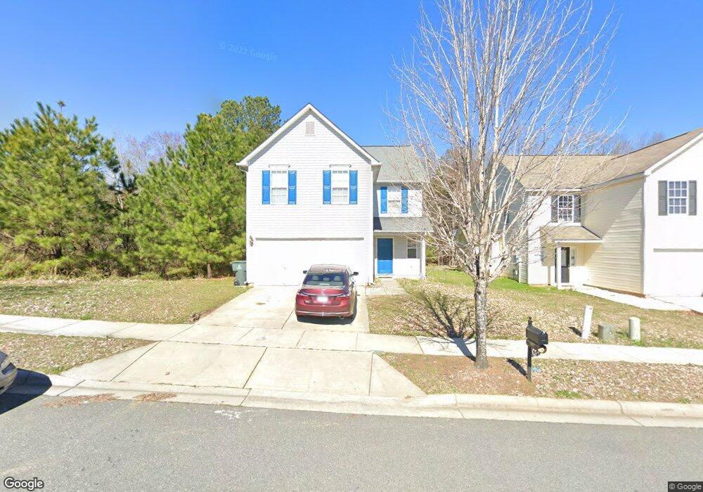
986 Ramsgate Dr SW Concord, NC 28025
Estimated Value: $244,000 - $332,000
5
Beds
3
Baths
2,232
Sq Ft
$138/Sq Ft
Est. Value
About This Home
This home is located at 986 Ramsgate Dr SW, Concord, NC 28025 and is currently estimated at $306,953, approximately $137 per square foot. 986 Ramsgate Dr SW is a home located in Cabarrus County with nearby schools including A.T. Allen Elementary School, C.C. Griffin Middle School, and Central Cabarrus High School.
Ownership History
Date
Name
Owned For
Owner Type
Purchase Details
Closed on
Aug 3, 2024
Sold by
Crp/Th Sfr Program Tx Owner Lp
Bought by
Crp/Tp Sfr Program Owner Llc
Current Estimated Value
Purchase Details
Closed on
Jun 28, 2024
Sold by
Byrd Ashley Renee and Gross Alan Raul
Bought by
Crp/Th Sfr Program Tx Owner Lp
Purchase Details
Closed on
Jan 18, 2011
Sold by
Rbc Bank Usa
Bought by
Gross Alan R and Gross Annette J
Home Financials for this Owner
Home Financials are based on the most recent Mortgage that was taken out on this home.
Original Mortgage
$129,900
Interest Rate
4.58%
Mortgage Type
VA
Purchase Details
Closed on
Jan 11, 2010
Sold by
Royce Homes North Carolina Llc
Bought by
Rbc Bank Usa and Royal Bank Of Canada
Create a Home Valuation Report for This Property
The Home Valuation Report is an in-depth analysis detailing your home's value as well as a comparison with similar homes in the area
Home Values in the Area
Average Home Value in this Area
Purchase History
| Date | Buyer | Sale Price | Title Company |
|---|---|---|---|
| Crp/Tp Sfr Program Owner Llc | -- | None Listed On Document | |
| Crp/Tp Sfr Program Owner Llc | -- | None Listed On Document | |
| Crp/Th Sfr Program Tx Owner Lp | $240,000 | None Listed On Document | |
| Crp/Th Sfr Program Tx Owner Lp | $240,000 | None Listed On Document | |
| Gross Alan R | $130,000 | None Available | |
| Rbc Bank Usa | $113,361 | None Available |
Source: Public Records
Mortgage History
| Date | Status | Borrower | Loan Amount |
|---|---|---|---|
| Previous Owner | Gross Alan R | $129,900 |
Source: Public Records
Tax History
| Year | Tax Paid | Tax Assessment Tax Assessment Total Assessment is a certain percentage of the fair market value that is determined by local assessors to be the total taxable value of land and additions on the property. | Land | Improvement |
|---|---|---|---|---|
| 2025 | $3,116 | $312,890 | $68,000 | $244,890 |
| 2024 | $3,116 | $312,890 | $68,000 | $244,890 |
| 2023 | $2,505 | $205,310 | $40,000 | $165,310 |
| 2022 | $2,505 | $205,310 | $40,000 | $165,310 |
| 2021 | $2,505 | $205,310 | $40,000 | $165,310 |
| 2020 | $2,505 | $205,310 | $40,000 | $165,310 |
| 2019 | $1,931 | $158,300 | $20,000 | $138,300 |
| 2018 | $1,900 | $158,300 | $20,000 | $138,300 |
| 2017 | $1,868 | $158,300 | $20,000 | $138,300 |
| 2016 | $1,108 | $142,010 | $24,000 | $118,010 |
| 2015 | $1,676 | $142,010 | $24,000 | $118,010 |
| 2014 | $1,676 | $142,010 | $24,000 | $118,010 |
Source: Public Records
Map
Nearby Homes
- 1039 Manston Place SW
- 4194 Clifftonville Ave SW
- 836 Chastain Ave
- 3969 Potts Grove Place
- 608 Nannyberry Ln
- 741 Nannyberry Ln
- 4003 Long Arrow Dr Unit 366
- 4018 Bethesda Place
- 303 Olde North Church Dr Unit 38
- 685 Continental Dr
- 1308 Roseberry Place SW
- 3560 Us Highway 601 S
- 5016 Hildreth Ct
- 4227 Kiser Woods Dr SW
- 5248 Ellie Ct
- 1562 Piney Church Rd
- 3044 Parade Ln SW
- 456 Debra Cir SW
- 5582 Flowes Store Rd
- 847 Kathryn Dr SE
- 982 Ramsgate Dr SW
- 990 Ramsgate Dr SW
- 978 Ramsgate Dr SW
- 974 Ramsgate Dr SW
- 970 Ramsgate Dr SW
- 979 Ramsgate Dr SW
- 983 Ramsgate Dr SW
- 995 Ramsgate Dr SW
- 4132 Broadstairs Dr
- 999 Ramsgate Dr SW
- 975 Ramsgate Dr SW
- 4136 Broadstairs Dr
- 966 Ramsgate Dr SW
- 966 Ramsgate Dr SW Unit 128
- 4132 Broadstairs Dr SW
- 971 Ramsgate Dr SW
- 1003 Ramsgate Dr SW Unit 85
- 4140 Broadstairs Dr
- 967 Ramsgate Dr SW
- 962 Ramsgate Dr SW
Your Personal Tour Guide
Ask me questions while you tour the home.