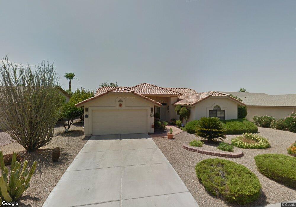
9863 W Menadota Dr Peoria, AZ 85382
Estimated Value: $370,212 - $503,000
--
Bed
3
Baths
1,880
Sq Ft
$242/Sq Ft
Est. Value
About This Home
This home is located at 9863 W Menadota Dr, Peoria, AZ 85382 and is currently estimated at $455,803, approximately $242 per square foot. 9863 W Menadota Dr is a home located in Maricopa County with nearby schools including Apache Elementary School, Sunrise Mountain High School, and Sonoran Science Academy-Peoria.
Ownership History
Date
Name
Owned For
Owner Type
Purchase Details
Closed on
Apr 21, 2023
Sold by
Burton Joan S
Bought by
Kauffmann Joan S and Kauffmann John S
Current Estimated Value
Purchase Details
Closed on
Sep 3, 1998
Sold by
Housley Wayne G and Housley Anne M
Bought by
Burton Joan S
Home Financials for this Owner
Home Financials are based on the most recent Mortgage that was taken out on this home.
Original Mortgage
$45,500
Interest Rate
6.89%
Mortgage Type
Purchase Money Mortgage
Purchase Details
Closed on
Feb 16, 1994
Sold by
Bourland Roger
Bought by
Housley Wayne G and Housley Anne M
Home Financials for this Owner
Home Financials are based on the most recent Mortgage that was taken out on this home.
Original Mortgage
$93,000
Interest Rate
8.56%
Mortgage Type
New Conventional
Create a Home Valuation Report for This Property
The Home Valuation Report is an in-depth analysis detailing your home's value as well as a comparison with similar homes in the area
Home Values in the Area
Average Home Value in this Area
Purchase History
| Date | Buyer | Sale Price | Title Company |
|---|---|---|---|
| Kauffmann Joan S | -- | None Listed On Document | |
| Burton Joan S | $144,000 | North American Title Agency | |
| Housley Wayne G | $124,000 | United Title Agency |
Source: Public Records
Mortgage History
| Date | Status | Borrower | Loan Amount |
|---|---|---|---|
| Previous Owner | Burton Joan S | $45,500 | |
| Previous Owner | Housley Wayne G | $93,000 |
Source: Public Records
Tax History Compared to Growth
Tax History
| Year | Tax Paid | Tax Assessment Tax Assessment Total Assessment is a certain percentage of the fair market value that is determined by local assessors to be the total taxable value of land and additions on the property. | Land | Improvement |
|---|---|---|---|---|
| 2025 | $1,768 | $22,713 | -- | -- |
| 2024 | $1,741 | $21,632 | -- | -- |
| 2023 | $1,741 | $30,060 | $6,010 | $24,050 |
| 2022 | $1,705 | $24,650 | $4,930 | $19,720 |
| 2021 | $1,826 | $23,230 | $4,640 | $18,590 |
| 2020 | $1,843 | $22,110 | $4,420 | $17,690 |
| 2019 | $1,783 | $20,230 | $4,040 | $16,190 |
| 2018 | $1,724 | $18,860 | $3,770 | $15,090 |
| 2017 | $1,725 | $17,430 | $3,480 | $13,950 |
| 2016 | $1,708 | $16,310 | $3,260 | $13,050 |
| 2015 | $1,593 | $15,680 | $3,130 | $12,550 |
Source: Public Records
Map
Nearby Homes
- 9869 W Chino Dr
- 9832 W Behrend Dr
- 9901 W Mescalero Ct
- 19702 N 98th Ln
- 19838 N Pine Springs Dr
- 9627 W Menadota Dr
- 19605 N Pine Springs Dr
- 9704 W Tonto Ln
- 9551 W Sierra Pinta Dr
- 9856 W Rimrock Dr
- 20424 N 96th Ln
- 19562 N 96th Ln Unit 80
- 9708 W Rimrock Dr Unit 96
- 9706 W Rimrock Dr Unit 95
- 9729 W Burnett Rd
- 9510 W Menadota Dr
- 10129 W Pine Springs Dr
- 9839 W Utopia Rd
- 9455 W Behrend Dr
- 10125 Willowcreek Cir
- 20053 N 98th Ln
- 9857 W Menadota Dr
- 9856 W Escuda Dr
- 9850 W Escuda Dr
- 20058 N 98th Ln
- 9851 W Menadota Dr
- 20037 N 98th Ln
- 9862 W Escuda Dr
- 9844 W Escuda Dr
- 9862 W Menadota Dr
- 9845 W Menadota Dr
- 9856 W Menadota Dr
- 20021 N 98th Ln
- 20034 N 98th Ln
- 20054 N 98th Ln
- 9868 W Escuda Dr
- 9850 W Menadota Dr
- 9838 W Escuda Dr
- 9839 W Menadota Dr
- 9845 W Escuda Dr