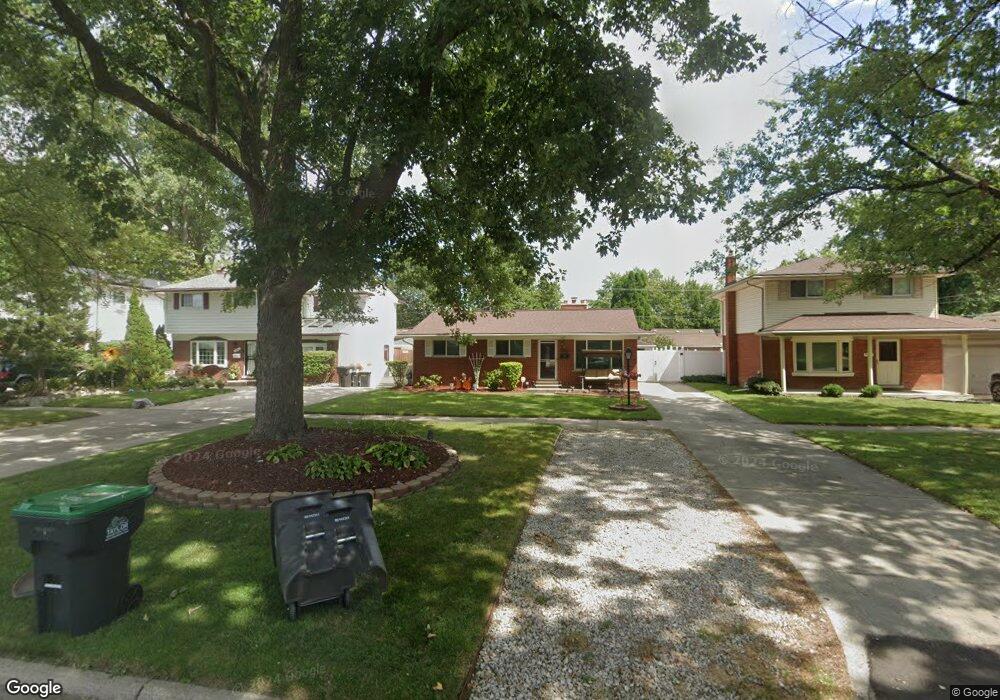
9867 Monroe Blvd Taylor, MI 48180
Estimated Value: $211,860 - $248,000
Studio
--
Bath
1,451
Sq Ft
$159/Sq Ft
Est. Value
About This Home
This home is located at 9867 Monroe Blvd, Taylor, MI 48180 and is currently estimated at $230,965, approximately $159 per square foot. 9867 Monroe Blvd is a home located in Wayne County with nearby schools including Kinyon Elementary School, Robert J. West Middle School, and Taylor Preparatory High School.
Ownership History
Date
Name
Owned For
Owner Type
Purchase Details
Closed on
Jun 25, 2015
Sold by
Wilhoite Ray and Wilhoite Tammy
Bought by
Wilhoite Ray and Wilhoite Tammy
Current Estimated Value
Purchase Details
Closed on
Dec 28, 1994
Sold by
Timothy J Gassman
Bought by
Wilhoite Ray and Wilhoite Tammy
Home Financials for this Owner
Home Financials are based on the most recent Mortgage that was taken out on this home.
Original Mortgage
$79,000
Interest Rate
8.75%
Mortgage Type
New Conventional
Create a Home Valuation Report for This Property
The Home Valuation Report is an in-depth analysis detailing your home's value as well as a comparison with similar homes in the area
Home Values in the Area
Average Home Value in this Area
Purchase History
| Date | Buyer | Sale Price | Title Company |
|---|---|---|---|
| Wilhoite Ray | -- | Attorney | |
| Wilhoite Ray | $88,800 | -- |
Source: Public Records
Mortgage History
| Date | Status | Borrower | Loan Amount |
|---|---|---|---|
| Closed | Wilhoite Ray | $79,000 |
Source: Public Records
Tax History
| Year | Tax Paid | Tax Assessment Tax Assessment Total Assessment is a certain percentage of the fair market value that is determined by local assessors to be the total taxable value of land and additions on the property. | Land | Improvement |
|---|---|---|---|---|
| 2025 | $2,499 | $119,600 | $0 | $0 |
| 2024 | $2,420 | $111,400 | $0 | $0 |
| 2023 | $2,888 | $98,000 | $0 | $0 |
| 2022 | $2,309 | $93,000 | $0 | $0 |
| 2021 | $2,538 | $83,600 | $0 | $0 |
| 2020 | $2,515 | $75,000 | $0 | $0 |
| 2019 | $251,497 | $63,600 | $0 | $0 |
| 2018 | $1,983 | $54,200 | $0 | $0 |
| 2017 | $1,069 | $50,700 | $0 | $0 |
| 2016 | $2,450 | $49,200 | $0 | $0 |
| 2015 | $4,481 | $45,800 | $0 | $0 |
| 2013 | $4,460 | $46,500 | $0 | $0 |
| 2012 | $1,977 | $45,000 | $10,400 | $34,600 |
Source: Public Records
Map
Nearby Homes
- 9883 Roosevelt St
- 22243 Kinyon St Unit 3
- 9942 Lincoln St
- 9640 Dudley St
- 22150 Haig St
- 9651 Blaty St
- 9560 Sylvester St
- 9223 Roosevelt St
- 9814 Cass Ave
- 10219 Island Lake Dr
- 10652 Mortenview Dr
- 22311 Wick Rd
- 22134 Wick Rd
- 22327 Wick Rd
- 6445 Pardee Rd
- 21059 Wick Rd
- 10868 Pardee Rd Unit 56
- 9444 Polk St
- 10578 Island Lake Dr
- 8953 William St
- 9859 Monroe Blvd
- 9879 Monroe Blvd
- 9887 Monroe Blvd
- 9847 Monroe Blvd
- 9846 Katherine St
- 9854 Katherine St
- 9836 Katherine St
- 9839 Monroe Blvd
- 9899 Monroe Blvd Unit Bldg-Unit
- 9899 Monroe Blvd
- 9866 Katherine St
- 9828 Katherine St
- 9818 Katherine St
- 9827 Monroe Blvd
- 9878 Katherine St
- 9868 Monroe Blvd
- 9856 Monroe Blvd
- 9810 Katherine St
- 9882 Monroe Blvd
- 9819 Monroe Blvd