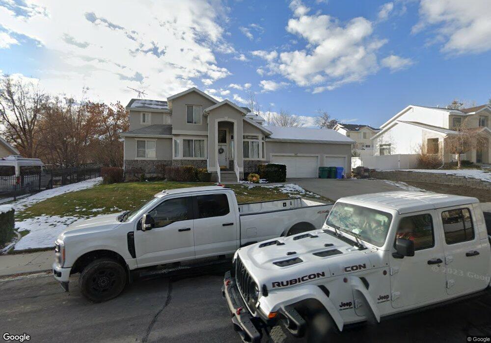
9867 N Mulberry Dr Cedar Hills, UT 84062
Estimated Value: $639,000 - $781,000
4
Beds
3
Baths
3,746
Sq Ft
$193/Sq Ft
Est. Value
About This Home
This home is located at 9867 N Mulberry Dr, Cedar Hills, UT 84062 and is currently estimated at $721,991, approximately $192 per square foot. 9867 N Mulberry Dr is a home located in Utah County with nearby schools including Deerfield Elementary School, Mountain Ridge Junior High School, and Lone Peak High School.
Ownership History
Date
Name
Owned For
Owner Type
Purchase Details
Closed on
Sep 9, 2019
Sold by
Manakofua Sione
Bought by
Manakofua Sione and Ngatuvai Luseane P
Current Estimated Value
Home Financials for this Owner
Home Financials are based on the most recent Mortgage that was taken out on this home.
Original Mortgage
$382,936
Outstanding Balance
$342,091
Interest Rate
4.62%
Mortgage Type
FHA
Estimated Equity
$379,900
Purchase Details
Closed on
Aug 28, 2019
Sold by
Zhang Ye and Zhao Jiang
Bought by
Manakofua Sione
Home Financials for this Owner
Home Financials are based on the most recent Mortgage that was taken out on this home.
Original Mortgage
$382,936
Outstanding Balance
$342,091
Interest Rate
4.62%
Mortgage Type
FHA
Estimated Equity
$379,900
Purchase Details
Closed on
Feb 9, 2012
Sold by
Cook Stephen Earl and Cook Amarilis
Bought by
Federal Home Loan Mortgage Corporation
Purchase Details
Closed on
Jun 24, 2002
Sold by
Cook Stephen E and Cook Amarilis
Bought by
Cook Stephen Earl and Cook Amarilis
Home Financials for this Owner
Home Financials are based on the most recent Mortgage that was taken out on this home.
Original Mortgage
$200,000
Interest Rate
6.86%
Purchase Details
Closed on
Feb 15, 2001
Sold by
Reinheimer Daniel G and Reinheimer Michelle E
Bought by
Cook Stephen E and Cook Amarilis
Purchase Details
Closed on
Sep 12, 2000
Sold by
Washington Mutual Bank
Bought by
Reinheimer Daniel G and Reinheimer Michelle E
Home Financials for this Owner
Home Financials are based on the most recent Mortgage that was taken out on this home.
Original Mortgage
$160,500
Interest Rate
8.11%
Purchase Details
Closed on
Nov 5, 1998
Sold by
The Ryland Group Inc
Bought by
Willey Douglas L and Willey Charisee L
Home Financials for this Owner
Home Financials are based on the most recent Mortgage that was taken out on this home.
Original Mortgage
$203,150
Interest Rate
4.87%
Create a Home Valuation Report for This Property
The Home Valuation Report is an in-depth analysis detailing your home's value as well as a comparison with similar homes in the area
Home Values in the Area
Average Home Value in this Area
Purchase History
| Date | Buyer | Sale Price | Title Company |
|---|---|---|---|
| Manakofua Sione | -- | Skyline Title Llc | |
| Manakofua Sione | -- | Skyline Title Llc | |
| Federal Home Loan Mortgage Corporation | -- | Guardian Title Insurance Age | |
| Cook Stephen Earl | -- | Title West Title Co | |
| Cook Stephen E | -- | Empire Land Title Company | |
| Reinheimer Daniel G | -- | First American Title Ins | |
| Willey Douglas L | -- | Guardian Title Insurance |
Source: Public Records
Mortgage History
| Date | Status | Borrower | Loan Amount |
|---|---|---|---|
| Open | Manakofua Sione | $382,936 | |
| Previous Owner | Cook Stephen Earl | $200,000 | |
| Previous Owner | Reinheimer Daniel G | $160,500 | |
| Previous Owner | Willey Douglas L | $203,150 |
Source: Public Records
Tax History Compared to Growth
Tax History
| Year | Tax Paid | Tax Assessment Tax Assessment Total Assessment is a certain percentage of the fair market value that is determined by local assessors to be the total taxable value of land and additions on the property. | Land | Improvement |
|---|---|---|---|---|
| 2025 | $2,940 | $379,390 | $244,800 | $445,000 |
| 2024 | $2,940 | $348,205 | $0 | $0 |
| 2023 | $2,752 | $350,185 | $0 | $0 |
| 2022 | $2,848 | $353,925 | $0 | $0 |
| 2021 | $2,543 | $470,800 | $148,500 | $322,300 |
| 2020 | $2,369 | $427,900 | $137,500 | $290,400 |
| 2019 | $2,243 | $420,700 | $130,300 | $290,400 |
| 2018 | $2,150 | $380,000 | $123,000 | $257,000 |
| 2017 | $2,106 | $199,045 | $0 | $0 |
| 2016 | $1,982 | $174,240 | $0 | $0 |
| 2015 | $1,883 | $156,695 | $0 | $0 |
| 2014 | $1,794 | $148,280 | $0 | $0 |
Source: Public Records
Map
Nearby Homes
- 9900 N Meadow Dr
- 9752 N Dorchester Dr
- 4198 W Sage Rd N
- 248 N Deerfield Ln
- 10207 N Cottonwood Dr
- 4441 W Bridgestone Dr
- 9681 N Peach Ct
- 9587 N 4500 W
- 3870 Mountaintop Cir
- 4631 W Harvey Blvd
- 4124 N 810 W
- 3851 W Mountaintop Cir Unit 5
- 10052 N Marigold Ln
- 9506 N 4000 W
- 1172 Murdock Dr
- 4696 W Camellia Ln
- 4616 W Carriage Ln
- 4292 W Joshua Ln
- 9481 N 3830 W
- 1243 N 1270 E
- 9851 N Mulberry Dr
- 9881 N Mulberry Dr
- 9874 Wildflower Cir
- 9882 Wildflower Cir
- 9882 N Wildflower Cir
- 9862 N Mulberry Dr
- 9876 N Mulberry Dr
- 9842 Manila Cir
- 9897 N Mulberry Dr
- 9848 N Mulberry Dr
- 9837 N Mulberry Dr
- 9834 N Manila Cir
- 9892 N Mulberry Dr
- 9898 Wildflower Cir
- 9898 N Wildflower Cir
- 9875 Wildflower Cir
- 9875 N Wildflower Cir
- 9843 N Manila Cir
- 9875 N Meadow Dr
- 9832 N Mulberry Dr