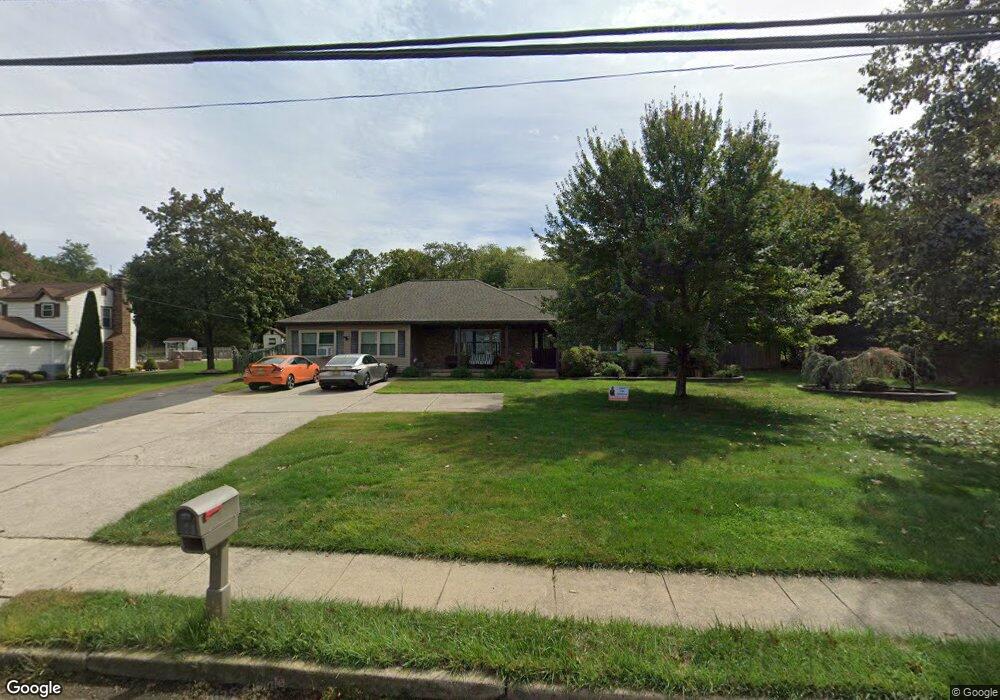
987 Bennetts Mills Rd Jackson, NJ 08527
Estimated Value: $699,000 - $821,000
4
Beds
3
Baths
3,804
Sq Ft
$202/Sq Ft
Est. Value
About This Home
This home is located at 987 Bennetts Mills Rd, Jackson, NJ 08527 and is currently estimated at $768,058, approximately $201 per square foot. 987 Bennetts Mills Rd is a home located in Ocean County with nearby schools including Crawford-Rodriguez Elementary School, Christa McAuliffe Middle School, and Jackson Liberty High School.
Ownership History
Date
Name
Owned For
Owner Type
Purchase Details
Closed on
Dec 1, 2010
Sold by
Concepcion Richard and Concepcion Stephanie
Bought by
Concepcion Richard and Concepcion Stephanie
Current Estimated Value
Home Financials for this Owner
Home Financials are based on the most recent Mortgage that was taken out on this home.
Original Mortgage
$130,000
Interest Rate
3.68%
Mortgage Type
New Conventional
Create a Home Valuation Report for This Property
The Home Valuation Report is an in-depth analysis detailing your home's value as well as a comparison with similar homes in the area
Home Values in the Area
Average Home Value in this Area
Purchase History
| Date | Buyer | Sale Price | Title Company |
|---|---|---|---|
| Concepcion Richard | -- | None Available |
Source: Public Records
Mortgage History
| Date | Status | Borrower | Loan Amount |
|---|---|---|---|
| Closed | Concepcion Richard | $130,000 |
Source: Public Records
Tax History Compared to Growth
Tax History
| Year | Tax Paid | Tax Assessment Tax Assessment Total Assessment is a certain percentage of the fair market value that is determined by local assessors to be the total taxable value of land and additions on the property. | Land | Improvement |
|---|---|---|---|---|
| 2025 | $10,693 | $674,800 | $300,600 | $374,200 |
| 2024 | $10,037 | $390,400 | $119,100 | $271,300 |
| 2023 | $9,834 | $390,400 | $119,100 | $271,300 |
| 2022 | $10,084 | $390,400 | $119,100 | $271,300 |
| 2021 | $9,639 | $390,400 | $119,100 | $271,300 |
| 2020 | $9,752 | $390,400 | $119,100 | $271,300 |
| 2019 | $9,619 | $390,400 | $119,100 | $271,300 |
| 2018 | $9,298 | $386,600 | $119,100 | $267,500 |
| 2017 | $9,074 | $386,600 | $119,100 | $267,500 |
| 2016 | $8,669 | $386,600 | $119,100 | $267,500 |
| 2015 | $8,487 | $309,300 | $119,100 | $190,200 |
| 2014 | $6,555 | $309,300 | $119,100 | $190,200 |
Source: Public Records
Map
Nearby Homes
- 28 Independence Ct
- 6 Sturm Ln
- 22 Forge Ct Unit 65
- 11 Ash Rd
- 48 Colonial Ct Unit 113
- 52 Sturm Ln
- 14 Salem Ln
- 1090 Bennetts Mills Rd
- 5 Hampton Dr
- 80 Rita Ln
- 95 Marginal Rd
- 8 Hampton Dr
- 116 Joan Ct
- 31 Renee Ct Unit 31
- 111 Joan Ct Unit 111
- 99 Joan Ct
- 120 Joan Ct Unit 120
- 32 Locust Ave
- 117 Joan Ct Unit 117
- 34 Forest Hill Ave
- 995 Bennetts Mills Rd
- 983 Bennetts Mills Rd
- 990 Bennetts Mills Rd
- 1000 Bennetts Mills Rd
- 969 Bennetts Mills Rd
- 1004 Bennetts Mills Rd
- 1009 Bennetts Mills Rd
- 42 Independence Ct
- 1005 Bennetts Mills Rd
- 40 Independence Ct
- 965 Bennetts Mills Rd
- 38 Independence Ct Unit 140
- 36 Independence Ct
- 1012 Bennetts Mills Rd
- 32 Independence Ct
- 1008 Bennetts Mills Rd
- 41 Independence Ct Unit 137
- 16 Bates Rd
- 39 Independence Ct
- 30 Independence Ct Unit 32