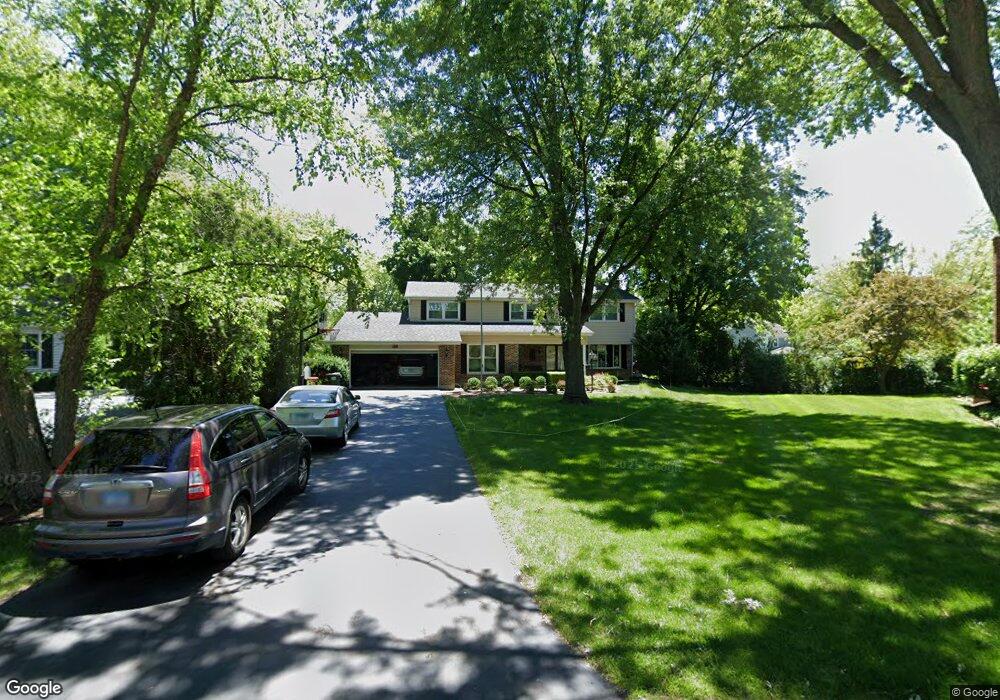
987 Commonwealth Ct Barrington, IL 60010
North Barrington Hills NeighborhoodEstimated Value: $621,331 - $735,000
--
Bed
3
Baths
3,155
Sq Ft
$215/Sq Ft
Est. Value
About This Home
This home is located at 987 Commonwealth Ct, Barrington, IL 60010 and is currently estimated at $677,833, approximately $214 per square foot. 987 Commonwealth Ct is a home located in Lake County with nearby schools including Roslyn Road Elementary School, Barrington Mdle School- Prairie Cmps, and Barrington High School.
Ownership History
Date
Name
Owned For
Owner Type
Purchase Details
Closed on
Aug 17, 1999
Sold by
Bytnar Sandra and Will Of Raymond L Ganczak
Bought by
Sarkar Roni K and Sarkar Heather R
Current Estimated Value
Home Financials for this Owner
Home Financials are based on the most recent Mortgage that was taken out on this home.
Original Mortgage
$180,000
Outstanding Balance
$48,581
Interest Rate
6.87%
Estimated Equity
$629,252
Create a Home Valuation Report for This Property
The Home Valuation Report is an in-depth analysis detailing your home's value as well as a comparison with similar homes in the area
Home Values in the Area
Average Home Value in this Area
Purchase History
| Date | Buyer | Sale Price | Title Company |
|---|---|---|---|
| Sarkar Roni K | $270,000 | -- |
Source: Public Records
Mortgage History
| Date | Status | Borrower | Loan Amount |
|---|---|---|---|
| Open | Sarkar Roni K | $180,000 |
Source: Public Records
Tax History Compared to Growth
Tax History
| Year | Tax Paid | Tax Assessment Tax Assessment Total Assessment is a certain percentage of the fair market value that is determined by local assessors to be the total taxable value of land and additions on the property. | Land | Improvement |
|---|---|---|---|---|
| 2024 | $12,353 | $174,467 | $40,280 | $134,187 |
| 2023 | $11,972 | $165,371 | $38,180 | $127,191 |
| 2022 | $11,972 | $158,299 | $43,194 | $115,105 |
| 2021 | $11,808 | $155,607 | $42,459 | $113,148 |
| 2020 | $13,269 | $178,088 | $42,328 | $135,760 |
| 2019 | $12,751 | $173,389 | $41,211 | $132,178 |
| 2018 | $12,249 | $169,995 | $41,037 | $128,958 |
| 2017 | $12,188 | $166,580 | $40,213 | $126,367 |
| 2016 | $12,016 | $160,296 | $38,696 | $121,600 |
| 2015 | $11,377 | $150,343 | $36,293 | $114,050 |
| 2014 | $10,850 | $136,826 | $34,906 | $101,920 |
| 2012 | $10,993 | $139,178 | $35,506 | $103,672 |
Source: Public Records
Map
Nearby Homes
- 709 Prospect Ave
- 520 Shorely Dr Unit 201
- 541 N Hough St Unit 205
- 565 Shorely Dr Unit 202
- 26225 W Merton Rd
- 26153 W Cuba Rd
- 26303 W Merton Rd
- 25696 W Chatham Rd
- 206 N Cook St
- 432 Whitney Dr
- 0 Illinois Route 59
- 136 Grant St
- 215 N Hager Ave
- 534 E Main St
- 148 W Station St
- 323 W Main St
- 126 W Lake St
- 248 Beverly Rd
- 440 W Main St
- 239 Beverly Rd
- 989 Commonwealth Ct
- 985 Commonwealth Ct
- 982 Hampton Park
- 250 Covington Dr
- 984 Hampton Park
- 220 Covington Dr
- 280 Covington Dr
- 991 Commonwealth Ct
- 865 Churchill Ct
- 855 Churchill Ct
- 980 Hampton Park
- 986 Hampton Park
- 310 Covington Dr
- 845 Churchill Ct
- 993 Commonwealth Ct
- 995 Commonwealth Ct
- 840 Fairfax Ct
- 990 Commonwealth Ct
- 974 Marlborough Rd
- 984 Commonwealth Ct