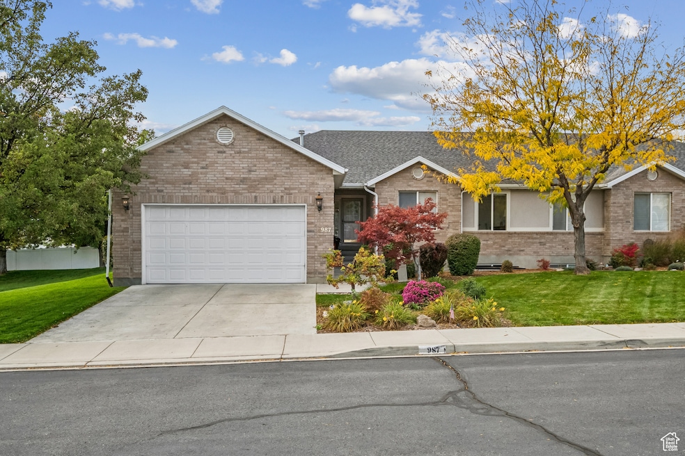
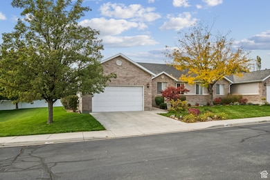
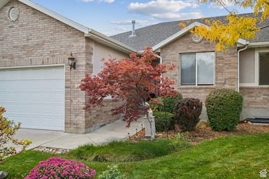
987 N 410 W American Fork, UT 84003
Estimated payment $3,478/month
Highlights
- RV Parking in Community
- Gated Community
- Rambler Architecture
- Shelley Elementary School Rated A-
- Clubhouse
- Main Floor Primary Bedroom
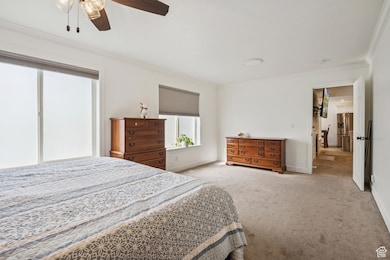
About This Home
Newly renovated Twin Home rambler nestled in quiet American Fork neighborhood. This home was perfectly modified to create a more open and inviting feel. Great for main floor living with a newly finished basement as well. Excellent location. Just minutes to Costco and other shopping and restaurants. Close to the freeway for easy commuting. Obsessed with the holidays? Plenty of storage in the basement and extra deep garage to hold all of your decorations.
Listing Agent
Tobin Miller
Visionary Real Estate License #9807604 Listed on: 10/17/2025
Townhouse Details
Home Type
- Townhome
Est. Annual Taxes
- $2,400
Year Built
- Built in 2002
Lot Details
- 2,178 Sq Ft Lot
- Partially Fenced Property
- Landscaped
HOA Fees
- $300 Monthly HOA Fees
Parking
- 2 Car Attached Garage
- 4 Open Parking Spaces
Home Design
- Rambler Architecture
- Twin Home
- Brick Exterior Construction
- Stucco
Interior Spaces
- 3,104 Sq Ft Home
- 2-Story Property
- 1 Fireplace
- Sliding Doors
- Basement Fills Entire Space Under The House
Kitchen
- Gas Range
- Microwave
- Portable Dishwasher
Flooring
- Carpet
- Tile
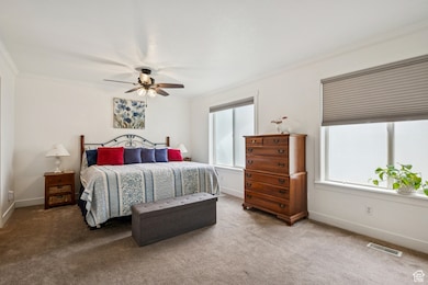
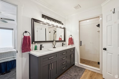
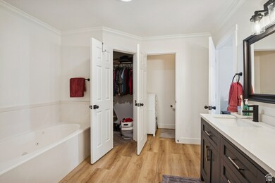
Bedrooms and Bathrooms
- 5 Bedrooms | 2 Main Level Bedrooms
- Primary Bedroom on Main
- Walk-In Closet
- Bathtub With Separate Shower Stall
Laundry
- Dryer
- Washer
Schools
- Shelley Elementary School
- American Fork Middle School
- American Fork High School
Utilities
- Forced Air Heating and Cooling System
- Natural Gas Connected
- Sewer Paid
Additional Features
- Sprinkler System
- Open Patio
Listing and Financial Details
- Exclusions: Freezer
- Assessor Parcel Number 52-869-0001
Community Details
Overview
- Association fees include ground maintenance, sewer, trash, water
- Association Phone (801) 375-6719
- Sunset Hills Subdivision
- RV Parking in Community
Amenities
- Picnic Area
- Clubhouse
Recreation
- Community Pool
- Snow Removal
Security
- Gated Community
Map
Home Values in the Area
Average Home Value in this Area
Tax History
| Year | Tax Paid | Tax Assessment Tax Assessment Total Assessment is a certain percentage of the fair market value that is determined by local assessors to be the total taxable value of land and additions on the property. | Land | Improvement |
|---|---|---|---|---|
| 2025 | $2,357 | $264,605 | $113,500 | $367,600 |
| 2024 | $2,357 | $261,855 | $0 | $0 |
| 2023 | $2,257 | $265,815 | $0 | $0 |
| 2022 | $2,137 | $248,380 | $0 | $0 |
| 2021 | $1,913 | $347,400 | $95,000 | $252,400 |
| 2020 | $1,861 | $327,700 | $95,000 | $232,700 |
| 2019 | $1,669 | $304,000 | $95,000 | $209,000 |
| 2018 | $1,746 | $304,000 | $95,000 | $209,000 |
| 2017 | $1,662 | $156,200 | $0 | $0 |
| 2016 | $1,503 | $131,285 | $0 | $0 |
| 2015 | $1,526 | $126,500 | $0 | $0 |
| 2014 | $1,406 | $114,950 | $0 | $0 |
Property History
| Date | Event | Price | List to Sale | Price per Sq Ft |
|---|---|---|---|---|
| 10/31/2025 10/31/25 | Pending | -- | -- | -- |
| 10/17/2025 10/17/25 | For Sale | $565,000 | -- | $182 / Sq Ft |
Purchase History
| Date | Type | Sale Price | Title Company |
|---|---|---|---|
| Warranty Deed | -- | Union Title | |
| Interfamily Deed Transfer | -- | Provo Land Title Co | |
| Interfamily Deed Transfer | -- | Mountain West Title Co | |
| Interfamily Deed Transfer | -- | -- | |
| Corporate Deed | -- | Mountain West Title Co |
Mortgage History
| Date | Status | Loan Amount | Loan Type |
|---|---|---|---|
| Previous Owner | $336,630 | New Conventional | |
| Previous Owner | $42,000 | Purchase Money Mortgage |
Source: UtahRealEstate.com
MLS Number: 2118233
APN: 52-869-0001
Disclaimer: Certain information contained herein is derived from information provided by parties other than Homes.com. All information provided is deemed reliable, but is not guaranteed to be accurate and should be independently verified.
![]() IDX information is provided exclusively for consumers’ personal, non-commercial use, that it may not be used for any purpose other than to identify prospective properties consumers may be interested in purchasing, and that the data is deemed reliable but is not guaranteed accurate by the MLS. Licensor is only providing the MLS Content and not other sources of data provided in the Product.
IDX information is provided exclusively for consumers’ personal, non-commercial use, that it may not be used for any purpose other than to identify prospective properties consumers may be interested in purchasing, and that the data is deemed reliable but is not guaranteed accurate by the MLS. Licensor is only providing the MLS Content and not other sources of data provided in the Product.
Based on information from the Wasatch Front Regional Multiple Listing Service, Inc.. All data, including all measurements and calculations of area, is obtained from various sources and has not been, and will not be, verified by broker or the MLS. All information should be independently reviewed and verified for accuracy. Properties may or may not be listed by the office/agent presenting the information.
- 471 W 1040 N
- 3889 W 950 Cir N Unit 366
- 914 N 400 W Unit A
- 425 W 1120 N
- 344 W 1080 N
- 984 N 300 W
- 602 W 860 N
- 796 N 200 W
- 782 N 200 W
- 641 N 420 W
- 356 W 1300 N
- 3935 W 1000 N Unit 438
- 3983 W 1000 N Unit 442
- 4007 W 1000 N
- 3947 W 1000 N Unit 439
- 3959 W 1000 N
- 822 W 800 St N Unit LOT319
- 287 W 1360 N
- 822 N 860 W Unit 317
- 179 W 1290 N