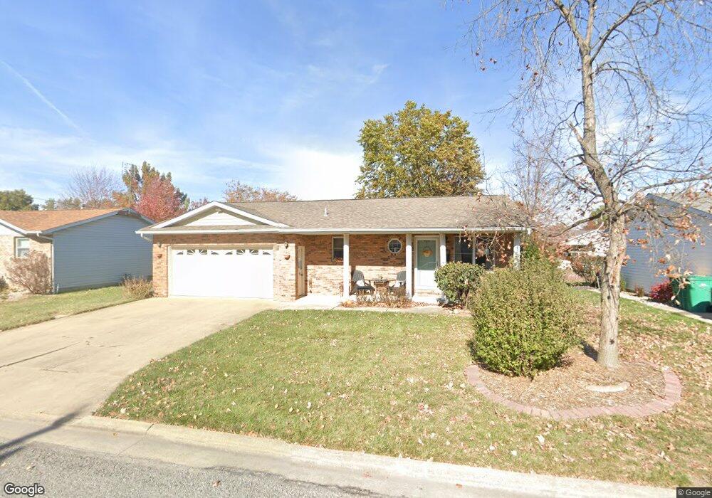
987 N 8th St Breese, IL 62230
Estimated Value: $226,000 - $267,000
--
Bed
1
Bath
1,316
Sq Ft
$182/Sq Ft
Est. Value
About This Home
This home is located at 987 N 8th St, Breese, IL 62230 and is currently estimated at $239,362, approximately $181 per square foot. 987 N 8th St is a home located in Clinton County with nearby schools including Breese ESD #12, Beckemeyer Elementary School, and Central Community High School.
Ownership History
Date
Name
Owned For
Owner Type
Purchase Details
Closed on
Dec 29, 2014
Sold by
Winter John W and Buss Deborah J
Bought by
Klein Michael A and Klein Cynthia S
Current Estimated Value
Home Financials for this Owner
Home Financials are based on the most recent Mortgage that was taken out on this home.
Original Mortgage
$65,165
Outstanding Balance
$36,463
Interest Rate
3.75%
Mortgage Type
New Conventional
Estimated Equity
$202,899
Create a Home Valuation Report for This Property
The Home Valuation Report is an in-depth analysis detailing your home's value as well as a comparison with similar homes in the area
Home Values in the Area
Average Home Value in this Area
Purchase History
| Date | Buyer | Sale Price | Title Company |
|---|---|---|---|
| Klein Michael A | $147,000 | Highland Community Title Llc |
Source: Public Records
Mortgage History
| Date | Status | Borrower | Loan Amount |
|---|---|---|---|
| Open | Klein Michael A | $65,165 |
Source: Public Records
Tax History Compared to Growth
Tax History
| Year | Tax Paid | Tax Assessment Tax Assessment Total Assessment is a certain percentage of the fair market value that is determined by local assessors to be the total taxable value of land and additions on the property. | Land | Improvement |
|---|---|---|---|---|
| 2024 | $4,039 | $64,600 | $9,330 | $55,270 |
| 2023 | $4,039 | $60,940 | $8,800 | $52,140 |
| 2022 | $3,994 | $55,400 | $8,000 | $47,400 |
| 2021 | $3,582 | $52,760 | $7,620 | $45,140 |
| 2020 | $3,504 | $50,730 | $7,330 | $43,400 |
| 2019 | $3,439 | $50,730 | $7,330 | $43,400 |
| 2018 | $3,262 | $46,124 | $6,843 | $39,281 |
| 2017 | $3,168 | $44,350 | $6,580 | $37,770 |
| 2016 | $3,140 | $44,350 | $6,580 | $37,770 |
| 2015 | $2,756 | $44,350 | $6,580 | $37,770 |
| 2013 | $2,756 | $45,120 | $6,580 | $38,540 |
Source: Public Records
Map
Nearby Homes
- 923 N 6th St
- 290 N Elm St
- 325 N Walnut St
- 13898 Lincoln Dr
- 436 S 2nd St
- 13964 Best One Dr
- 126 Jefferson Dr
- 620 S 6th St
- 429 S 6th St
- 330 S 5th St
- 10675 Buckingham Ct
- 14501 Saint Rose Rd
- 751 E 4th St
- 315 Briarwood Ln
- 560 W 4th St
- 10 S Hull St
- 8130 Main St
- 15556 Old State Rd
- 1102 Cherry St
- 16743 Ashland Ct