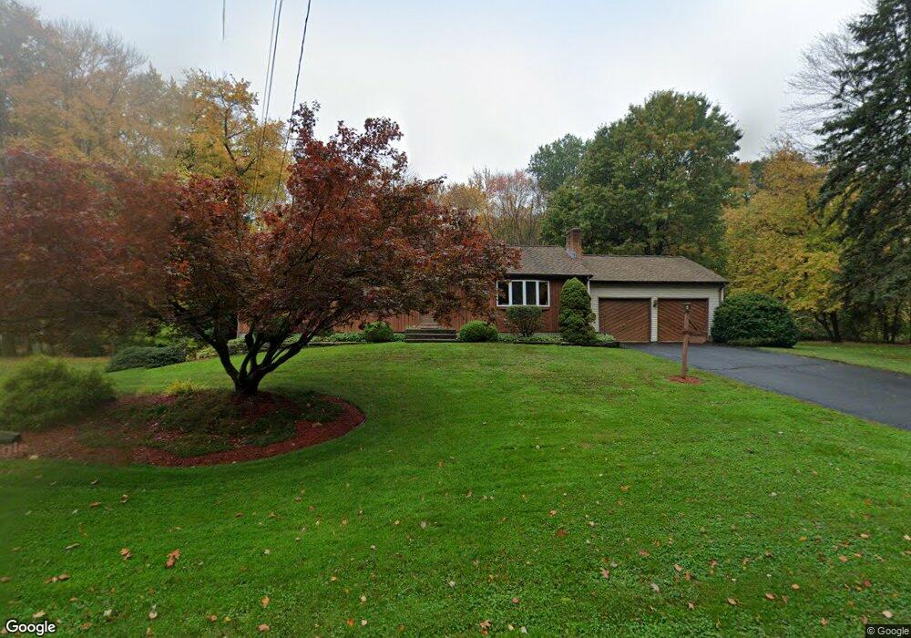
987 Strong Rd South Windsor, CT 06074
Estimated Value: $356,000 - $480,000
3
Beds
2
Baths
1,352
Sq Ft
$313/Sq Ft
Est. Value
About This Home
This home is located at 987 Strong Rd, South Windsor, CT 06074 and is currently estimated at $422,554, approximately $312 per square foot. 987 Strong Rd is a home located in Hartford County with nearby schools including Timothy Edwards School, South Windsor High School, and Odyssey Community School.
Ownership History
Date
Name
Owned For
Owner Type
Purchase Details
Closed on
Jul 13, 1988
Sold by
Pasay Thomas J
Bought by
Conrath Douglas A
Current Estimated Value
Home Financials for this Owner
Home Financials are based on the most recent Mortgage that was taken out on this home.
Original Mortgage
$152,000
Interest Rate
10.57%
Create a Home Valuation Report for This Property
The Home Valuation Report is an in-depth analysis detailing your home's value as well as a comparison with similar homes in the area
Home Values in the Area
Average Home Value in this Area
Purchase History
| Date | Buyer | Sale Price | Title Company |
|---|---|---|---|
| Conrath Douglas A | $190,000 | -- |
Source: Public Records
Mortgage History
| Date | Status | Borrower | Loan Amount |
|---|---|---|---|
| Closed | Conrath Douglas A | $126,500 | |
| Closed | Conrath Douglas A | $152,000 |
Source: Public Records
Tax History Compared to Growth
Tax History
| Year | Tax Paid | Tax Assessment Tax Assessment Total Assessment is a certain percentage of the fair market value that is determined by local assessors to be the total taxable value of land and additions on the property. | Land | Improvement |
|---|---|---|---|---|
| 2025 | $8,425 | $236,600 | $108,500 | $128,100 |
| 2024 | $8,153 | $236,600 | $108,500 | $128,100 |
| 2023 | $7,841 | $236,600 | $108,500 | $128,100 |
| 2022 | $6,699 | $172,800 | $108,500 | $64,300 |
| 2021 | $6,542 | $172,800 | $108,500 | $64,300 |
| 2020 | $6,546 | $172,800 | $108,500 | $64,300 |
| 2019 | $6,653 | $172,800 | $108,500 | $64,300 |
| 2018 | $6,509 | $172,800 | $108,500 | $64,300 |
| 2017 | $6,611 | $173,600 | $108,500 | $65,100 |
| 2016 | $6,482 | $173,600 | $108,500 | $65,100 |
| 2015 | $6,343 | $173,600 | $108,500 | $65,100 |
| 2014 | $6,165 | $173,600 | $108,500 | $65,100 |
Source: Public Records
Map
Nearby Homes
- 10 Victorian Woods Ln Unit 10
- 668 Sullivan Ave
- 22 Candlewood Dr Unit 22
- 62 Candlewood Dr Unit 62
- 816 Sand Stone Dr Unit 816
- 81 Candlewood Dr Unit 81
- 50 High St
- 130 Candlewood Dr Unit 130
- 11 Kupchunos Rd
- 509 Mill Pond Dr
- 24 Podunk Cir Unit 24
- 1202 Twin Circle Dr
- 908 Mill Pond Dr
- 2201 Mill Pond Dr Unit 2201
- 610 Clark St
- 88 Andreis Trail
- 178 Scott Dr
- 51 Carriage Dr
- 66 Farmbrook Ln
- 360 Felt Rd
- 1005 Strong Rd
- 990 Strong Rd
- 1019 Strong Rd
- 955 Strong Rd
- 1010 Strong Rd
- 1020 Strong Rd
- 1030 Strong Rd
- 450 Foster Rd
- 946 Strong Rd
- L24-3 Griffin Rd
- 6 St Marc Cir Unit J6
- 2 St Marc Cir Unit Q
- 1209 Twin CI Unit 1209
- 1041 Strong Rd
- 505 Foster Rd
- 1040 Strong Rd
- 432 Foster Rd
- 455 Foster Rd
- 485 Foster Rd
- 930 Strong Rd