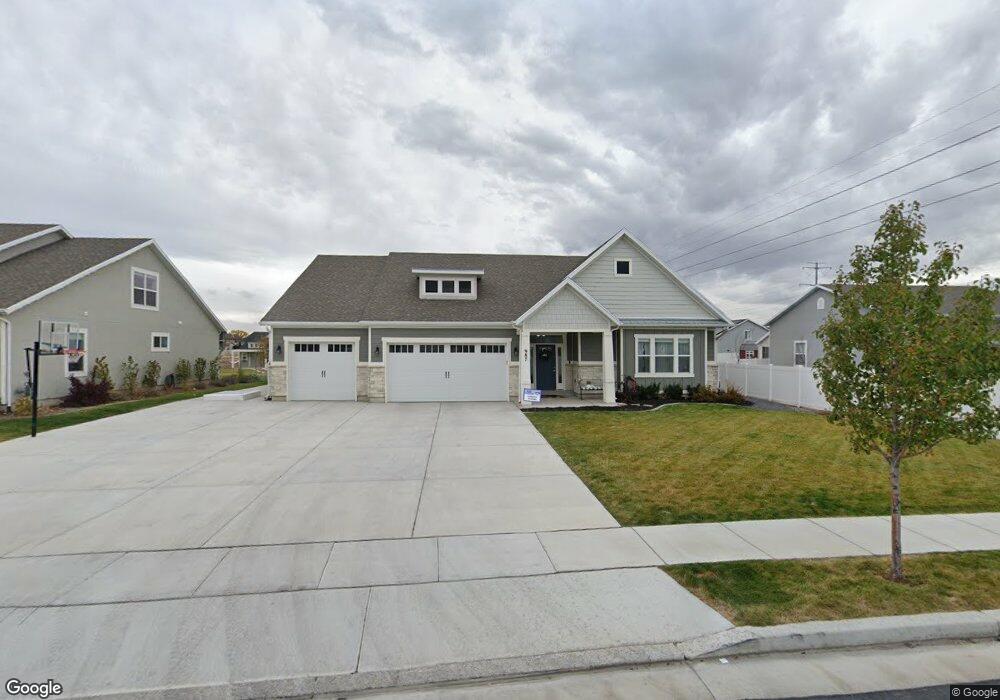
987 W 2100 N West Bountiful, UT 84087
Estimated Value: $872,000 - $947,000
5
Beds
4
Baths
3,739
Sq Ft
$243/Sq Ft
Est. Value
About This Home
This home is located at 987 W 2100 N, West Bountiful, UT 84087 and is currently estimated at $910,046, approximately $243 per square foot. 987 W 2100 N is a home with nearby schools including West Bountiful Elementary School, Bountiful Junior High School, and Viewmont High School.
Ownership History
Date
Name
Owned For
Owner Type
Purchase Details
Closed on
Aug 15, 2019
Sold by
Kinross Estates Llc
Bought by
Uffens Blake Dee and Uffens Rachel
Current Estimated Value
Home Financials for this Owner
Home Financials are based on the most recent Mortgage that was taken out on this home.
Original Mortgage
$478,052
Outstanding Balance
$417,776
Interest Rate
3.7%
Mortgage Type
New Conventional
Estimated Equity
$492,270
Purchase Details
Closed on
Mar 15, 2019
Sold by
Kinross Estates Llc
Bought by
South Davis Sewer District
Create a Home Valuation Report for This Property
The Home Valuation Report is an in-depth analysis detailing your home's value as well as a comparison with similar homes in the area
Home Values in the Area
Average Home Value in this Area
Purchase History
| Date | Buyer | Sale Price | Title Company |
|---|---|---|---|
| Uffens Blake Dee | -- | Us Title Company Of U | |
| South Davis Sewer District | -- | None Available |
Source: Public Records
Mortgage History
| Date | Status | Borrower | Loan Amount |
|---|---|---|---|
| Open | Uffens Blake Dee | $478,052 |
Source: Public Records
Tax History Compared to Growth
Tax History
| Year | Tax Paid | Tax Assessment Tax Assessment Total Assessment is a certain percentage of the fair market value that is determined by local assessors to be the total taxable value of land and additions on the property. | Land | Improvement |
|---|---|---|---|---|
| 2025 | $5,156 | $436,150 | $154,475 | $281,675 |
| 2024 | $4,804 | $412,500 | $128,168 | $284,332 |
| 2023 | $4,976 | $785,000 | $234,439 | $550,561 |
| 2022 | $5,190 | $436,701 | $118,883 | $317,818 |
| 2021 | $4,835 | $621,000 | $173,079 | $447,921 |
| 2020 | $4,547 | $573,000 | $177,119 | $395,881 |
| 2019 | $2,530 | $169,843 | $169,843 | $0 |
Source: Public Records
Map
Nearby Homes
- 979 W 2100 N
- 2088 N 1000 W
- 2072 N 1000 W
- 971 W 2100 N
- 2122 N 1000 W Unit 6
- 2144 N 1000 W Unit 5
- 2054 N 1000 W Unit 25
- 2054 N 1000 W
- 965 W 2100 N
- 2091 N 1000 W
- 2180 N 1000 W
- 2111 N 1000 W Unit 31
- 2083 N 1000 W
- 2083 N 1000 W Unit 29
- 2012 N 1000 W Unit 138
- 978 W 1950 N
- 953 W 2100 N
- 2125 N 1000 W Unit 32
- 972 W 1950 N Unit 131
- 984 W 1950 N Unit 133