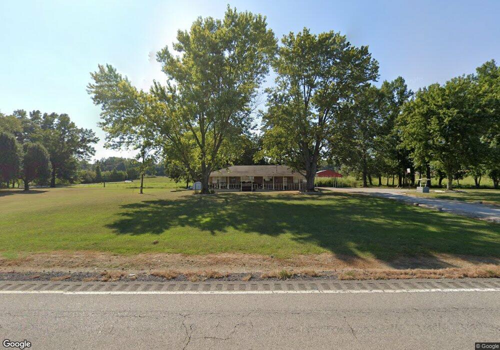
9871 State Highway 13 Phil Campbell, AL 35581
Estimated Value: $100,000 - $150,000
--
Bed
--
Bath
1,529
Sq Ft
$80/Sq Ft
Est. Value
About This Home
This home is located at 9871 State Highway 13, Phil Campbell, AL 35581 and is currently estimated at $121,809, approximately $79 per square foot. 9871 State Highway 13 is a home located in Marion County.
Ownership History
Date
Name
Owned For
Owner Type
Purchase Details
Closed on
Jan 15, 2016
Sold by
Traders And Farmers Bank
Bought by
Noble Ida Rose
Current Estimated Value
Home Financials for this Owner
Home Financials are based on the most recent Mortgage that was taken out on this home.
Original Mortgage
$27,000
Interest Rate
3.99%
Mortgage Type
Purchase Money Mortgage
Purchase Details
Closed on
Apr 18, 2014
Sold by
Traders And Farmers Bank
Bought by
Hood Roy Alter and Thompson Peggy Ann
Home Financials for this Owner
Home Financials are based on the most recent Mortgage that was taken out on this home.
Original Mortgage
$57,348
Interest Rate
4.37%
Mortgage Type
Purchase Money Mortgage
Create a Home Valuation Report for This Property
The Home Valuation Report is an in-depth analysis detailing your home's value as well as a comparison with similar homes in the area
Home Values in the Area
Average Home Value in this Area
Purchase History
| Date | Buyer | Sale Price | Title Company |
|---|---|---|---|
| Noble Ida Rose | $47,000 | -- | |
| Hood Roy Alter | $55,000 | -- |
Source: Public Records
Mortgage History
| Date | Status | Borrower | Loan Amount |
|---|---|---|---|
| Closed | Noble Ida Rose | $27,000 | |
| Previous Owner | Hood Roy Alter | $57,348 |
Source: Public Records
Tax History Compared to Growth
Tax History
| Year | Tax Paid | Tax Assessment Tax Assessment Total Assessment is a certain percentage of the fair market value that is determined by local assessors to be the total taxable value of land and additions on the property. | Land | Improvement |
|---|---|---|---|---|
| 2024 | -- | $8,720 | $820 | $7,900 |
| 2023 | $0 | $8,720 | $820 | $7,900 |
| 2022 | $0 | $8,340 | $820 | $7,520 |
| 2021 | $0 | $8,340 | $820 | $7,520 |
| 2020 | $151 | $6,740 | $800 | $5,940 |
| 2019 | $151 | $6,740 | $800 | $5,940 |
| 2018 | $69 | $6,740 | $800 | $5,940 |
| 2017 | $431 | $13,460 | $1,580 | $11,880 |
| 2016 | $416 | $14,360 | $1,780 | $12,580 |
| 2015 | -- | $6,820 | $540 | $6,280 |
| 2014 | $422 | $14,540 | $1,060 | $13,480 |
| 2013 | $422 | $14,540 | $1,060 | $13,480 |
Source: Public Records
Map
Nearby Homes
- 1789 County Road 65
- 1601 Kelley Rd
- 000 Benefield Farm Rd
- 526 Co Hwy 369
- 461 Cox Rd
- 571 Cothrum Rd
- 2065 Alabama 237
- Cr 366
- 6391 Highway 13 Unit 1
- 1996 County Highway 366
- 1047 County Line Church Rd
- 00 Kent St
- 364 Mc Clung Ave
- 364 Steele St
- 4025 County Road 172
- 1440 Pike Ave
- 1406 Pike Ave
- 0 Mayhall Dr
- 339 Mcnutt Rd
- 00 Pike Ave
- 129 County Highway 137
- 9805 State Highway 13
- 307 County Highway 137
- 192 Vickery Dr
- 9730 Alabama 13
- 350 Vickery Dr
- 345 County Highway 137
- 434 Vickery Dr
- 443 County Highway 137
- 9625 State Highway 13
- 9595 State Highway 13
- 9595 State Highway 13
- 264 Hulsey Rd
- 9562 State Highway 13
- 275 Corner Rd
- 250 Hulsey Rd
- 243 Mann Cir
- 290 Hulsey Rd
- 10359 State Highway 13
- 404 Hulsey Rd