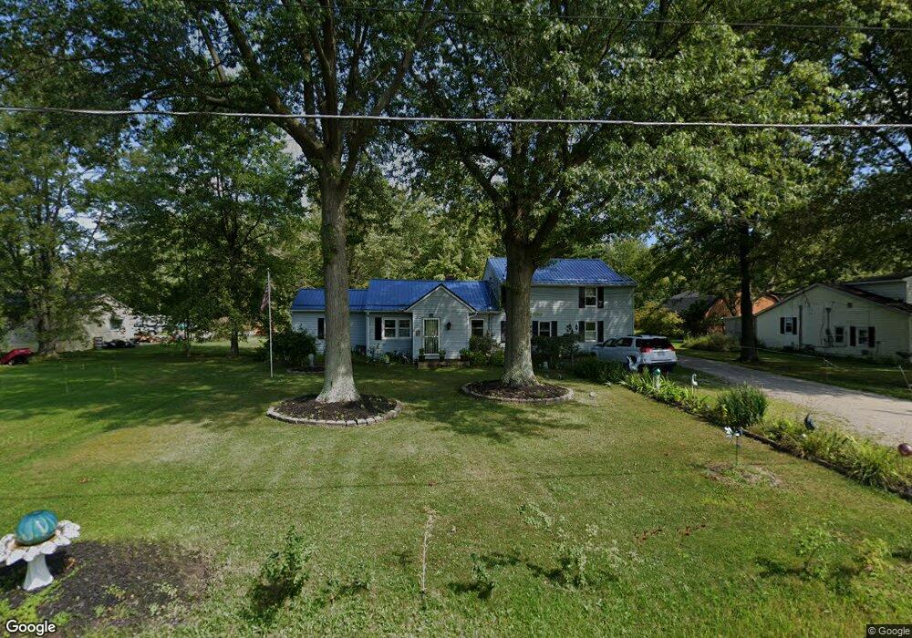
9879 Mitchell Rd Columbia Station, OH 44028
Estimated Value: $269,553 - $428,000
4
Beds
3
Baths
2,202
Sq Ft
$155/Sq Ft
Est. Value
About This Home
This home is located at 9879 Mitchell Rd, Columbia Station, OH 44028 and is currently estimated at $340,638, approximately $154 per square foot. 9879 Mitchell Rd is a home located in Lorain County with nearby schools including Olmsted Falls Intermediate Building, Falls-Lenox Primary Elementary School, and Olmsted Falls Middle School.
Ownership History
Date
Name
Owned For
Owner Type
Purchase Details
Closed on
Mar 12, 2012
Sold by
Yonts Melanie Tanya and Viccarone Gene P
Bought by
Viccarone Gene P and Viccarone Melanie T
Current Estimated Value
Home Financials for this Owner
Home Financials are based on the most recent Mortgage that was taken out on this home.
Original Mortgage
$310,000
Outstanding Balance
$39,661
Interest Rate
3.86%
Mortgage Type
New Conventional
Estimated Equity
$300,977
Purchase Details
Closed on
Oct 4, 2005
Sold by
Yonts Charles E and Yonts Wilma J
Bought by
Yonts Dustin C
Create a Home Valuation Report for This Property
The Home Valuation Report is an in-depth analysis detailing your home's value as well as a comparison with similar homes in the area
Home Values in the Area
Average Home Value in this Area
Purchase History
| Date | Buyer | Sale Price | Title Company |
|---|---|---|---|
| Viccarone Gene P | -- | Attorney | |
| Yonts Dustin C | -- | -- |
Source: Public Records
Mortgage History
| Date | Status | Borrower | Loan Amount |
|---|---|---|---|
| Open | Viccarone Gene P | $310,000 |
Source: Public Records
Tax History Compared to Growth
Tax History
| Year | Tax Paid | Tax Assessment Tax Assessment Total Assessment is a certain percentage of the fair market value that is determined by local assessors to be the total taxable value of land and additions on the property. | Land | Improvement |
|---|---|---|---|---|
| 2024 | $2,186 | $48,405 | $16,632 | $31,773 |
| 2023 | $3,118 | $55,269 | $17,973 | $37,296 |
| 2022 | $3,053 | $55,269 | $17,973 | $37,296 |
| 2021 | $3,053 | $55,269 | $17,973 | $37,296 |
| 2020 | $3,083 | $50,560 | $16,440 | $34,120 |
| 2019 | $2,751 | $50,560 | $16,440 | $34,120 |
| 2018 | $2,730 | $50,560 | $16,440 | $34,120 |
| 2017 | $2,694 | $46,510 | $15,240 | $31,270 |
| 2016 | $2,714 | $46,510 | $15,240 | $31,270 |
| 2015 | $2,731 | $46,510 | $15,240 | $31,270 |
| 2014 | $2,709 | $46,510 | $15,240 | $31,270 |
| 2013 | $2,710 | $46,510 | $15,240 | $31,270 |
Source: Public Records
Map
Nearby Homes
- 26571 Sprague Rd
- 9628 Kingston Trail
- 27167 Watkin Rd
- 9954 Ethan Dr
- 8860 Sharp Rd
- 0 V L Schady Rd Unit 5163658
- 8706 Stearns Rd
- 33700 Henwell Rd
- 33621 Henwell Rd
- 8481 Jennings Rd
- 33743 Henwell Rd
- 9129 Riverwood Dr
- 9113 Riverwood Dr
- 27056 Sprague Rd
- 9032 Riverwood Dr
- 32017 Cottonwood Crest
- 8727 Hazelwood Run
- 33110 Wren Haven Cir
- 9130 Devonshire Dr
- 9112 Devonshire Dr
- 9913 Mitchell Rd
- 27211 Sprague Rd
- 9939 Mitchell Rd
- 9837 Mitchell Rd
- 27191 Sprague Rd
- 9836 Mitchell Rd
- 27179 Sprague Rd
- 27139 Sprague Rd
- 10011 Mitchell Rd
- 27348 Sprague Rd
- 27352 Sprague Rd
- 27344 Sprague Rd
- 27340 Sprague Rd
- 27332 Sprague Rd
- 27356 Sprague Rd
- 10063 Mitchell Rd
- 27364 Sprague Rd
- 27077 Sprague Rd
- 9680 Sunray Dr
- 9676 Sunray Dr