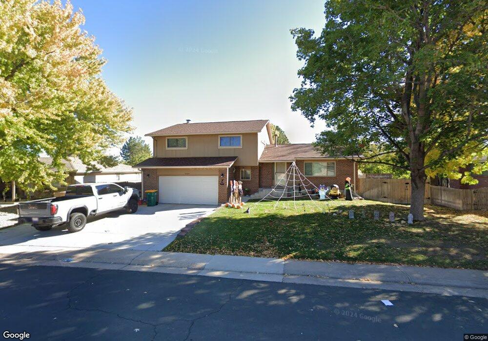
988 Mercury Cir Lone Tree, CO 80124
Estimated Value: $662,957 - $682,000
4
Beds
3
Baths
2,524
Sq Ft
$266/Sq Ft
Est. Value
About This Home
This home is located at 988 Mercury Cir, Lone Tree, CO 80124 and is currently estimated at $672,479, approximately $266 per square foot. 988 Mercury Cir is a home located in Douglas County with nearby schools including Acres Green Elementary School, Cresthill Middle School, and Highlands Ranch High School.
Ownership History
Date
Name
Owned For
Owner Type
Purchase Details
Closed on
Aug 17, 2020
Sold by
Liphardt Daniel S
Bought by
Alfaro Ulises and Alfaro Angela
Current Estimated Value
Home Financials for this Owner
Home Financials are based on the most recent Mortgage that was taken out on this home.
Original Mortgage
$380,000
Outstanding Balance
$337,087
Interest Rate
3%
Mortgage Type
New Conventional
Estimated Equity
$335,392
Purchase Details
Closed on
Mar 16, 2007
Sold by
Jones David A and Jones Lydia M
Bought by
Liphardt Daniel S
Home Financials for this Owner
Home Financials are based on the most recent Mortgage that was taken out on this home.
Original Mortgage
$181,500
Interest Rate
6.26%
Mortgage Type
Unknown
Purchase Details
Closed on
Sep 23, 1977
Sold by
Morris General Contractors Inc
Bought by
Jones David A and Jones Lydia M
Create a Home Valuation Report for This Property
The Home Valuation Report is an in-depth analysis detailing your home's value as well as a comparison with similar homes in the area
Home Values in the Area
Average Home Value in this Area
Purchase History
| Date | Buyer | Sale Price | Title Company |
|---|---|---|---|
| Alfaro Ulises | $475,000 | Colorado Escrow & Title | |
| Liphardt Daniel S | $261,500 | Fahtco | |
| Jones David A | $56,700 | -- |
Source: Public Records
Mortgage History
| Date | Status | Borrower | Loan Amount |
|---|---|---|---|
| Open | Alfaro Ulises | $380,000 | |
| Previous Owner | Liphardt Daniel S | $181,500 |
Source: Public Records
Tax History Compared to Growth
Tax History
| Year | Tax Paid | Tax Assessment Tax Assessment Total Assessment is a certain percentage of the fair market value that is determined by local assessors to be the total taxable value of land and additions on the property. | Land | Improvement |
|---|---|---|---|---|
| 2024 | $3,868 | $45,830 | $7,980 | $37,850 |
| 2023 | $3,908 | $45,830 | $7,980 | $37,850 |
| 2022 | $2,842 | $31,920 | $6,770 | $25,150 |
| 2021 | $2,955 | $31,920 | $6,770 | $25,150 |
| 2020 | $2,694 | $29,800 | $6,390 | $23,410 |
| 2019 | $2,703 | $29,800 | $6,390 | $23,410 |
| 2018 | $2,214 | $26,150 | $5,570 | $20,580 |
| 2017 | $2,250 | $26,150 | $5,570 | $20,580 |
| 2016 | $2,033 | $23,140 | $3,930 | $19,210 |
| 2015 | $2,079 | $23,140 | $3,930 | $19,210 |
| 2014 | $1,914 | $19,950 | $3,980 | $15,970 |
Source: Public Records
Map
Nearby Homes
- 979 Mercury Cir
- 789 Hamal Dr
- 7971 Arrowhead Ct
- 13134 Deneb Dr
- 8049 Sweet Water Rd
- 202 Helena Cir
- 7804 Silverweed Way
- 8159 Lodgepole Trail
- 9275 Erminedale Dr
- 9416 Kemper Dr
- 426 Jupiter Dr
- 8260 Lodgepole Trail
- 9412 La Quinta Way
- 7057 Chestnut Hill St
- 9308 Miles Dr Unit 5
- 8176 Lone Oak Ct
- 250 Jupiter Dr
- 7404 La Quinta Ln
- 7041 Chestnut Hill Trail
- 7151 Palisade Dr
- 994 Mercury Cir
- 986 Mercury Cir
- 13143 Spica Dr
- 989 Mercury Cir
- 984 Mercury Cir
- 13133 Spica Dr
- 985 Mercury Cir
- 13031 Mercury Dr
- 995 Mercury Cir
- 13037 Mercury Dr
- 13153 Spica Dr
- 13043 Mercury Dr
- 978 Mercury Cir
- 999 Mercury Cir
- 13092 Peacock Dr
- 13124 Peacock Dr
- 13082 Peacock Dr
- 975 Mercury Cir
- 13049 Mercury Dr
- 13163 Spica Dr