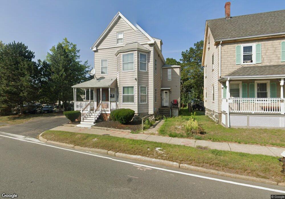
988 Morrissey Blvd Boston, MA 02122
Neponset-Port Norfolk NeighborhoodEstimated Value: $905,000 - $1,129,298
5
Beds
2
Baths
1,667
Sq Ft
$607/Sq Ft
Est. Value
About This Home
This home is located at 988 Morrissey Blvd, Boston, MA 02122 and is currently estimated at $1,011,325, approximately $606 per square foot. 988 Morrissey Blvd is a home located in Suffolk County with nearby schools including Neighborhood House Charter School, Helen Y. Davis Leadership Academy Charter Public School, and St Brendan School.
Ownership History
Date
Name
Owned For
Owner Type
Purchase Details
Closed on
Jan 31, 2014
Sold by
Citibank Na Tr
Bought by
Kandalaft Alexander N
Current Estimated Value
Purchase Details
Closed on
Jul 11, 2012
Sold by
Broeker Stefan and Citibank Na
Bought by
Citibank Na
Create a Home Valuation Report for This Property
The Home Valuation Report is an in-depth analysis detailing your home's value as well as a comparison with similar homes in the area
Home Values in the Area
Average Home Value in this Area
Purchase History
| Date | Buyer | Sale Price | Title Company |
|---|---|---|---|
| Kandalaft Alexander N | $246,750 | -- | |
| Citibank Na | $275,695 | -- |
Source: Public Records
Mortgage History
| Date | Status | Borrower | Loan Amount |
|---|---|---|---|
| Previous Owner | Kandalaft Alexander N | $25,355 |
Source: Public Records
Tax History Compared to Growth
Tax History
| Year | Tax Paid | Tax Assessment Tax Assessment Total Assessment is a certain percentage of the fair market value that is determined by local assessors to be the total taxable value of land and additions on the property. | Land | Improvement |
|---|---|---|---|---|
| 2025 | $11,052 | $954,400 | $250,900 | $703,500 |
| 2024 | $9,109 | $835,700 | $224,800 | $610,900 |
| 2023 | $8,391 | $781,300 | $210,200 | $571,100 |
| 2022 | $8,173 | $751,200 | $202,100 | $549,100 |
| 2021 | $7,634 | $715,500 | $192,500 | $523,000 |
| 2020 | $7,150 | $677,100 | $188,500 | $488,600 |
| 2019 | $6,609 | $627,000 | $144,000 | $483,000 |
| 2018 | $6,254 | $596,800 | $147,800 | $449,000 |
| 2017 | $5,670 | $535,400 | $147,800 | $387,600 |
| 2016 | $5,276 | $479,600 | $147,800 | $331,800 |
| 2015 | $4,746 | $391,900 | $142,900 | $249,000 |
| 2014 | $4,271 | $339,500 | $142,900 | $196,600 |
Source: Public Records
Map
Nearby Homes
- 36 Mckone St Unit 2
- 36 Mckone St
- 36 Mckone St Unit 1
- 223 Neponset Ave Unit 2
- 56 Coffey St Unit 10
- 51 Coffey St Unit 51C
- 3 N Munroe Terrace
- 378 Neponset Ave
- 4 Payne St Unit 5
- 60 Houghton St Unit 62
- 62 Redfield St Unit 1
- 43 Chickatawbut St
- 400-412 Neponset Ave
- 45 Chickatawbut St Unit 1
- 34 Houghton St
- 171 Walnut St Unit 4
- 169 Walnut St Unit 2
- 108 King St Unit 3
- 104 King St Unit 2
- 96 King St Unit 1
- 988 Morrissey Blvd Unit 2
- 988 William t Morrissey Blvd
- 992 William t Morrissey Blvd
- 996 William t Morrissey Blvd
- 16 Norwood St
- 16 Norwood St
- 16 Norwood St Unit 1
- 16 Norwood St Unit 2
- 12 Norwood St Unit 14
- 20 Norwood St
- 20 Norwood St Unit 303
- 20 Norwood St Unit 304
- 20 Norwood St Unit 302
- 20 Norwood St Unit 301
- 20 Norwood St Unit 204
- 20 Norwood St Unit 201
- 20 Norwood St Unit 3
- 20 Norwood St Unit 2
- 12-14 Norwood St Unit 12
- 12-14 Norwood St Unit 2