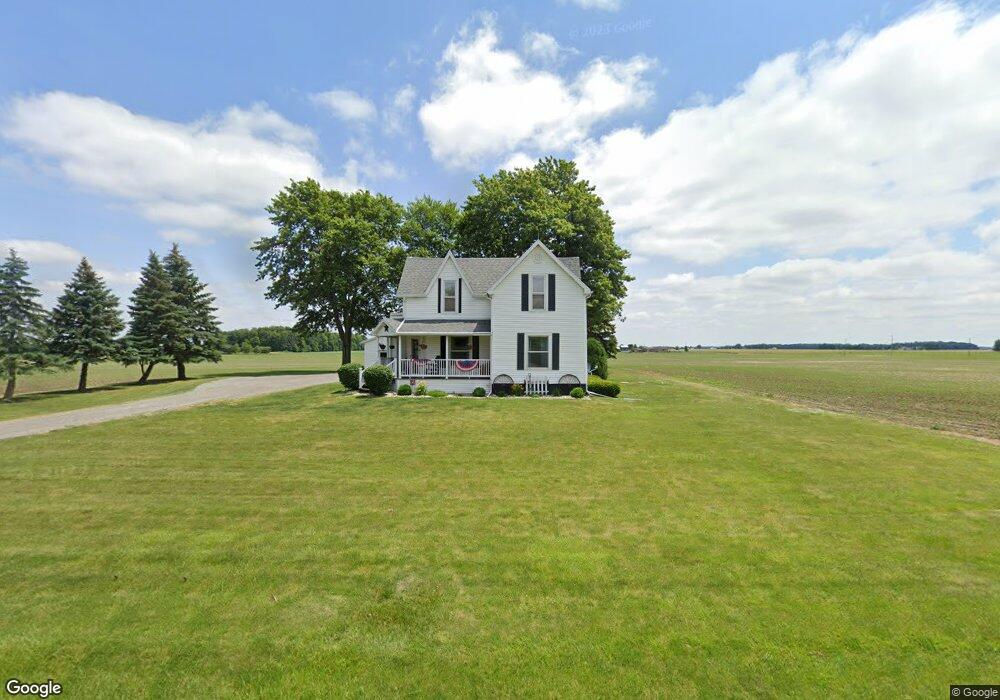
9881 State Route 49 van Wert, OH 45891
Estimated Value: $166,000 - $219,000
3
Beds
1
Bath
1,616
Sq Ft
$117/Sq Ft
Est. Value
About This Home
This home is located at 9881 State Route 49, van Wert, OH 45891 and is currently estimated at $189,133, approximately $117 per square foot. 9881 State Route 49 is a home located in Van Wert County with nearby schools including Crestview Elementary School and Crestview High School.
Ownership History
Date
Name
Owned For
Owner Type
Purchase Details
Closed on
Feb 3, 2021
Sold by
Weber Douglas and Weber Mary
Bought by
Adkins Casey and Adkins Nicole
Current Estimated Value
Home Financials for this Owner
Home Financials are based on the most recent Mortgage that was taken out on this home.
Original Mortgage
$122,735
Outstanding Balance
$109,582
Interest Rate
2.6%
Mortgage Type
FHA
Estimated Equity
$79,551
Purchase Details
Closed on
Oct 5, 1999
Bought by
Weber Douglas and Weber Mary
Purchase Details
Closed on
Apr 8, 1994
Bought by
Bowen Dennis L and Bowen Natalie
Create a Home Valuation Report for This Property
The Home Valuation Report is an in-depth analysis detailing your home's value as well as a comparison with similar homes in the area
Home Values in the Area
Average Home Value in this Area
Purchase History
| Date | Buyer | Sale Price | Title Company |
|---|---|---|---|
| Adkins Casey | $125,000 | None Available | |
| Adkings Casey | -- | None Listed On Document | |
| Weber Douglas | $89,900 | -- | |
| Bowen Dennis L | $57,500 | -- |
Source: Public Records
Mortgage History
| Date | Status | Borrower | Loan Amount |
|---|---|---|---|
| Open | Adkings Casey | $122,735 | |
| Closed | Adkings Casey | $122,735 |
Source: Public Records
Tax History Compared to Growth
Tax History
| Year | Tax Paid | Tax Assessment Tax Assessment Total Assessment is a certain percentage of the fair market value that is determined by local assessors to be the total taxable value of land and additions on the property. | Land | Improvement |
|---|---|---|---|---|
| 2024 | $1,152 | $38,150 | $5,930 | $32,220 |
| 2023 | $1,152 | $38,150 | $5,930 | $32,220 |
| 2022 | $1,024 | $26,890 | $4,640 | $22,250 |
| 2021 | $1,027 | $26,890 | $4,640 | $22,250 |
| 2020 | $1,024 | $26,890 | $4,640 | $22,250 |
| 2019 | $803 | $22,830 | $4,100 | $18,730 |
| 2018 | $797 | $22,830 | $4,100 | $18,730 |
| 2017 | $743 | $22,830 | $4,100 | $18,730 |
| 2016 | $677 | $21,750 | $4,100 | $17,650 |
| 2015 | $670 | $21,750 | $4,100 | $17,650 |
| 2014 | $685 | $21,750 | $4,100 | $17,650 |
| 2013 | $744 | $21,750 | $4,100 | $17,650 |
Source: Public Records
Map
Nearby Homes
- 1414 Rye Dr
- 1385 Rye Dr
- 11309 Dull Robinson Rd
- 8399 Hook Rd
- 713 Oak St
- 208 E Tully St
- 0 Terry Rd
- 146 Dealey Dr
- 152 Dealey Dr
- 158 Dealey Dr
- 164 Dealey Dr
- 170 Dealey Dr
- 5044 Payne Rd
- 9188 John Brown Rd Unit Lot 37
- 9188 John Brown Rd Unit Lot 7
- 9188 John Brown Rd Unit LOT 60
- 3020 Wren-Landeck Rd
- 1421 Krendl Dr
- 1384 Rye Dr
- 1391 Rye Dr
- 5967 Harrison Center Rd
- 16437 Ohio 49
- 6018 State Route 49 Corner
- 6158 Harrison Center Rd
- 5775 Harrison Center Rd
- 5731 Harrison Center Rd
- 6315 Harrison Center Rd
- 5728 Harrison Center Rd
- 6433 Harrison-Center Rd
- 6433 Harrison Center Rd
- 6513 Harrison Center Rd
- 5897 Us Route 224
- 5522 Harrison Center Rd
- 5523 Harrison Center Rd
- 5897 State Route 224
- 5464 Harrison Center Rd
- 6124 Monmouth Rd
- 6086 Monmouth Rd
- 6042 Monmouth Rd
- 6174 Monmouth Rd