Estimated Value: $172,761 - $203,000
2
Beds
2
Baths
888
Sq Ft
$209/Sq Ft
Est. Value
About This Home
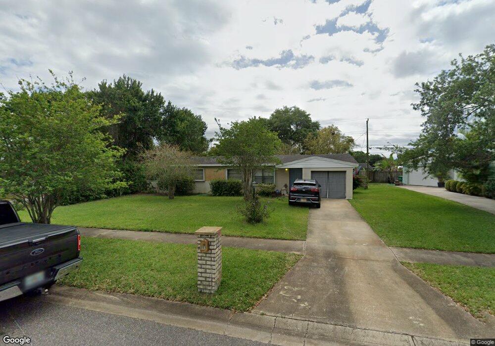
This home is located at 989 MacCo Rd Unit 2, Cocoa, FL 32927 and is currently estimated at $185,940, approximately $209 per square foot. 989 MacCo Rd Unit 2 is a home located in Brevard County with nearby schools including Atlantis Elementary School, Space Coast Junior/Senior High School, and East Atlantic Prep of Brevard County.
Ownership History
Date
Name
Owned For
Owner Type
Purchase Details
Closed on
Jun 26, 2020
Sold by
Robinson Robert H
Bought by
Robinson Robert H and Robinson Sherrie L
Current Estimated Value
Purchase Details
Closed on
Dec 17, 2011
Sold by
Pickens Alice R and The Alice R Pickens Revocable
Bought by
Robinson Robert H
Purchase Details
Closed on
Oct 11, 2011
Sold by
Pickens Alice R
Bought by
Robinson Robert H
Purchase Details
Closed on
Jul 24, 2008
Sold by
Pickens Alice R
Bought by
Pickens Alice R and The Alice R Pickens Revocable
Purchase Details
Closed on
Jan 13, 2005
Sold by
Pickens Robert J and Pickens Alice R
Bought by
Pickens Alice R
Create a Home Valuation Report for This Property
The Home Valuation Report is an in-depth analysis detailing your home's value as well as a comparison with similar homes in the area
Home Values in the Area
Average Home Value in this Area
Purchase History
| Date | Buyer | Sale Price | Title Company |
|---|---|---|---|
| Robinson Robert H | -- | Attorney | |
| Robinson Robert H | -- | None Available | |
| Robinson Robert H | $40,000 | None Available | |
| Pickens Alice R | -- | None Available | |
| Pickens Alice R | -- | -- |
Source: Public Records
Tax History Compared to Growth
Tax History
| Year | Tax Paid | Tax Assessment Tax Assessment Total Assessment is a certain percentage of the fair market value that is determined by local assessors to be the total taxable value of land and additions on the property. | Land | Improvement |
|---|---|---|---|---|
| 2025 | $1,773 | $127,150 | -- | -- |
| 2024 | $1,823 | $125,950 | -- | -- |
| 2023 | $1,823 | $138,630 | $0 | $0 |
| 2022 | $1,563 | $118,020 | $0 | $0 |
| 2021 | $1,365 | $80,620 | $42,000 | $38,620 |
| 2020 | $1,287 | $76,950 | $40,000 | $36,950 |
| 2019 | $1,202 | $73,980 | $35,000 | $38,980 |
| 2018 | $1,144 | $66,950 | $27,000 | $39,950 |
| 2017 | $1,071 | $56,930 | $24,000 | $32,930 |
| 2016 | $981 | $44,500 | $18,000 | $26,500 |
| 2015 | $929 | $32,150 | $15,000 | $17,150 |
| 2014 | $855 | $29,230 | $11,000 | $18,230 |
Source: Public Records
Map
Nearby Homes
- 977 Poinsetta St
- 1010 Illinois Rd
- 973 Poinsetta St
- 361 Payne Ave
- 1008 Jersey St
- 1029 Illinois Rd
- 000 Arabella Ln
- 973 Kaufman St
- 961 Kaufman St
- 453 Camel Cir
- 995 Barclay Dr
- 520 Arabella Ln
- 1015 Hibiscus St
- 7210 N Highway 1 Unit 102
- 7240 N Highway 1 Unit 106
- 7170 N Highway 1 Unit 103
- 7060 N Highway 1 Unit AA206
- 7060 N Highway 1 Unit Aa-201
- 219 Fecco St
- 7030 N Highway 1 Unit 101