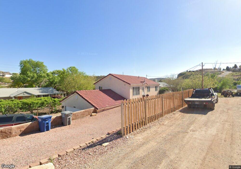
989 N State St La Verkin, UT 84745
Estimated Value: $326,000 - $464,000
4
Beds
2
Baths
1,144
Sq Ft
$349/Sq Ft
Est. Value
About This Home
This home is located at 989 N State St, La Verkin, UT 84745 and is currently estimated at $398,842, approximately $348 per square foot. 989 N State St is a home located in Washington County with nearby schools including La Verkin Elementary School, Hurricane Middle School, and Hurricane High School.
Ownership History
Date
Name
Owned For
Owner Type
Purchase Details
Closed on
Dec 21, 2020
Sold by
Porter Raymond P and Porter Sharlene T
Bought by
Porter Raymond P and Porter Sharlene T
Current Estimated Value
Home Financials for this Owner
Home Financials are based on the most recent Mortgage that was taken out on this home.
Original Mortgage
$121,640
Interest Rate
2.6%
Mortgage Type
VA
Create a Home Valuation Report for This Property
The Home Valuation Report is an in-depth analysis detailing your home's value as well as a comparison with similar homes in the area
Home Values in the Area
Average Home Value in this Area
Purchase History
| Date | Buyer | Sale Price | Title Company |
|---|---|---|---|
| Porter Raymond P | -- | Amrock Inc | |
| Porter Raymond P | -- | Amrock |
Source: Public Records
Mortgage History
| Date | Status | Borrower | Loan Amount |
|---|---|---|---|
| Closed | Porter Raymond P | $121,640 |
Source: Public Records
Tax History Compared to Growth
Tax History
| Year | Tax Paid | Tax Assessment Tax Assessment Total Assessment is a certain percentage of the fair market value that is determined by local assessors to be the total taxable value of land and additions on the property. | Land | Improvement |
|---|---|---|---|---|
| 2025 | $932 | $123,860 | $30,250 | $93,610 |
| 2023 | $933 | $123,695 | $30,250 | $93,445 |
| 2022 | $923 | $115,225 | $22,000 | $93,225 |
| 2021 | $876 | $161,000 | $35,000 | $126,000 |
| 2020 | $904 | $155,300 | $35,000 | $120,300 |
| 2019 | $853 | $140,500 | $25,300 | $115,200 |
| 2018 | $960 | $77,880 | $0 | $0 |
| 2017 | $960 | $77,880 | $0 | $0 |
| 2016 | $922 | $71,775 | $0 | $0 |
| 2015 | $863 | $64,570 | $0 | $0 |
| 2014 | $911 | $67,210 | $0 | $0 |
Source: Public Records
Map
Nearby Homes
- 1037 N State St
- 987 N State St
- 1045 N State St Unit 1
- 965 N State St
- 1680 S Bringhurst Ln
- 880 S Bringhurst Ln
- 869 N State St
- 324 W 900 N
- Lot #1 Riverwood Estates
- 1085 N State St
- 334 W 900 N
- 780 W 1000 N
- Lot #3 Riverwood Estates
- 344 W 900 N
- 900 W 900 N
- Parcel Lv-Cre-3-59
- .36 acres Terrace Cir
- 365 W 900 N
- 780 W 900 N
- 1070 N State St