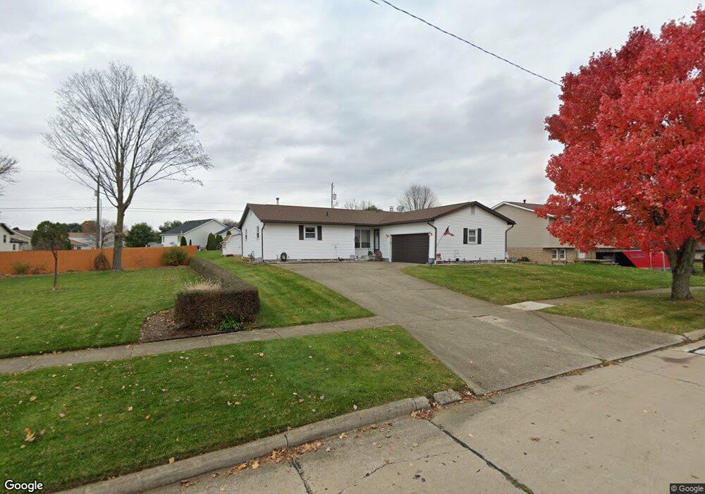
989 Patrick Place Wooster, OH 44691
Estimated Value: $242,337 - $270,000
3
Beds
2
Baths
1,295
Sq Ft
$197/Sq Ft
Est. Value
About This Home
This home is located at 989 Patrick Place, Wooster, OH 44691 and is currently estimated at $254,584, approximately $196 per square foot. 989 Patrick Place is a home located in Wayne County with nearby schools including Parkview Elementary School, Edgewood Middle School, and Wooster High School.
Ownership History
Date
Name
Owned For
Owner Type
Purchase Details
Closed on
Jan 15, 2021
Sold by
Estate Of Linda Sue Coblentz
Bought by
Coblentz Raymond Gerald
Current Estimated Value
Purchase Details
Closed on
Oct 23, 2018
Sold by
Estate Of Thelma J Mccomas
Bought by
Coblentz Linda Sue Mccomas
Purchase Details
Closed on
Aug 27, 2003
Sold by
Mccomas Claude L and Mccomas Thelma J
Bought by
Mccomas Thelma J
Create a Home Valuation Report for This Property
The Home Valuation Report is an in-depth analysis detailing your home's value as well as a comparison with similar homes in the area
Home Values in the Area
Average Home Value in this Area
Purchase History
| Date | Buyer | Sale Price | Title Company |
|---|---|---|---|
| Coblentz Raymond Gerald | -- | None Available | |
| Coblentz Linda Sue Mccomas | -- | None Available | |
| Mccomas Thelma J | -- | -- |
Source: Public Records
Tax History
| Year | Tax Paid | Tax Assessment Tax Assessment Total Assessment is a certain percentage of the fair market value that is determined by local assessors to be the total taxable value of land and additions on the property. | Land | Improvement |
|---|---|---|---|---|
| 2024 | $2,255 | $64,720 | $13,410 | $51,310 |
| 2023 | $2,278 | $64,720 | $13,410 | $51,310 |
| 2022 | $2,007 | $47,240 | $9,790 | $37,450 |
| 2021 | $2,070 | $47,240 | $9,790 | $37,450 |
| 2020 | $1,963 | $47,240 | $9,790 | $37,450 |
| 2019 | $2,137 | $39,220 | $8,640 | $30,580 |
| 2018 | $1,624 | $39,220 | $8,640 | $30,580 |
| 2017 | $1,627 | $39,220 | $8,640 | $30,580 |
| 2016 | $1,670 | $37,770 | $8,640 | $29,130 |
| 2015 | $1,639 | $37,770 | $8,640 | $29,130 |
| 2014 | $1,640 | $37,770 | $8,640 | $29,130 |
| 2013 | $1,624 | $37,120 | $9,740 | $27,380 |
Source: Public Records
Map
Nearby Homes
- 835 Marilyn Dr
- 2185 Ryan Ct
- 972 Carriage Ln
- 869 Meadow Ln
- 2360 Star Dr
- 2447 Wetherington Ln Unit 131
- 2447 Wetherington Ln Unit 130
- 2447 Wetherington Ln
- 2457 Barrington Way Unit 327
- 2457 Barrington Way Unit 325
- 2520 Barrington Way
- 2452 Barrington Way Unit 424
- 2552 Monterey St
- 1704 Carlin Trail
- 1627 Carlin Trail
- 1643 Carlin Trail
- 1942 Fisher Dr
- 211 Oakley Rd
- 1047 Ashwood Dr
- 2011 Burbank Rd
- 2013 Normandy Dr
- 977 Patrick Place
- 1006 Brooke Way
- 965 Patrick Place
- 2031 Normandy Dr
- 1010 Brooke Way
- 990 Brooke Way
- 986 Patrick Place
- 1919 Normandy Dr
- 953 Patrick Place
- 972 Patrick Place
- 960 Patrick Place
- 2041 Normandy Dr
- 970 Brooke Way
- 941 Patrick Place
- 2012 Normandy Dr
- 1930 Normandy Dr
- 948 Patrick Place
- 2036 Normandy Dr
- 2024 Normandy Dr
Your Personal Tour Guide
Ask me questions while you tour the home.