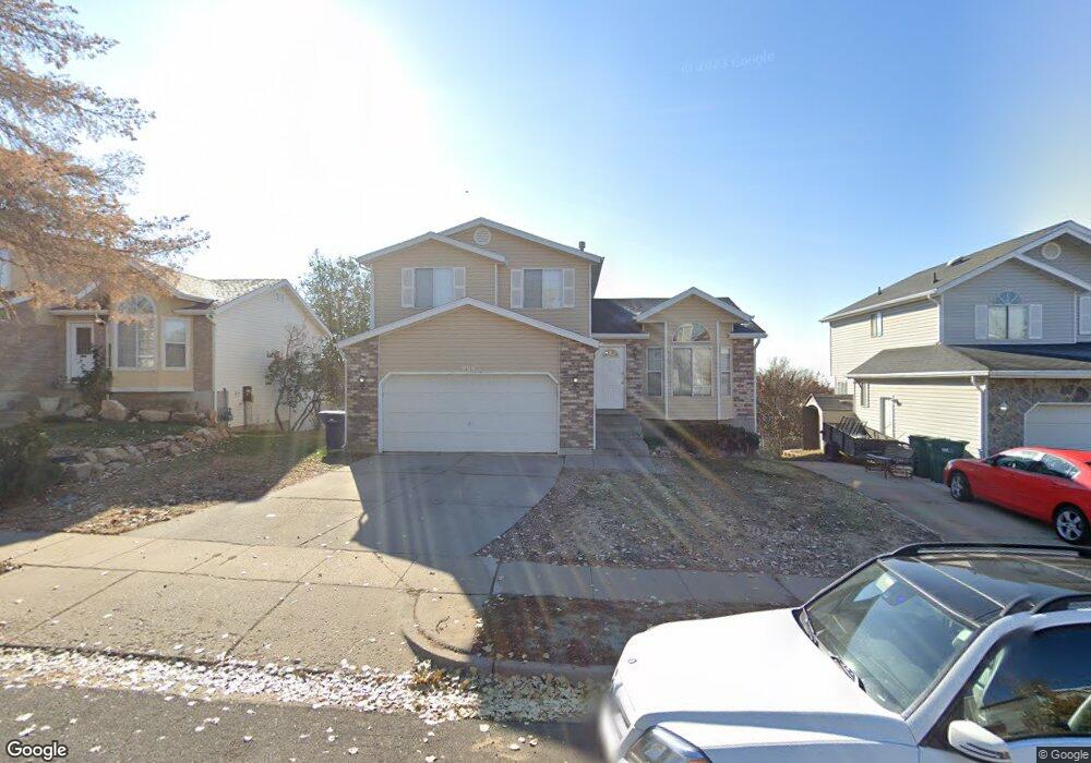
989 W 2600 N Layton, UT 84041
Estimated Value: $474,000 - $523,000
4
Beds
3
Baths
2,386
Sq Ft
$208/Sq Ft
Est. Value
About This Home
This home is located at 989 W 2600 N, Layton, UT 84041 and is currently estimated at $495,336, approximately $207 per square foot. 989 W 2600 N is a home located in Davis County with nearby schools including Lincoln Elementary School, North Layton Junior High School, and Northridge High School.
Ownership History
Date
Name
Owned For
Owner Type
Purchase Details
Closed on
Jul 7, 2025
Sold by
Mattinson Tyler
Bought by
Mattinson Tyler and Mattinson Mabel Aung
Current Estimated Value
Home Financials for this Owner
Home Financials are based on the most recent Mortgage that was taken out on this home.
Original Mortgage
$66,890
Outstanding Balance
$66,778
Interest Rate
6.89%
Mortgage Type
Credit Line Revolving
Estimated Equity
$428,558
Purchase Details
Closed on
Aug 5, 2019
Sold by
Bruno Gerald C
Bought by
Mattison Tyler
Home Financials for this Owner
Home Financials are based on the most recent Mortgage that was taken out on this home.
Original Mortgage
$276,450
Interest Rate
3.8%
Mortgage Type
New Conventional
Purchase Details
Closed on
Jul 28, 2009
Sold by
Baker John Charles and Baker Priscilla L
Bought by
Bruno Gerald C
Home Financials for this Owner
Home Financials are based on the most recent Mortgage that was taken out on this home.
Original Mortgage
$203,278
Interest Rate
5.3%
Mortgage Type
VA
Purchase Details
Closed on
Jun 28, 2006
Sold by
Emmerson Dale L and Emmerson Pamela D
Bought by
Baker John Charles and Baker Priscilla L
Home Financials for this Owner
Home Financials are based on the most recent Mortgage that was taken out on this home.
Original Mortgage
$183,000
Interest Rate
6.57%
Mortgage Type
Purchase Money Mortgage
Purchase Details
Closed on
May 6, 1998
Sold by
Brandt Steven J and Brandt Jennifer L
Bought by
Emmerson Dale L and Emmerson Pamela D
Purchase Details
Closed on
Nov 20, 1996
Sold by
Adamo Anthony J
Bought by
Brandt Steven J and Brandt Jennifer L
Home Financials for this Owner
Home Financials are based on the most recent Mortgage that was taken out on this home.
Original Mortgage
$119,700
Interest Rate
7.88%
Purchase Details
Closed on
Nov 19, 1996
Sold by
Applonie Paul T and Applonie Jennifer M
Bought by
Woodward Justin M and Woodward Brooke K
Home Financials for this Owner
Home Financials are based on the most recent Mortgage that was taken out on this home.
Original Mortgage
$119,700
Interest Rate
7.88%
Create a Home Valuation Report for This Property
The Home Valuation Report is an in-depth analysis detailing your home's value as well as a comparison with similar homes in the area
Home Values in the Area
Average Home Value in this Area
Purchase History
| Date | Buyer | Sale Price | Title Company |
|---|---|---|---|
| Mattinson Tyler | -- | Title Guarantee | |
| Mattinson Tyler | -- | Title Guarantee | |
| Mattison Tyler | -- | Us Title Company Of | |
| Bruno Gerald C | -- | First American Title | |
| Baker John Charles | -- | Bonneville Superior Title | |
| Emmerson Dale L | -- | Founders Title Co | |
| Brandt Steven J | -- | First American Title Co | |
| Woodward Justin M | -- | Backman Stewart Title Servic |
Source: Public Records
Mortgage History
| Date | Status | Borrower | Loan Amount |
|---|---|---|---|
| Open | Mattinson Tyler | $66,890 | |
| Closed | Mattinson Tyler | $66,890 | |
| Previous Owner | Mattison Tyler | $276,450 | |
| Previous Owner | Bruno Gerald C | $203,278 | |
| Previous Owner | Baker John Charles | $183,000 | |
| Previous Owner | Brandt Steven J | $119,700 | |
| Previous Owner | Woodward Justin M | $84,765 |
Source: Public Records
Tax History Compared to Growth
Tax History
| Year | Tax Paid | Tax Assessment Tax Assessment Total Assessment is a certain percentage of the fair market value that is determined by local assessors to be the total taxable value of land and additions on the property. | Land | Improvement |
|---|---|---|---|---|
| 2024 | $2,159 | $228,250 | $99,632 | $128,618 |
| 2023 | $2,232 | $416,000 | $127,651 | $288,349 |
| 2022 | $2,271 | $229,900 | $64,702 | $165,198 |
| 2021 | $2,007 | $303,000 | $83,812 | $219,188 |
| 2020 | $1,795 | $260,000 | $73,386 | $186,614 |
| 2019 | $1,777 | $252,000 | $72,413 | $179,587 |
| 2018 | $1,622 | $231,000 | $72,413 | $158,587 |
| 2016 | $1,482 | $108,845 | $21,250 | $87,595 |
| 2015 | $1,425 | $99,385 | $21,250 | $78,135 |
| 2014 | $1,488 | $106,089 | $21,250 | $84,839 |
| 2013 | -- | $100,486 | $20,680 | $79,806 |
Source: Public Records
Map
Nearby Homes
- 2402 N 725 W
- 2378 N 675 W
- 2887 N 1175 W
- 781 W 2150 N
- 2949 N 1175 W
- 2211 N 525 W
- 709 W Highway 193
- 850 S 1650 E Unit D
- 2875 N Hill Field Rd Unit 58
- 2875 N Hill Field Rd Unit 17
- 2875 N Hill Field Rd Unit 62
- 1548 E 925 S
- 2187 N 450 W
- 65 Sunset Dr
- 63 Sunset Dr
- 1606 W 1960 N
- 86 Atherton Way
- 121 Barrington Way
- 85 Atherton Way
- 14 Lakeview Dr