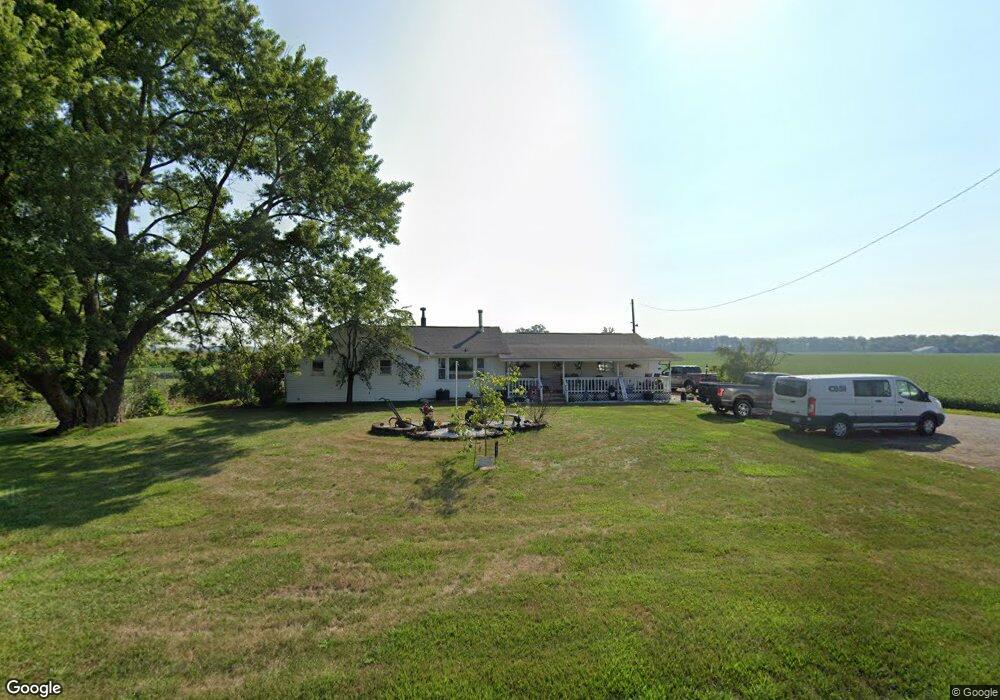
9890 State Route 762 Orient, OH 43146
Estimated Value: $318,174 - $436,000
4
Beds
2
Baths
2,034
Sq Ft
$182/Sq Ft
Est. Value
About This Home
This home is located at 9890 State Route 762, Orient, OH 43146 and is currently estimated at $370,794, approximately $182 per square foot. 9890 State Route 762 is a home located in Pickaway County.
Ownership History
Date
Name
Owned For
Owner Type
Purchase Details
Closed on
Mar 12, 2004
Sold by
Keefer Robert W and Keefer Madalyn C
Bought by
Potts Kevin L and Potts Amy M
Current Estimated Value
Home Financials for this Owner
Home Financials are based on the most recent Mortgage that was taken out on this home.
Original Mortgage
$33,500
Interest Rate
5%
Mortgage Type
Unknown
Create a Home Valuation Report for This Property
The Home Valuation Report is an in-depth analysis detailing your home's value as well as a comparison with similar homes in the area
Home Values in the Area
Average Home Value in this Area
Purchase History
| Date | Buyer | Sale Price | Title Company |
|---|---|---|---|
| Potts Kevin L | $167,500 | Title First Agency Inc |
Source: Public Records
Mortgage History
| Date | Status | Borrower | Loan Amount |
|---|---|---|---|
| Closed | Potts Kevin L | $33,500 | |
| Closed | Potts Kevin L | $125,625 |
Source: Public Records
Tax History Compared to Growth
Tax History
| Year | Tax Paid | Tax Assessment Tax Assessment Total Assessment is a certain percentage of the fair market value that is determined by local assessors to be the total taxable value of land and additions on the property. | Land | Improvement |
|---|---|---|---|---|
| 2024 | -- | $82,630 | $22,010 | $60,620 |
| 2023 | $3,110 | $82,630 | $22,010 | $60,620 |
| 2022 | $2,406 | $58,710 | $14,680 | $44,030 |
| 2021 | $2,413 | $58,710 | $14,680 | $44,030 |
| 2020 | $2,414 | $58,710 | $14,680 | $44,030 |
| 2019 | $1,925 | $48,980 | $13,960 | $35,020 |
| 2018 | $1,911 | $48,980 | $13,960 | $35,020 |
| 2017 | $1,961 | $48,980 | $13,960 | $35,020 |
| 2016 | $1,776 | $44,280 | $12,160 | $32,120 |
| 2015 | $1,777 | $44,280 | $12,160 | $32,120 |
| 2014 | $1,779 | $44,280 | $12,160 | $32,120 |
| 2013 | $1,967 | $47,060 | $12,160 | $34,900 |
Source: Public Records
Map
Nearby Homes
- 0 Burgett Rd
- 10819 Thrailkill Rd
- 7529 Stahl Rd
- 7879 Railroad St
- 7789 State Route 762
- 0 Scioto-Darby Rd Unit 225032793
- 11652 Matville Rd
- 8143 Snyder Rd
- 6670 Ridpath Rd
- 11044 Coontz Rd
- 186 Red Oak Ct
- 12232 Cleo Rd
- 166 Rosewood Loop SE
- 169 Chestnut Commons Dr
- 8835 Iroquois Way
- 6259 Cherokee Ln
- 182 Honey Locust Ln
- 12310 Graham Dr
- 6275 Cherokee Ln
- 0 Matville Rd Unit 225036975
- 9871 State Route 762
- 9861 State Route 762
- 9641 State Route 762
- 10280 State Route 762
- 9220 Burgett Rd
- 9152 Burgett Rd
- 9425 State Route 762
- 9120 Burgett Rd
- 9403 State Route 762
- 9419 State Route 762
- 9056 Burgett Rd
- 9381 State Route 762
- 8986 Burgett Rd
- 10521 Thrailkill Rd
- 9311 State Route 762
- 10565 Thrailkill Rd
- 10640 State Route 762
- 10621 Thrailkill Rd
- 9291 State Route 762
- 10643 Thrailkill Rd