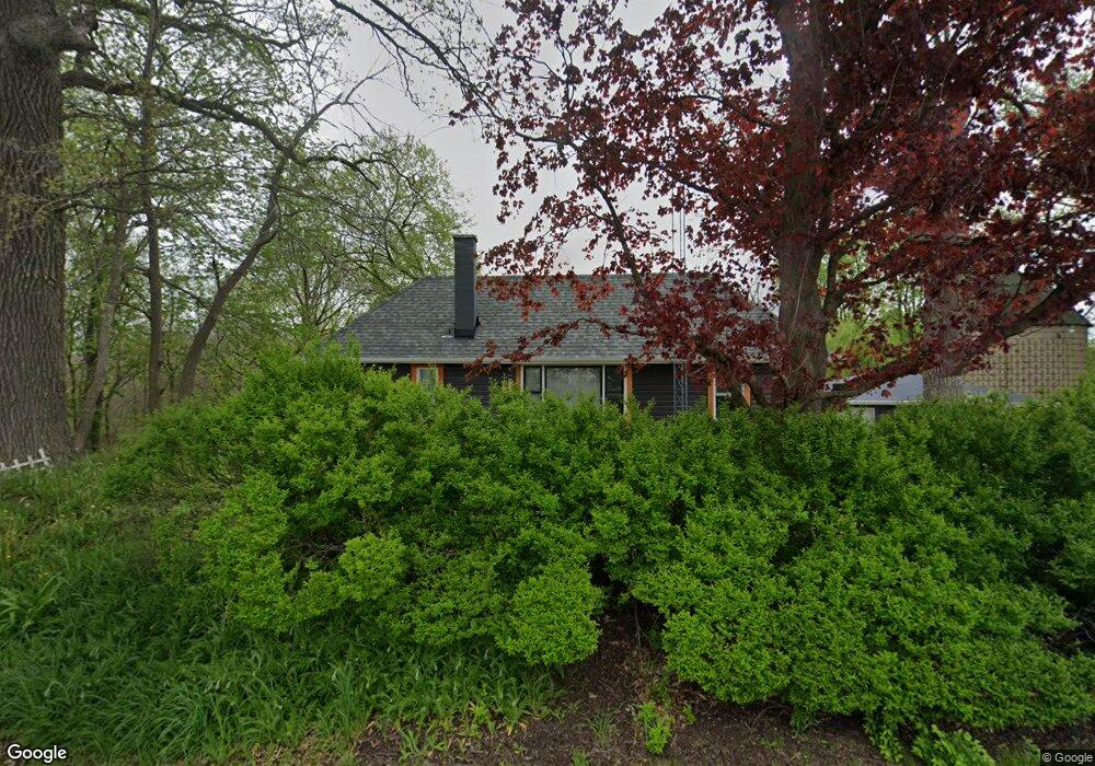
9895 Brown Rd Morris, IL 60450
Estimated Value: $134,000 - $308,000
Studio
--
Bath
1,140
Sq Ft
$198/Sq Ft
Est. Value
About This Home
This home is located at 9895 Brown Rd, Morris, IL 60450 and is currently estimated at $225,663, approximately $197 per square foot. 9895 Brown Rd is a home with nearby schools including Saratoga Elementary School and Morris Community High School.
Ownership History
Date
Name
Owned For
Owner Type
Purchase Details
Closed on
Sep 30, 2020
Sold by
Fazio Vincent M
Bought by
Quasny Curtis D and Quasny Gina
Current Estimated Value
Purchase Details
Closed on
May 5, 2020
Sold by
Hartz Kristi
Bought by
Fazio Vincent M and Fazio Natale
Create a Home Valuation Report for This Property
The Home Valuation Report is an in-depth analysis detailing your home's value as well as a comparison with similar homes in the area
Purchase History
| Date | Buyer | Sale Price | Title Company |
|---|---|---|---|
| Quasny Curtis D | $87,000 | Chicago Title | |
| Fazio Vincent M | -- | None Available |
Source: Public Records
Tax History
| Year | Tax Paid | Tax Assessment Tax Assessment Total Assessment is a certain percentage of the fair market value that is determined by local assessors to be the total taxable value of land and additions on the property. | Land | Improvement |
|---|---|---|---|---|
| 2024 | $3,962 | $60,846 | $12,893 | $47,953 |
| 2023 | $3,611 | $55,461 | $11,752 | $43,709 |
| 2022 | $3,358 | $51,568 | $10,927 | $40,641 |
| 2021 | $3,209 | $48,815 | $10,344 | $38,471 |
| 2020 | $3,127 | $46,696 | $9,895 | $36,801 |
| 2019 | $2,877 | $43,237 | $9,162 | $34,075 |
| 2018 | $2,858 | $42,754 | $9,060 | $33,694 |
| 2017 | $2,697 | $40,827 | $8,652 | $32,175 |
| 2016 | $2,538 | $38,325 | $8,122 | $30,203 |
| 2015 | $1,159 | $34,838 | $7,383 | $27,455 |
| 2014 | $1,081 | $32,916 | $6,976 | $25,940 |
| 2013 | $1,082 | $33,360 | $7,070 | $26,290 |
Source: Public Records
Map
Nearby Homes
- 35 Cedar St
- 12 Maple St
- 23 Birch Ave
- 2823 Ninovan Ln
- 2811 Ninovan Ln
- 2813 Ninovan Ln
- 2812 Ninovan Ln
- 2804 Ninovan Ln
- 1280 Alicia Dr
- 6010-6060 E Minooka Rd
- 1315 Burns Ln
- 1403 Fabiola Ct S
- 2037 Isabella Ln
- 1308 Dahlgren Ln
- 802 Joanne Dr
- 817 Casey Dr
- 825 Grant Dr
- LOT 28 O Toole Dr
- 706 O Toole Dr
- 2200 Holt Rd
- 9940 Brown Rd
- 9885 Brown Rd
- 9835 Brown Rd
- 10150 Brown Rd
- 3735 Shady Oaks Rd
- 3645 Shady Oaks Rd
- 10225 Brown Rd
- 9590 Brown Rd
- 10685 Tabler Rd
- 10605 Tabler Rd
- 9550 Sandridge Industrial Ct Unit 4
- 9550 Sandridge Industrial Ct Unit 3
- 9550 Sandridge Industrial Ct Unit 2
- 9550 Sandridge Industrial Ct Unit ABC
- 4095 Sand Ridge Rd
- 9545 Sandridge Industrial Ct Unit A-1
- 9545 Sandridge Industrial Ct Unit A
- 9540 Sand Ridge Industrial Ct Unit E
- 9540 Sand Ridge Industrial Ct Unit C
- 9540 Sand Ridge Industrial Ct Unit A
Your Personal Tour Guide
Ask me questions while you tour the home.