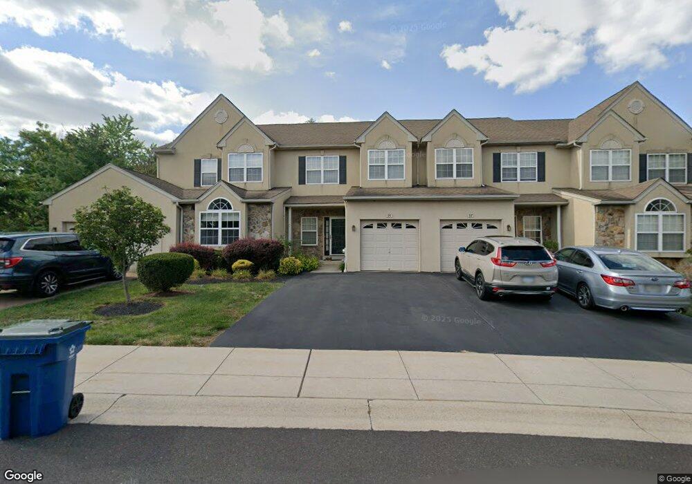
99 Arbor Cir Colmar, PA 18915
Estimated Value: $509,883 - $550,000
3
Beds
3
Baths
2,349
Sq Ft
$226/Sq Ft
Est. Value
About This Home
This home is located at 99 Arbor Cir, Colmar, PA 18915 and is currently estimated at $530,221, approximately $225 per square foot. 99 Arbor Cir is a home located in Montgomery County with nearby schools including Bridle Path Elementary School, Penndale Middle School, and North Penn Senior High School.
Ownership History
Date
Name
Owned For
Owner Type
Purchase Details
Closed on
Jul 20, 2005
Sold by
Arbors Residential Lp
Bought by
Yan Hongxing and Zhai Ni
Current Estimated Value
Home Financials for this Owner
Home Financials are based on the most recent Mortgage that was taken out on this home.
Original Mortgage
$30,000
Outstanding Balance
$15,729
Interest Rate
5.63%
Mortgage Type
Credit Line Revolving
Estimated Equity
$514,492
Purchase Details
Closed on
May 13, 2004
Sold by
Arbors Residential Lp
Bought by
Peco Energy Co and Verizon Pa Inc
Create a Home Valuation Report for This Property
The Home Valuation Report is an in-depth analysis detailing your home's value as well as a comparison with similar homes in the area
Home Values in the Area
Average Home Value in this Area
Purchase History
| Date | Buyer | Sale Price | Title Company |
|---|---|---|---|
| Yan Hongxing | $303,132 | -- | |
| Peco Energy Co | -- | Wheatland Title Guaranty Co |
Source: Public Records
Mortgage History
| Date | Status | Borrower | Loan Amount |
|---|---|---|---|
| Open | Yan Hongxing | $30,000 | |
| Open | Yan Hongxing | $242,500 |
Source: Public Records
Tax History Compared to Growth
Tax History
| Year | Tax Paid | Tax Assessment Tax Assessment Total Assessment is a certain percentage of the fair market value that is determined by local assessors to be the total taxable value of land and additions on the property. | Land | Improvement |
|---|---|---|---|---|
| 2025 | $6,835 | $170,720 | -- | -- |
| 2024 | $6,835 | $170,720 | -- | -- |
| 2023 | $6,542 | $170,720 | $0 | $0 |
| 2022 | $6,329 | $170,720 | $0 | $0 |
| 2021 | $6,149 | $170,720 | $0 | $0 |
| 2020 | $6,003 | $170,720 | $0 | $0 |
| 2019 | $5,903 | $170,720 | $0 | $0 |
| 2018 | $5,904 | $170,720 | $0 | $0 |
| 2017 | $5,678 | $170,720 | $0 | $0 |
| 2016 | $5,612 | $170,720 | $0 | $0 |
| 2015 | $5,387 | $170,720 | $0 | $0 |
| 2014 | $5,387 | $170,720 | $0 | $0 |
Source: Public Records
Map
Nearby Homes
- 2943 E Walnut St Unit 59
- 83 Bethlehem Pike Unit 1213 FIRESTONE
- 83 Bethlehem Pike Unit 1106- MADISON PLAN
- 417 Wynstone Ct
- 0002 Sydney Ln
- 303 Wynstone Ct
- 000 Lenape Dr
- 206 Broad Acres Rd
- 2674 Anthony Dr
- 6 Lantern Ln
- 2111 Hidden Meadow Dr
- 100 Victoria Dr
- 304 Victoria Dr
- 1823 N Line St
- 110 Country Club Dr
- 405 Country Club Dr
- 924 Bethlehem Pike
- 5 Fortuna Dr
- 6 Fortuna Dr
- 9 Fortuna Dr